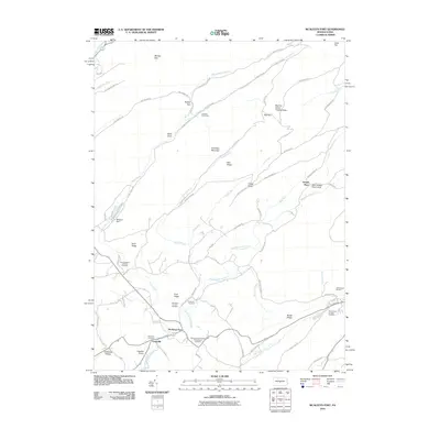
2010 Map of McAlevys Fort
USGS Topo · Published 2010About this map
McAlevys Fort and Ennisville serve as the primary residential hubs in this landscape of ridges and creek valleys. Located along the winding course of Standing Stone Creek, these settlements are characterized by a density of family and community landmarks, including the Ennisville Cemetery and the McAlevys Fort United Presbyterian Cemetery. The surrounding terrain is defined by significant elevations like Greenlee Mountain and Gettis Ridge, which are accessed by a network of rural routes such as Laurel Run Rd and Pine Swamp Rd.
Find a feature on this map
77 named features on this map. Tap any name to fly to it.
Don’t see what you’re looking for? This feature index may not catch every label — zoom into the map to look around manually.
Map Details
Editions of this 2010 McAlevys Fort Map
This is the sole edition of this map. No revisions or reprints were ever made.
Other maps of this area

1908 · Bellefonte
USGS Topo · 1:62,500

1909 · Bellefonte
USGS Topo · 1:62,500

1919 · Menno
USGS Topo · 1:62,500

1924 · Centre Hall
USGS Topo · 1:62,500

1924 · Lewistown
USGS Topo · 1:62,500

1927 · Lewisburg
USGS Topo · 1:62,500

1929 · Centre Hall
USGS Topo · 1:62,500

1935 · Allensville
USGS Topo · 1:62,500

1938 · Allensville
USGS Topo · 1:62,500

1943 · Lewistown
USGS Topo · 1:125,000
Featured Places
- McAlevys Fort, Jackson Township
- Harris Township, PA
- Barree Township, PA
- Jackson Township, PA
- Union Township, PA