1960s Maps of Jackson Township, Pennsylvania
Explore 6 historic maps of Jackson Township from the 1960s. These maps offer a rare glimpse into what life looked like during the 1960s — showing old roads, neighborhoods, homes, and landmarks that have changed or disappeared over time.
Whether you're researching your family's past, planning a metal detecting trip, or studying how Jackson Township's landscape evolved across the 1960s, these high-resolution maps are a powerful tool for exploring the history of this region.
- Focus on a specific era: All maps on this page are from the 1960s, giving you a focused view of this time period.
- See what’s changed: Compare century-old streets, trails, and buildings to today's modern landscape using overlays and satellite layers.
- Research with precision: Use these maps for genealogy, historical research, land use analysis, or educational projects.
- View, download, or print: Maps are fully viewable online in high resolution, and can be downloaded or printed for your own records.
Start exploring Jackson Township's history through authentic maps from the 1960s. This is your window into the past.
Jackson Township, PA maps
(6)- 1961 Map of Harrisburg
 1961 Harrisburg1961 Print · USGSCentral Pennsylvania is shown at a mid-century peak of industrial and military activity, from the Susquehanna water gaps to the fertile Dutch Country. Genealogists and historians can trace the rail corridors of the Pennsylvania RR and find landmarks like Carlisle Barracks or the Anthracite Coal Fields.2 unique versions available
 - 1963 Map of Mc Alevys Fort, 1965 Print
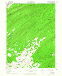 1963 Mc Alevys Fort1965 Print · USGSNorth of Huntingdon in the mid-1960s, this area shows a landscape defined by prominent ridges and early industrial sites. Researchers can trace local genealogy at McAlevys Fort or find historic locations like the Jackson-Miller Sch and Greenwood Furnace.4 unique versions available
 - 1963 Map of Allensville, 1965 Print
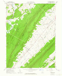 1963 Allensville1965 Print · USGSBig Valley in the early 1960s remains a corridor of traditional farmsteads and rural institutions between the ridges of central Pennsylvania. Genealogists and historians can trace family roots through the Mennonite Cem, Wesley Chapel, and the vanished schoolrooms of Waynesburg Sch.3 unique versions available
 - 1963 Map of Pine Grove Mills, 1965 Print
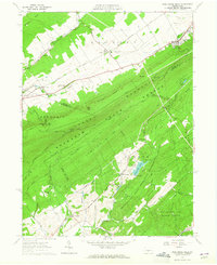 1963 Pine Grove Mills1965 Print · USGSThe ridges of central Pennsylvania define this early 1960s landscape, where university experimental forests meet historic furnace settlements. Genealogists and researchers can trace the valley communities of Pine Grove Mills and Neffs Mills or locate local landmarks like the Pennsylvania Furnace Cem and Monroe Furnace.4 unique versions available
 - 1964 Map of Harrisburg
 1964 Harrisburg1964 Print · USGSCentral Pennsylvania in the mid-fifties reveals a landscape shaped by ridge-and-valley geology and critical Cold War infrastructure. Researchers can trace the massive Indiantown Gap Military Reservation or the rail corridors of the Pennsylvania RR and Reading RR.
 - 1966 Map of Barrville, 1968 Print
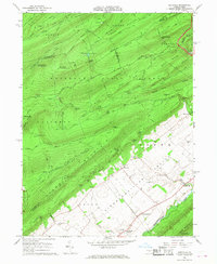 1966 Barrville1968 Print · USGSThe high ridges and deep gaps of Mifflin County appear in detail during the mid-sixties, from the forested slopes of Broad Mountain to the farms of the valley floor. Genealogists and hikers can trace old schoolhouse locations like Mountain View Sch and quiet rural burials at Long Lane Cem.3 unique versions available
End of results
Showing maps 1-6 of 6
Top cities near Jackson Township
- State College historical maps
- Lewistown historical maps
- Huntingdon historical maps
- Granville Township historical maps
- Boalsburg historical maps
- Pleasant Gap historical maps
See more
Top neighborhoods of Jackson Township
Frequently asked questions
- What are the different types of historical maps available for Jackson Township?
- What is the oldest map of Jackson Township?
- Where can I purchase historical maps of Jackson Township for my home or office?
- Where can I download high-res historical maps of Jackson Township?
- Are there historical topographic maps available for Jackson Township?
- Is there historical aerial imagery available for Jackson Township?
- Where are historical maps of Jackson Township sourced from?