2020s Maps of Brush Valley Township, Pennsylvania
Explore 5 historic maps of Brush Valley Township from the 2020s. These maps offer a rare glimpse into what life looked like during the 2020s — showing old roads, neighborhoods, homes, and landmarks that have changed or disappeared over time.
Whether you're researching your family's past, planning a metal detecting trip, or studying how Brush Valley Township's landscape evolved across the 2020s, these high-resolution maps are a powerful tool for exploring the history of this region.
- Focus on a specific era: All maps on this page are from the 2020s, giving you a focused view of this time period.
- See what’s changed: Compare century-old streets, trails, and buildings to today's modern landscape using overlays and satellite layers.
- Research with precision: Use these maps for genealogy, historical research, land use analysis, or educational projects.
- View, download, or print: Maps are fully viewable online in high resolution, and can be downloaded or printed for your own records.
Start exploring Brush Valley Township's history through authentic maps from the 2020s. This is your window into the past.
Brush Valley Township, PA maps
(5)- 2023 Map of Bolivar, 2023 Print
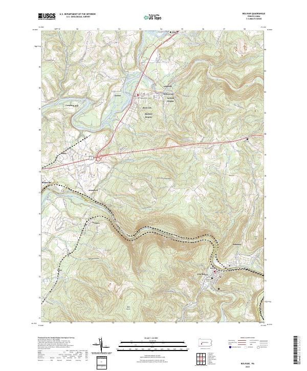 2023 Bolivar2023 Print · USGSThe Conemaugh River valley at the Indiana and Westmoreland county line reveals a landscape of industrial river towns and steep ridges. Researchers can trace local lineage through the Bolivar Old Town Cem or explore the geography of Black Lick and the Conemaugh Water Gap.
 - 2023 Map of New Florence, 2023 Print
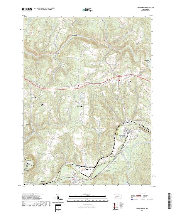 2023 New Florence2023 Print · USGSThe Conemaugh and Blacklick valleys are shown here in the 2020s, highlighting a landscape defined by river-cut terrain and coal-country history. Genealogists can trace family names at Armagh Old Presbyterian Cem or locate the junction at Conpitt Junction.
 - 2023 Map of Brush Valley, 2023 Print
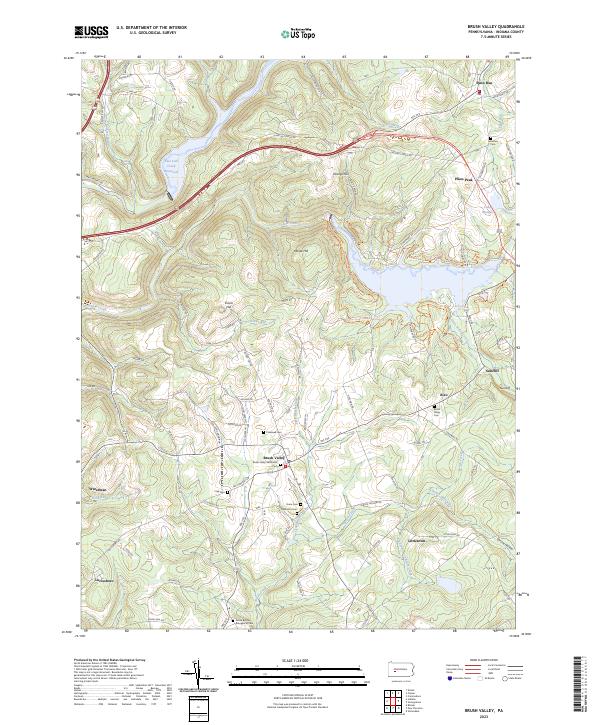 2023 Brush Valley2023 Print · USGSIndiana County's rural heartland is captured here in the early twenty-first century, showcasing a landscape of high ridges and deep creek valleys. Researchers can trace family history through a high density of rural cemeteries like Harmony Cem, Fry Cem, and Robinson Cem.
 - 2023 Map of Indiana, 2023 Print
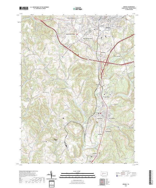 2023 Indiana2023 Print · USGSIndiana and its surrounding mining communities are captured here in the early twenty-first century as the landscape reflects both academic and industrial growth. Genealogists and local historians can trace family locations at Lucerne Mines, Coy Junction, and the Bethel Presbyterian Church Cem.
 - 2023 Map of Strongstown, 2023 Print
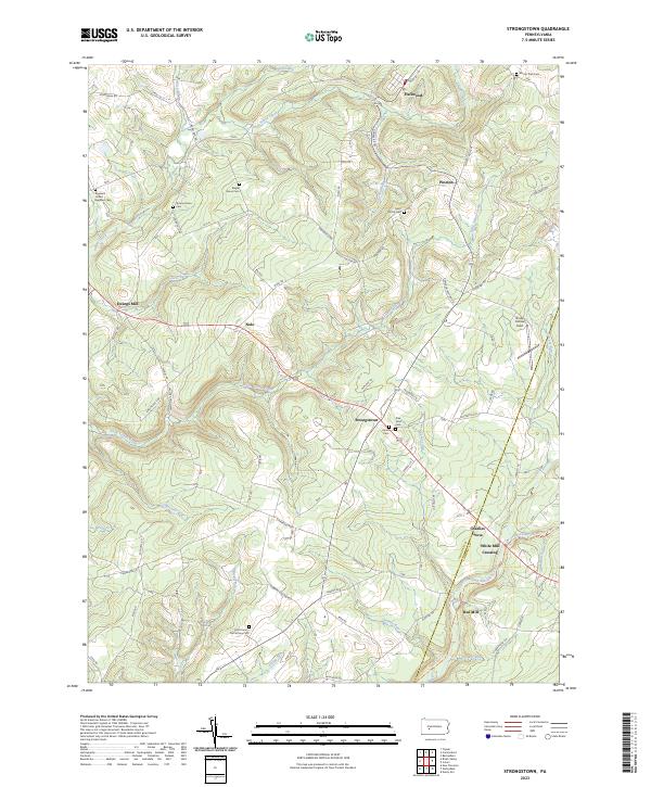 2023 Strongstown2023 Print · USGSIndiana and Cambria counties are documented in this contemporary survey, showing the enduring network of hill-country settlements. Researchers can trace historic industry and lineage through White Mill Crossing, the Ghost Town Trl, and Saint Patrick Cem.
End of results
Showing maps 1-5 of 5
Top cities near Brush Valley Township
- Johnstown historical maps
- Indiana historical maps
- Franklin historical maps
- Westmont historical maps
- Blairsville historical maps
- Rayne Township historical maps
See more
Top neighborhoods of Brush Valley Township
- Dias historical maps
- Littletown historical maps
- Claghorn historical maps
- Suncliff historical maps
- Rico historical maps
Frequently asked questions
- What are the different types of historical maps available for Brush Valley Township?
- What is the oldest map of Brush Valley Township?
- Where can I purchase historical maps of Brush Valley Township for my home or office?
- Where can I download high-res historical maps of Brush Valley Township?
- Are there historical topographic maps available for Brush Valley Township?
- Is there historical aerial imagery available for Brush Valley Township?
- Where are historical maps of Brush Valley Township sourced from?