Old Maps of Buffington Township, Pennsylvania for Genealogy
Trace your family roots with 45 historic maps of Buffington Township. These high-res maps reveal old neighborhoods, homesites, landmarks, and streets — helping you uncover where your ancestors lived and how the area evolved over time.
- Explore historic neighborhoods: Identify where your relatives may have lived in the 1800s or 1900s.
- Compare maps over time: Trace the changes in streets, buildings, and landmarks for multi-generational research.
- Perfect for genealogy & ancestry research: Used by family historians and researchers to map out lineage and migration.
These maps are an incredible resource for exploring your personal connection to Buffington Township's past.
Buffington Township, PA maps
(45)- 1902 Map of Indiana
 1902 Indiana1902 Print · USGSIndiana County at the turn of the century shows a landscape of growing rail towns and rural farmsteads connected by the Pennsylvania Railroad. Researchers can trace ancestral roots through vanished crossroads and early industrial sites like Homer, Mechanicsburg, and Graceton.8 unique versions available
 - 1902 Map of Barnesboro, 1956 Print
 1902 Barnesboro1956 Print · USGSIndiana and Cambria counties are documented here at a peak of rail and coal development. Genealogists and historians can trace family roots through numerous small settlements like Possum Glory and Nicktown or follow the Pennsylvania RR through the bustling streets of Barnesboro.
 - 1904 Map of Barnesboro
 1904 Barnesboro1904 Print · USGSNorthwestern Cambria County was a hub of river and rail activity at the turn of the century, as the coal industry took hold. Genealogists can trace family names and small settlements from Barnesboro and Cherrytree to remote outposts like Strongstown and Nolo.5 unique versions available
 - 1904 Map of Johnstown, 1954 Print
 1904 Johnstown1954 Print · USGSJohnstown and the Cambria County coalfields are shown in detail during their industrial peak in the early twentieth century. Researchers can trace ancestral neighborhoods like Morrellville and Franklin, or locate historic landmarks such as the Old Portage RR Tunnel and Grandview Cemetery.2 unique versions available
 - 1907 Map of Johnstown
 1907 Johnstown1907 Print · USGSJohnstown and the surrounding coal valleys are captured here at the height of their industrial expansion in the early twentieth century. Researchers can trace the path of the Pennsylvania RR and find vanished local landmarks like Expedit PO and the Old Portage RR Tunnel.6 unique versions available
 - 1920 Map of New Florence, 1958 Print
 1920 New Florence1958 Print · USGSThe Conemaugh River valley at the dawn of the 1920s shows a landscape defined by the PENNSYLVANIA RR and industrial coal towns. Genealogists can locate family homesteads near dozens of named country schools like Wallace School or trace the old Lincoln Highway through Armagh.
 - 1921 Map of New Florence
 1921 New Florence1921 Print · USGSWestmoreland and Indiana counties are captured in the early 1920s as industrial rail corridors and the Lincoln Highway begin to modernize the rural landscape. Genealogists can locate family landmarks like Campbell's Mill, the Centerville Huff PO, and several country schools including Robbs School.
 - 1922 Map of New Florence
 1922 New Florence1922 Print · USGSWestern Pennsylvania in the early 1920s shows a landscape of river-carved ridges and busy rail corridors connecting coal and quarry towns. Genealogists can trace family footprints across dozens of rural schools and stations like Lockport Station, Centerville (Huff PO), and Grafton.5 unique versions available
 - 1943 Map of Punxsutawney
 1943 Punxsutawney1943 Print · USGSThe Pennsylvania coal country around the turn of the century and through the war years is captured in this detailed survey of Jefferson, Indiana, and Clearfield counties. Researchers can trace the rail-reliant economy through Findley Mills, Rossiter Junction, and landmarks like the St Lawrence Fire Tower.
 - 1944 Map of New Florence
 1944 New Florence1944 Print · USGSWestmoreland and Indiana counties during the wartime years reveal a landscape shaped by coal, steam, and rail. Genealogists can trace family footprints in vanished settlements and school districts like Robindale Smokeless PO, Scottglen Sta, and Mahan Sch.
 - 1953 Map of Pittsburgh
 1953 Pittsburgh1953 Print · USGSWestern Pennsylvania's industrial landscape at the start of the fifties shows the steel and rail corridors between Pittsburgh and Altoona. Trace family roots in river towns like Tarentum or follow the Pennsylvania Turnpike across Laurel Hill.
 - 1954 Map of Pittsburgh
 1954 Pittsburgh1954 Print · USGSWestern Pennsylvania in the early fifties remains a powerhouse of heavy industry and vital transit corridors. Genealogists and historians can trace the rail-and-river network connecting Pittsburgh, Johnstown, and Altoona via the Pennsylvania RR and the Lincoln Highway.2 unique versions available
 - 1958 Map of Pittsburgh
 1958 Pittsburgh1958 Print · USGSWestern Pennsylvania in the late fifties shows an industrial heartland defined by the confluence of the Allegheny River and Monongahela River. Researchers can trace the sprawling rail networks of the Pennsylvania RR and find established towns like Butler, Latrobe, and Windber.5 unique versions available
 - 1959 Map of Pittsburgh
 1959 Pittsburgh1959 Print · USGSWestern Pennsylvania in the late fifties is captured here at the height of its industrial era. Genealogists and historians can trace the riverfront growth of Pittsburgh, the rail works at Altoona, and the mountain gaps of Laurel Hill.
 - 1961 Map of Strongstown, 1963 Print
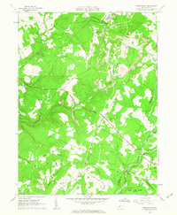 1961 Strongstown1963 Print · USGSIndiana County and the Cambria County border appear here during the early sixties, a landscape where coal mining and timbering met traditional farming. Researchers can trace the Cherry Tree and Dixonville Railroad or locate local landmarks like Ewings Mill and Barkley Ch.4 unique versions available
 - 1963 Map of Brush Valley, 1965 Print
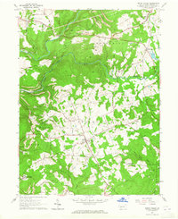 1963 Brush Valley1965 Print · USGSIndiana County's coal country and rural hamlets are mapped here during the early sixties, showing the region's transition from agricultural roots to industrial extraction. Researchers can locate numerous family cemeteries like Evans Cem and Frye Cem, or trace the extent of Strip Mines near Waterman and Luciusboro.4 unique versions available
 - 1964 Map of Pittsburgh
 1964 Pittsburgh1964 Print · USGSWestern Pennsylvania in the late fifties and early sixties shows a landscape of powerful river industries and expanding highways. Genealogists and historians can trace the rail corridors of the Pennsylvania RR through industrial hubs like Johnstown, Altoona, and Nanty Glo.
 - 1964 Map of New Florence, 1966 Print
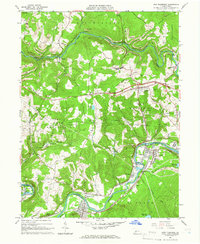 1964 New Florence1966 Print · USGSThe Indiana and Westmoreland county line was a hub of mining and rail activity in the mid-sixties. Genealogists and local researchers can trace the rail corridor from New Florence to Conpitt Junction or locate family sites near St Marys Cem and Seward.6 unique versions available
 - 1964 Map of Vintondale, 1966 Print
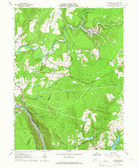 1964 Vintondale1966 Print · USGSCambria and Indiana counties were defined by the coal and rail industries during the early sixties. Genealogists can trace family roots through the settlements of Vintondale and Dilltown, or locate landmarks like the Delano Sch and Wehrum Mine Dump.3 unique versions available
 - 1981 Map of Johnstown, 1983 Print
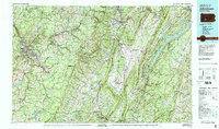 1981 Johnstown1983 Print · USGSSouth Central Pennsylvania is captured here in the early eighties, from the industrial heart of the Conemaugh Valley to the ridges of the Allegheny Front. Local historians can trace the rail corridors of Conrail and the growth of mountain communities like Ebensburg, Nanty Glo, and Windber.
 - 1983 Map of Indiana
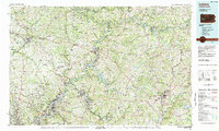 1983 Indiana1983 Print · USGSWestern Pennsylvania in the early eighties shows a landscape of industrial river towns and expanding university campuses. Genealogists can trace family roots through Lucernemines and Spring Church, or locate ancestors in Oakland Cemetery.
 - 1984 Map of Tyrone, 1985 Print
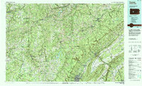 1984 Tyrone1985 Print · USGSCentral Pennsylvania in the mid-eighties shows a rugged landscape defined by the industry of Altoona and the ridges of the Appalachians. Genealogists and historians can trace the rail corridors of CONRAIL and locate vanished family homes near Glendale Lake or within Sinking Valley.
 - 1986 Map of Pittsburgh East
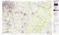 1986 Pittsburgh East1986 Print · USGSWestern Pennsylvania in the mid-eighties shows a landscape defined by industrial rivers and rising mountain ridges. Trace the dense rail networks of CONRAIL and the Pittsburgh and Lake Erie RR connecting historic centers like Monessen, Jeannette, and Connellsville.3 unique versions available
 - 1998 Map of Vintondale, 1999 Print
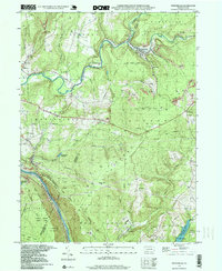 1998 Vintondale1999 Print · USGSIn the late nineties, the area around Vintondale and Wehrum remains defined by its deep mining heritage and the winding Blacklick Creek. Genealogists and historians can locate family landmarks like Memorial Ch and Delano Sch, or trace the old CONRAIL line and the Gallitzin Trail.
 - 1998 Map of Brush Valley, 1999 Print
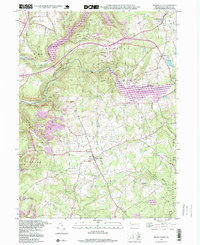 1998 Brush Valley1999 Print · USGSIndiana County in the late nineties showcases a landscape of major reservoirs and rural hamlets. Researchers can trace family history through numerous burial sites like Harmony Cem or explore the industrial footprint of Strip Mines near Brush Valley.
Showing maps 1-25 of 45
Top cities near Buffington Township
- Johnstown historical maps
- Indiana historical maps
- Franklin historical maps
- Westmont historical maps
- Northern Cambria historical maps
- Rayne Township historical maps
See more
Top neighborhoods of Buffington Township
Frequently asked questions
- What are the different types of historical maps available for Buffington Township?
- What is the oldest map of Buffington Township?
- Where can I purchase historical maps of Buffington Township for my home or office?
- Where can I download high-res historical maps of Buffington Township?
- Are there historical topographic maps available for Buffington Township?
- Is there historical aerial imagery available for Buffington Township?
- Where are historical maps of Buffington Township sourced from?