1930s Maps of East Mahoning Township, Pennsylvania
Explore 3 historic maps of East Mahoning Township from the 1930s. These maps offer a rare glimpse into what life looked like during the 1930s — showing old roads, neighborhoods, homes, and landmarks that have changed or disappeared over time.
Whether you're researching your family's past, planning a metal detecting trip, or studying how East Mahoning Township's landscape evolved across the 1930s, these high-resolution maps are a powerful tool for exploring the history of this region.
- Focus on a specific era: All maps on this page are from the 1930s, giving you a focused view of this time period.
- See what’s changed: Compare century-old streets, trails, and buildings to today's modern landscape using overlays and satellite layers.
- Research with precision: Use these maps for genealogy, historical research, land use analysis, or educational projects.
- View, download, or print: Maps are fully viewable online in high resolution, and can be downloaded or printed for your own records.
Start exploring East Mahoning Township's history through authentic maps from the 1930s. This is your window into the past.
East Mahoning Township, PA maps
(3)- 1938 Map of Smicksburg, 1965 Print
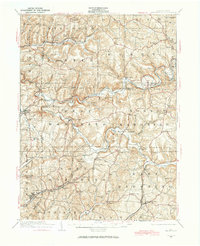 1938 Smicksburg1965 Print · USGSThe rural valleys of western Pennsylvania are captured here just before the Second World War, showing a network of railroad towns and agricultural hubs. Researchers can trace the lineage of local landmarks like Mottarns Mill, Glade Run Ch, and the many one-room schoolhouses such as Schranger Sch.
 - 1939 Map of Smicksburg
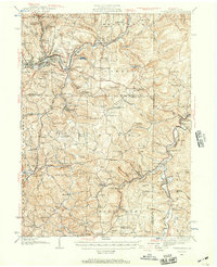
 1939 Smicksburg1939 Print · USGSBefore the mid-century industrial shifts, this part of rural Pennsylvania was a busy landscape of township schools and creek-side rail stops. Genealogists can trace early homesteads near Smicksburg, Moffatts Mill, and Gilgal Ch.2 unique versions available
 - 1939 Map of Punxsutawney, 1957 Print
 1939 Punxsutawney1957 Print · USGSPunxsutawney and the surrounding coal-and-rail country appear here in the years leading up to World War II. Genealogists and historians can trace defunct school districts like Harmony Thomas Sch, early rail junctions in Cloe, and burial sites at Fairview Cem.2 unique versions available
End of results
Showing maps 1-3 of 3
Top cities near East Mahoning Township
- Indiana historical maps
- Punxsutawney historical maps
- Rayne Township historical maps
- Winslow historical maps
- Brush Valley Township historical maps
- Clymer historical maps
See more
Top neighborhoods of East Mahoning Township
- Savan historical maps
- Barton historical maps
- Georgeville historical maps
- Mottarns Mill historical maps
- Oak Tree historical maps
Frequently asked questions
- What are the different types of historical maps available for East Mahoning Township?
- What is the oldest map of East Mahoning Township?
- Where can I purchase historical maps of East Mahoning Township for my home or office?
- Where can I download high-res historical maps of East Mahoning Township?
- Are there historical topographic maps available for East Mahoning Township?
- Is there historical aerial imagery available for East Mahoning Township?
- Where are historical maps of East Mahoning Township sourced from?