2020s Maps of East Mahoning Township, Pennsylvania
Explore 4 historic maps of East Mahoning Township from the 2020s. These maps offer a rare glimpse into what life looked like during the 2020s — showing old roads, neighborhoods, homes, and landmarks that have changed or disappeared over time.
Whether you're researching your family's past, planning a metal detecting trip, or studying how East Mahoning Township's landscape evolved across the 2020s, these high-resolution maps are a powerful tool for exploring the history of this region.
- Focus on a specific era: All maps on this page are from the 2020s, giving you a focused view of this time period.
- See what’s changed: Compare century-old streets, trails, and buildings to today's modern landscape using overlays and satellite layers.
- Research with precision: Use these maps for genealogy, historical research, land use analysis, or educational projects.
- View, download, or print: Maps are fully viewable online in high resolution, and can be downloaded or printed for your own records.
Start exploring East Mahoning Township's history through authentic maps from the 2020s. This is your window into the past.
East Mahoning Township, PA maps
(4)- 2023 Map of Rochester Mills, 2023 Print
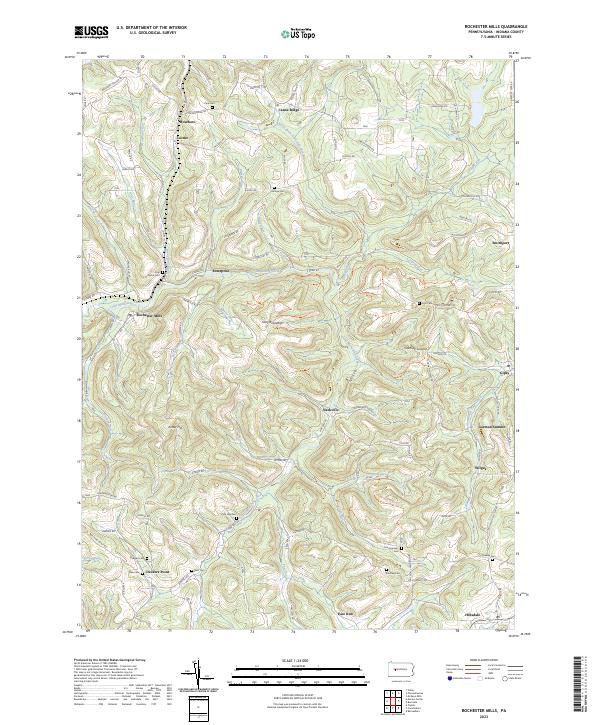 2023 Rochester Mills2023 Print · USGSThe rural uplands of Indiana County appear here in detail, showing a landscape defined by the winding Little Mahoning Creek. Researchers can trace old family sites and crossroads near Rochester Mills, Nashville, and burial grounds like Pine Vale Cem.
 - 2023 Map of Marion Center, 2023 Print
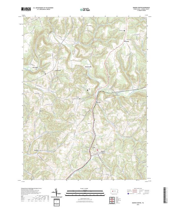 2023 Marion Center2023 Print · USGSModern Indiana County settlement patterns emerge around Marion Center and Georgeville in this recent survey. Local historians can trace family locations near the Gilgal Cem or identify old landmarks like Mottarns Mill and the Marion Center Speedway Airport.
 - 2023 Map of Commodore, 2023 Print
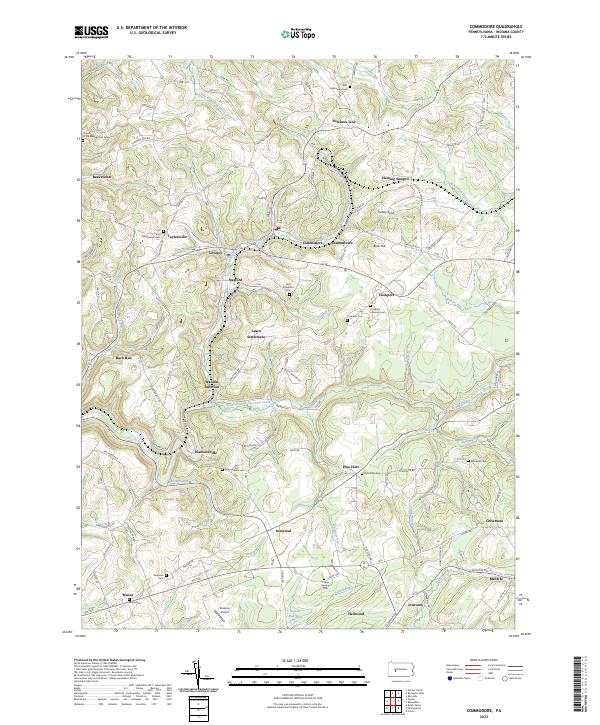 2023 Commodore2023 Print · USGSIndiana County settlement and the upper watershed of Two Lick Creek are captured here in the early twenty-first century. Researchers can trace rural lineages through sites like Learn Settlement, Wandin Junction, and the Saint Elizabeths Cem.
 - 2023 Map of Clymer, 2023 Print
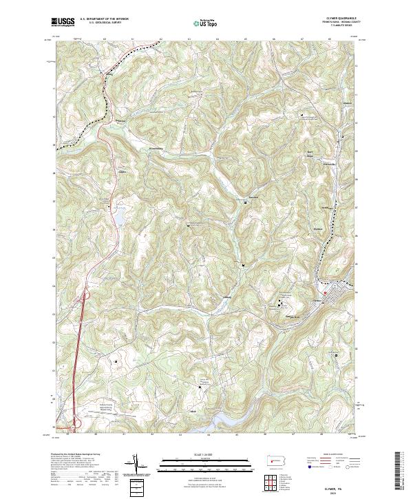 2023 Clymer2023 Print · USGSThe Indiana County highlands come to life in this contemporary survey of the hills surrounding Clymer. Genealogists can trace family names at Rich Hill Cem or locate the historic foundations of Kintersburg and Barr Slope along the creek valleys.
End of results
Showing maps 1-4 of 4
Top cities near East Mahoning Township
- Indiana historical maps
- Punxsutawney historical maps
- Rayne Township historical maps
- Winslow historical maps
- Brush Valley Township historical maps
- Clymer historical maps
See more
Top neighborhoods of East Mahoning Township
- Savan historical maps
- Barton historical maps
- Georgeville historical maps
- Mottarns Mill historical maps
- Oak Tree historical maps
Frequently asked questions
- What are the different types of historical maps available for East Mahoning Township?
- What is the oldest map of East Mahoning Township?
- Where can I purchase historical maps of East Mahoning Township for my home or office?
- Where can I download high-res historical maps of East Mahoning Township?
- Are there historical topographic maps available for East Mahoning Township?
- Is there historical aerial imagery available for East Mahoning Township?
- Where are historical maps of East Mahoning Township sourced from?