Old Maps of McCalmont Township, Pennsylvania for Academic Research
Study the evolution of McCalmont Township with 51 high-resolution historic maps. Whether you're teaching, researching, or modeling changes in land use, these maps provide essential visual documentation of urban, environmental, and geographic change.
- Analyze long-term change: Track patterns in development, transportation, and natural features.
- Ideal for environmental or urban studies: Support academic projects with primary historical map data.
- Use in the classroom or lab: Educators and researchers rely on these maps to bring historical context to life.
These maps are a powerful tool for teaching, research, and visualizing how McCalmont Township has changed over the decades.
McCalmont Township, PA maps
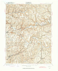
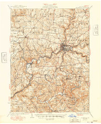
(51)- 1906 Map of Punxsutawney
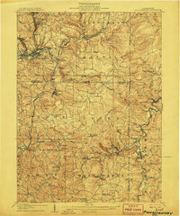 1906 Punxsutawney1906 Print · USGSPunxsutawney and the surrounding coal townships of the early 1900s are captured here at the height of the region's industrial growth. Genealogists and historians can trace the specific locations of historic post offices like Adrian and Gettysburg alongside family-named sites such as Bella Mills.4 unique versions available
 - 1909 Map of Smicksburg
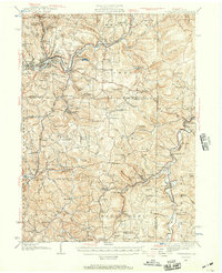
 1909 Smicksburg1909 Print · USGSIndiana and Jefferson Counties are seen here in the early twentieth century as a complex network of small hamlets and emerging rail lines. Genealogists can trace family roots through specific landmarks like Motterns Mill, Mt Zion Church, and the dual-named New Salem Pierce PO.2 unique versions available
 - 1922 Map of Du Bois, 1957 Print
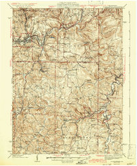
 1922 Du Bois1957 Print · USGSJefferson and Clearfield Counties are shown during the height of the region's mining and rail era in the early twenties. Genealogists and researchers can trace family lands near Eleanora Mines, rural schools like Mason School, and stops along the Pittsburg and Shawmut railroad.2 unique versions available
 - 1924 Map of Du Bois
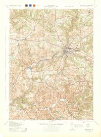
 1924 Du Bois1924 Print · USGSJefferson and Clearfield Counties were at the heart of the Pennsylvania coal and rail economy in the early twenties. Genealogists and historians can trace dozens of small settlements and local schoolhouses like Allens Mills, Soldier PO, and the Beechwoods School.5 unique versions available
 - 1924 Map of Brookville, 1957 Print
 1924 Brookville1957 Print · USGSJefferson County in the early 1920s is captured here at a peak of rural development, showing a landscape defined by rail lines and small creek-side settlements. Genealogists can locate dozens of country schools and churches, from Mead Chapel to the Smith School and Ramsaytown.2 unique versions available
 - 1926 Map of Brookville
 1926 Brookville1926 Print · USGSJefferson County at the peak of its rail-and-river industrial era is captured in this survey of the northern coalfields. Genealogists and historians can trace family land near Brookville or locate vanished rural schoolhouses like Hazel Dell School and Mead Chapel.3 unique versions available
 - 1938 Map of Smicksburg, 1965 Print
 1938 Smicksburg1965 Print · USGSThe rural valleys of western Pennsylvania are captured here just before the Second World War, showing a network of railroad towns and agricultural hubs. Researchers can trace the lineage of local landmarks like Mottarns Mill, Glade Run Ch, and the many one-room schoolhouses such as Schranger Sch.
 - 1939 Map of Smicksburg
 1939 Smicksburg1939 Print · USGSBefore the mid-century industrial shifts, this part of rural Pennsylvania was a busy landscape of township schools and creek-side rail stops. Genealogists can trace early homesteads near Smicksburg, Moffatts Mill, and Gilgal Ch.2 unique versions available
 - 1939 Map of Punxsutawney, 1957 Print
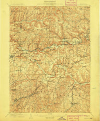
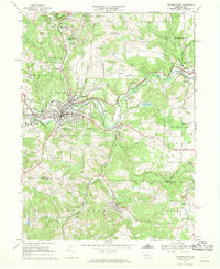
 1939 Punxsutawney1957 Print · USGSPunxsutawney and the surrounding coal-and-rail country appear here in the years leading up to World War II. Genealogists and historians can trace defunct school districts like Harmony Thomas Sch, early rail junctions in Cloe, and burial sites at Fairview Cem.2 unique versions available
 - 1942 Map of Punxsutawney
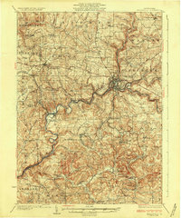
 1942 Punxsutawney1942 Print · USGSWest-central Pennsylvania during the early war years reveals a landscape shaped by rail transport and deep-rooted rural communities. Researchers can trace the legacy of local education and industry through dozens of named sites like Harmony Thomas School, McGees Mills, and Bells Mills.2 unique versions available
 - 1943 Map of Punxsutawney
 1943 Punxsutawney1943 Print · USGSThe Pennsylvania coal country around the turn of the century and through the war years is captured in this detailed survey of Jefferson, Indiana, and Clearfield counties. Researchers can trace the rail-reliant economy through Findley Mills, Rossiter Junction, and landmarks like the St Lawrence Fire Tower.
 - 1944 Map of Du Bois
 1944 Du Bois1944 Print · USGSJefferson and Clearfield counties are shown during the height of their industrial era in the 1940s. Genealogists can locate family-named landmarks like Groves Sch or McAninch Sch and trace the operations at Eleanora Mines.
 - 1944 Map of Brookville
 1944 Brookville1944 Print · USGSThe Jefferson and Clarion County borderlands come alive in the 1940s, showing a landscape defined by river-valley railroads and rural school districts. Researchers can trace the lineage of local communities through landmarks like Mead Chapel, the mining works at Conifer, and old post offices in Worthville or Markton.
 - 1949 Map of Brookville
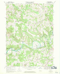
 1949 Brookville1949 Print · USGSJefferson County settlement at the end of the 1940s centers on the river junctions and rail lines near Brookville. Genealogists can trace family footprints across dozens of country schoolhouses like Oaks School and villages like Summerville or Knoxdale.
 - 1953 Map of Pittsburgh
 1953 Pittsburgh1953 Print · USGSWestern Pennsylvania's industrial landscape at the start of the fifties shows the steel and rail corridors between Pittsburgh and Altoona. Trace family roots in river towns like Tarentum or follow the Pennsylvania Turnpike across Laurel Hill.
 - 1954 Map of Pittsburgh
 1954 Pittsburgh1954 Print · USGSWestern Pennsylvania in the early fifties remains a powerhouse of heavy industry and vital transit corridors. Genealogists and historians can trace the rail-and-river network connecting Pittsburgh, Johnstown, and Altoona via the Pennsylvania RR and the Lincoln Highway.2 unique versions available
 - 1957 Map of Warren, 1964 Print
 1957 Warren1964 Print · USGSThe northern Pennsylvania oil and timber country comes into focus in the mid-fifties, showing the region before modern highway expansions. Trace the industrial rail networks of the Pennsylvania RR and the early Allegheny River Reservoir near Warren and Oil City.4 unique versions available
 - 1958 Map of Pittsburgh
 1958 Pittsburgh1958 Print · USGSWestern Pennsylvania in the late fifties shows an industrial heartland defined by the confluence of the Allegheny River and Monongahela River. Researchers can trace the sprawling rail networks of the Pennsylvania RR and find established towns like Butler, Latrobe, and Windber.5 unique versions available
 - 1958 Map of Warren
 1958 Warren1958 Print · USGSNorthern Pennsylvania’s timber and oil country is captured here during the late fifties, showing the interplay of industrial valleys and vast state forests. Genealogists can trace family connections across the Cornplanter Indian Reservation or through rail hubs like Oil City and Saint Marys.
 - 1959 Map of Warren
 1959 Warren1959 Print · USGSNorthern Pennsylvania's oil and timber country comes alive in this late-fifties study of the forest-clad plateaus. Trace the historic Cornplanter (Indian Reservation), the sprawling Oil Field, and the rail lines of the Pennsylvania RR.2 unique versions available
 - 1959 Map of Pittsburgh
 1959 Pittsburgh1959 Print · USGSWestern Pennsylvania in the late fifties is captured here at the height of its industrial era. Genealogists and historians can trace the riverfront growth of Pittsburgh, the rail works at Altoona, and the mountain gaps of Laurel Hill.
 - 1964 Map of Pittsburgh
 1964 Pittsburgh1964 Print · USGSWestern Pennsylvania in the late fifties and early sixties shows a landscape of powerful river industries and expanding highways. Genealogists and historians can trace the rail corridors of the Pennsylvania RR through industrial hubs like Johnstown, Altoona, and Nanty Glo.
 - 1966 Map of Reynoldsville, 1968 Print
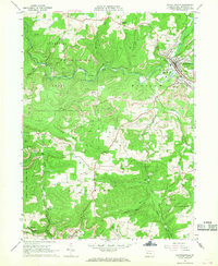 1966 Reynoldsville1968 Print · USGSJefferson County mining communities thrive during the late sixties as rail lines connect rural outposts. Genealogists can trace family names at St Marys Cem, identify the streets of Reynoldsville, or locate the Tipple Mine near Panic.4 unique versions available
 - 1968 Map of Punxsutawney, 1970 Print
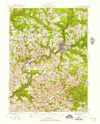
 1968 Punxsutawney1970 Print · USGSPunxsutawney and its surrounding coal-mining townships are captured in the late sixties, showing a landscape defined by rail lines and deep-valley settlements. Genealogists can locate family sites at Circle Hill Cem, Steffy Chapel, and Gobblers Knob.6 unique versions available
 - 1968 Map of Valier, 1970 Print
 1968 Valier1970 Print · USGSJefferson and Indiana Counties are captured in the late sixties as the local coal and gas economy shaped the hillsides. Researchers can trace family roots through numerous country cemeteries and churches, including White Church Cem, St Jacobs Ch, and Mapleview Sch.4 unique versions available
Showing maps 1-25 of 51
Top cities near McCalmont Township
- Sandy Township historical maps
- DuBois historical maps
- Punxsutawney historical maps
- Brookville historical maps
- Winslow historical maps
- Reynoldsville historical maps
See more
Top neighborhoods of McCalmont Township
Frequently asked questions
- What are the different types of historical maps available for McCalmont Township?
- What is the oldest map of McCalmont Township?
- Where can I purchase historical maps of McCalmont Township for my home or office?
- Where can I download high-res historical maps of McCalmont Township?
- Are there historical topographic maps available for McCalmont Township?
- Is there historical aerial imagery available for McCalmont Township?
- Where are historical maps of McCalmont Township sourced from?