Old Maps of Scott Township, Pennsylvania for Academic Research
Study the evolution of Scott Township with 46 high-resolution historic maps. Whether you're teaching, researching, or modeling changes in land use, these maps provide essential visual documentation of urban, environmental, and geographic change.
- Analyze long-term change: Track patterns in development, transportation, and natural features.
- Ideal for environmental or urban studies: Support academic projects with primary historical map data.
- Use in the classroom or lab: Educators and researchers rely on these maps to bring historical context to life.
These maps are a powerful tool for teaching, research, and visualizing how Scott Township has changed over the decades.
Scott Township, PA maps
(46)- 1889 Map of Scranton, 1954 Print
 1889 Scranton1954 Print · USGSThe industrial heart of the Lackawanna Valley is captured here during its late 19th-century boom, showing the dense rail networks and coal towns of the era. Genealogists can trace family roots through early street grids in Scranton and Dunmore or smaller settlements like Barberstown and Priceburg.
 - 1891 Map of Scranton
 1891 Scranton1891 Print · USGSThe Lackawanna Valley thrived at the peak of the coal era when rail lines and mine patches crowded the riverbanks. Genealogists and industrial historians can trace the early footprints of Scranton, Dunmore, and Old Forge alongside the Delaware and Hudson Canal Co R R.
 - 1892 Map of Dundaff
 1892 Dundaff1892 Print · USGSNortheastern Pennsylvania’s coal and rail corridors emerge in the 1890s as industry meets a landscape of glacial lakes and high ridges. Researchers can trace the early footprints of Carbondale and Jermyn or locate family homesteads near Crystal Lake and Dundaff.6 unique versions available
 - 1893 Map of Scranton
 1893 Scranton1893 Print · USGSLackawanna County's anthracite heartland is shown in detail during the late nineteenth-century industrial boom. Genealogists and historians can trace the early street grids of Scranton and Dunmore or locate smaller settlements like Old Forge and Barber Town.7 unique versions available
 - 1943 Map of Scranton
 1943 Scranton1943 Print · USGSNortheastern Pennsylvania’s coal and rail corridor comes to life in the 1940s, showcasing the dense urban industrial centers of the Wyoming Valley. Genealogists can locate family landmarks like the Fayette School and Locust Ridge School or trace the early paths of the DL & W and Erie railroads.
 - 1946 Map of Dalton, 1958 Print
 1946 Dalton1958 Print · USGSLackawanna County villages and railroad stops are captured here in the mid-1940s as the regional landscape balanced industry and agriculture. Trace family sites and community landmarks from La Plume Sta and Waverly to the Ackerly Fairgrounds and Hickory Grove Cem.5 unique versions available
 - 1946 Map of Olyphant, 1960 Print
 1946 Olyphant1960 Print · USGSThe Lackawanna Valley at the end of the 1940s reveals a landscape defined by coal and rail connectivity. Genealogists and historians can trace the foundations of local life through the St Nicholas Orphanage, Jessup High Sch, and various family cemeteries.6 unique versions available
 - 1946 Map of Carbondale, 1966 Print
 1946 Carbondale1966 Print · USGSThe Lackawanna River valley hummed with industry and rail activity in the years following the war. Researchers can trace the dual rail paths of the New York Ontario and Western and Delaware and Hudson through Carbondale, Jermyn, and Mayfield.3 unique versions available
 - 1947 Map of Scranton, 1957 Print
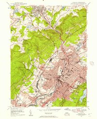 1947 Scranton1957 Print · USGSThe Lackawanna Valley in the late 1940s is a high-density industrial corridor defined by its deep coal roots and rail networks. Genealogists can locate family names at Forest Hill Cemetery, trace the early campus of Scranton University, or find vanished neighborhood landmarks like the State Oral Sch.4 unique versions available
 - 1948 Map of Olyphant
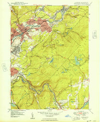 1948 Olyphant1948 Print · USGSThe Lackawanna Valley at the height of its industrial era shows a landscape shaped by coal and rail. Genealogists and historians can trace neighborhood schools and parish cemeteries like St Marys Cem or locate the St Nicholas Orphanage and Sturgis.2 unique versions available
 - 1949 Map of Carbondale
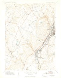 1949 Carbondale1949 Print · USGSThe industrial Lackawanna Valley is shown in detail during the late 1940s, tracing the river-and-rail corridor through Carbondale and Jermyn. Researchers can locate family landmarks like Scott High Sch, Mt Carmel Ch, and the Mid Valley Airport.2 unique versions available
 - 1949 Map of Dalton
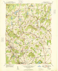 1949 Dalton1949 Print · USGSThe rural landscape north of Scranton in the 1940s reveals a dense network of family-named hills and small lakeside settlements. Researchers can trace the Delaware Lackawanna and Western line past the Blakely Home or locate early burial sites like Hickory Grove Cem and Wallsville Cem.
 - 1950 Map of Scranton
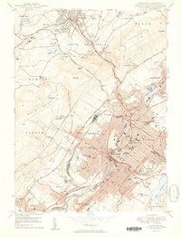 1950 Scranton1950 Print · USGSThe Lackawanna Valley at mid-century shows a bustling industrial landscape defined by coal, rail, and academia. Trace the urban layout of Scranton and Dunmore, finding family sites at Forest Hill Cemetery or landmarks like Marywood College.2 unique versions available
 - 1950 Map of Scranton, 1952 Print
 1950 Scranton1952 Print · USGSMid-century Northeast Pennsylvania and the Hudson Valley come alive in this survey of the tri-state region. Genealogists and historians can trace the dense rail networks of the Erie RR and DL&W RR between industrial hubs like Scranton and Wilkes-Barre.
 - 1953 Map of Scranton
 1953 Scranton1953 Print · USGSNortheastern Pennsylvania and the Catskills are shown in great detail during the early fifties, a time when rail lines and river valleys dictated the region's growth. Genealogists and historians can trace the industrial hearts of Scranton and Wilkes-Barre or locate remote landmarks like High Point and Lake Wallenpaupack.
 - 1959 Map of Scranton
 1959 Scranton1959 Print · USGSThe northern coalfields and the Hudson Valley meet in this mid-century survey of the Pennsylvania and New York borderlands. Genealogists and historians can trace the intricate rail networks of the Erie Railroad and the vast waters of Lake Wallenpaupack.2 unique versions available
 - 1962 Map of Scranton, 1977 Print
 1962 Scranton1977 Print · USGSThe industrial heart of eastern Pennsylvania and the New York Catskills are captured here in the early sixties. Genealogists and historians can trace the dense valley settlements from Scranton to Wilkes-Barre and the rail lines of the Erie Lackawanna Railroad.2 unique versions available
 - 1965 Map of Scranton
 1965 Scranton1965 Print · USGSThe tri-state highlands of Pennsylvania, New York, and New Jersey come alive in the mid-sixties as industry and recreation converge. Trace the intricate rail lines of the Erie Lackawanna RR or locate landmarks like the U S Military Academy.2 unique versions available
 - 1986 Map of Scranton
 1986 Scranton1986 Print · USGSNortheastern Pennsylvania in the mid-eighties shows an era of transition between its deep-rooted mining history and modern transit growth. Researchers can trace the industrial footprint of a Strip Mine, locate the Tobyhanna Army Depot, or find family sites near St Marys Cem and Wilkes College.2 unique versions available
 - 1986 Map of Honesdale
 1986 Honesdale1986 Print · USGSNortheastern Pennsylvania and the New York borderlands appear here in the mid-1980s, during a period of transition for the region's industrial river valleys. Genealogists can trace family connections across the Moosic Mountains between the coal towns of Carbondale and the canal-era heritage of Honesdale.2 unique versions available
 - 1994 Map of Dalton, 1995 Print
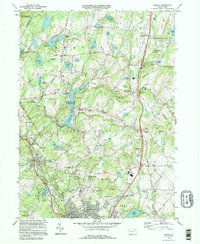 1994 Dalton1995 Print · USGSLackawanna County's rolling highlands and lake country appear here in the mid-1990s, showcasing a landscape of small crossroads and quiet cemeteries. Genealogists can trace family names through Decker Cem and Weatherby Cem or find old landmarks like St Gabriels Monastery.
 - 1994 Map of Carbondale, 1995 Print
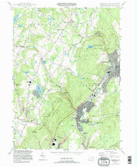 1994 Carbondale1995 Print · USGSThe Lackawanna River valley in the mid-nineties shows a transition from coal-era industry to modern conservation. Researchers can trace ancestral sites at Our Mother of Sorrows Cem or explore the geography of Archbald Pothole State Park and Finch Hill.
 - 1994 Map of Scranton, 1996 Print
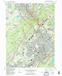 1994 Scranton1996 Print · USGSThe Lackawanna Valley at the end of the twentieth century shows a city shaped by rail and river. Researchers can trace the layout of historic neighborhoods like Providence and find local landmarks such as Steamtown National Historic Site and Forest Hill Cemetery.
 - 1994 Map of Olyphant, 1996 Print
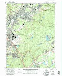 1994 Olyphant1996 Print · USGSThe Lackawanna Valley boroughs show a dense 1990s landscape of industry and community institutions just north of Scranton. Researchers can trace local heritage through numerous religious sites and landmarks like Mt Carmel Cem, Bishop O'Hara High School, and Grassy Island.
 - 1999 Map of Carbondale, 2001 Print
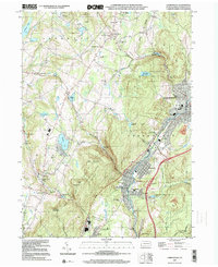 1999 Carbondale2001 Print · USGSThe Lackawanna River valley shows its transition from coal country to a modern residential and industrial corridor at the close of the century. Trace the heritage of anthracite towns through Brookside Cemetery or the geological wonders of Archbald Pothole State Park.
Showing maps 1-25 of 46
Top cities near Scott Township
- Scranton historical maps
- Dunmore historical maps
- Carbondale historical maps
- Old Forge historical maps
- Pittston historical maps
- Blakely historical maps
See more
Top neighborhoods of Scott Township
- Montdale historical maps
- Powell historical maps
- Chapman Lake historical maps
- Green Grove historical maps
- Tompkinsville historical maps
- Edella historical maps
See more
Frequently asked questions
- What are the different types of historical maps available for Scott Township?
- What is the oldest map of Scott Township?
- Where can I purchase historical maps of Scott Township for my home or office?
- Where can I download high-res historical maps of Scott Township?
- Are there historical topographic maps available for Scott Township?
- Is there historical aerial imagery available for Scott Township?
- Where are historical maps of Scott Township sourced from?