1950s Maps of Lancaster County, Pennsylvania
Explore 41 historic maps of Lancaster County from the 1950s. These maps offer a rare glimpse into what life looked like during the 1950s — showing old roads, neighborhoods, homes, and landmarks that have changed or disappeared over time.
Whether you're researching your family's past, planning a metal detecting trip, or studying how Lancaster County's landscape evolved across the 1950s, these high-resolution maps are a powerful tool for exploring the history of this region.
- Focus on a specific era: All maps on this page are from the 1950s, giving you a focused view of this time period.
- See what’s changed: Compare century-old streets, trails, and buildings to today's modern landscape using overlays and satellite layers.
- Research with precision: Use these maps for genealogy, historical research, land use analysis, or educational projects.
- View, download, or print: Maps are fully viewable online in high resolution, and can be downloaded or printed for your own records.
Start exploring Lancaster County's history through authentic maps from the 1950s. This is your window into the past.
Lancaster County, PA maps
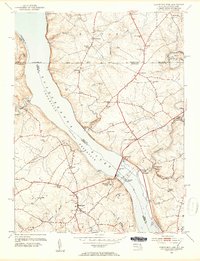
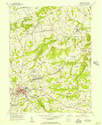
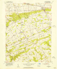
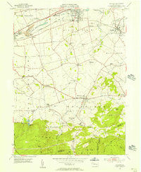
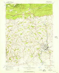
(41)- 1950 Map of Harrisburg, 1952 Print
 1950 Harrisburg1952 Print · USGSMid-century Central Pennsylvania comes alive through its dense rail networks and river valley settlements during the post-war industrial era. Genealogists and historians can trace family roots through hubs like Harrisburg, locate Carlisle Barracks, or follow the Pennsylvania RR through the Lebanon Valley.
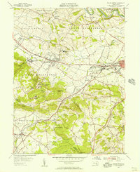
 - 1953 Map of Wernersville
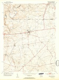
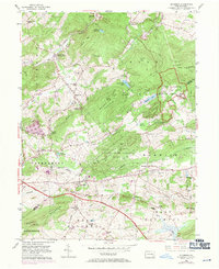
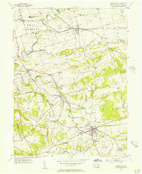
 1953 Wernersville1953 Print · USGSBerks and Lebanon counties are shown in detail during the early 1950s, highlighting a landscape of institutional growth and deep-rooted rural settlements. Genealogists can locate family landmarks like the Bethany Orphans Home, Kricks Mill, and the Blue Meeting House.
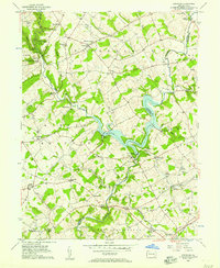
 - 1953 Map of Conowingo Dam, 1954 Print
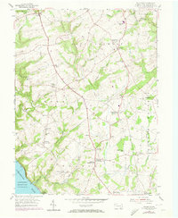
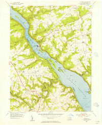
 1953 Conowingo Dam1954 Print · USGSThe Cecil and Harford County borderlands are caught in a period of industrial transition during the 1950s. Genealogists and researchers can trace family landmarks like Darlington Cem, old schools at New Valley Sch, and the rail lines serving Conowingo Sta.6 unique versions available
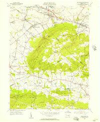
 - 1953 Map of Rising Sun, 1954 Print
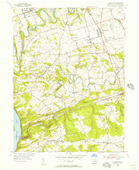
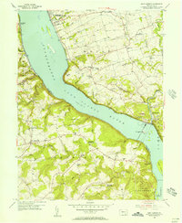
 1953 Rising Sun1954 Print · USGSNorthern Cecil County comes to life in the early fifties, following the historic Mason and Dixon Line into Pennsylvania. Genealogists can trace family names at West Nottingham Cem, Richards Oak, and the Brookview Chapel.6 unique versions available
 - 1953 Map of Oxford, 1955 Print
 1953 Oxford1955 Print · USGSChester County's rural townships and academic centers are captured here in the early fifties. Researchers can locate numerous family-named landmarks and institutions like Lincoln University, Faggs Manor, and the Chestnut Grove Sch.4 unique versions available
 - 1953 Map of Parkesburg, 1955 Print
 1953 Parkesburg1955 Print · USGSChester County's rail-and-valley landscape is captured here in the early fifties, showing the busy industrial corridor of the Pennsylvania Railroad. Trace old family sites near Sadsbury Meeting House or the rural crossroads of Cochranville.5 unique versions available
 - 1953 Map of Red Lion, 1956 Print
 1953 Red Lion1956 Print · USGSYork County's industrial and rural landscape is captured here in the early fifties as the region's rail network supported growing boroughs and historic furnaces. Researchers can trace family sites at Snavelys Sch, Leiphart Mill, or the historic Canadochly Ch.5 unique versions available
 - 1954 Map of Baltimore
 1954 Baltimore1954 Print · USGSThe Mid-Atlantic region in the early fifties shows a landscape of growing suburban centers and heavy rail corridors. Trace mid-century transit networks and military landmarks from the Aberdeen Proving Ground to the Gettysburg National Military Park.
 - 1954 Map of Elverson, 1970 Print
 1954 Elverson1970 Print · USGSBerks and Chester counties are captured here in the mid-fifties, showing the intersection of colonial history and modern transit. Trace old family sites near Geigertown, Joanna Heights, and churches like Bethesda Ch or Ebenezer Ch.
 - 1955 Map of Wakefield
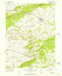
 1955 Wakefield1955 Print · USGSSouthern Lancaster County's rural landscape is captured here in the 1950s, showing a region of rolling farmland and river valleys. Genealogists can locate Fulton House, local schools like Brick Hill Sch, and the old Fairfield post office.5 unique versions available
 - 1955 Map of Wilmington
 1955 Wilmington1955 Print · USGSThe Delaware Valley and Jersey Shore are seen here during the mid-fifties era of rapid suburban expansion and highway development. You can trace the path of the New Jersey Turnpike, locate the Fort Dix Military Reservation, or explore the rail networks of the Pennsylvania Railroad.
 - 1955 Map of Conestoga, 1956 Print
 1955 Conestoga1956 Print · USGSLancaster County's southern townships are captured in the mid-fifties, showing a landscape shaped by winding creeks and crossroad villages. Genealogists and historians can trace family roots through numerous country landmarks like Boehm Ch, Marticville, and Colemanville.7 unique versions available
 - 1955 Map of Gap, 1956 Print
 1955 Gap1956 Print · USGSEastern Lancaster County in the mid-fifties shows a landscape of ridge-top mines and valley farms centered on the strategic Gap pass. Genealogists can locate family homes and landmarks like Nickel Mines, Georgetown (Bart PO), and the Octoraro Ch.6 unique versions available
 - 1955 Map of Quarryville, 1956 Print
 1955 Quarryville1956 Print · USGSMid-century Lancaster County comes to life in this survey of a landscape defined by rolling farmsteads and rail corridors. Genealogists and local historians can locate many district schools like Sandstone Sch, the Strasburg RR, and landmarks like the Quarryville Presbyterian Home.4 unique versions available
 - 1955 Map of Holtwood, 1956 Print
 1955 Holtwood1956 Print · USGSThe Susquehanna River defines this mid-century landscape as it flows through the reservoirs of the Holtwood Dam. Genealogists and historians can trace family-named sites like Erbs Mill, the old Coyne Lock, and the Pennsylvania RR corridor.6 unique versions available
 - 1955 Map of Safe Harbor, 1956 Print
 1955 Safe Harbor1956 Print · USGSThe Susquehanna River valley and the engineering of the river for power are seen here in the mid-1950s. Genealogists can trace family roots at Manor Meetinghouse, Bethany Ch, and small crossroads like Washington.7 unique versions available
 - 1955 Map of Richland, 1956 Print
 1955 Richland1956 Print · USGSThe Lebanon Valley was a bustling corridor of rail and old canal beds in the mid-fifties. Genealogists can trace family roots through numerous country landmarks like Heidelberg Ch, Kralls Ch, and the many rural schools and cemeteries scattered near Schaefferstown.6 unique versions available
 - 1955 Map of Sinking Spring, 1956 Print
 1955 Sinking Spring1956 Print · USGSBerks and Lancaster counties are shown during a period of steady mid-century growth along the Reading railroad line. Researchers can trace the layout of the Wernersville State Hospital or locate historic local churches like Hains Ch and Olive Leaf Chapel.6 unique versions available
 - 1955 Map of Airville, 1956 Print
 1955 Airville1956 Print · USGSYork County in the mid-fifties shows a landscape of river-valley hamlets and upland farms centered around the winding Muddy Creek. Genealogists can trace family footprints at Guinston Ch, the Indian Steps Museum, and old schoolhouses like Township Sch.5 unique versions available
 - 1955 Map of Kirkwood, 1957 Print
 1955 Kirkwood1957 Print · USGSThe Lancaster and Chester County line comes alive in the mid-fifties, dominated by the waters of Octoraro Lake and the rural townships surrounding it. Researchers can trace ancestral locations at Colerain Cem Ch, Little Britain, and the Township Central Sch.4 unique versions available
 - 1955 Map of Womelsdorf, 1957 Print
 1955 Womelsdorf1957 Print · USGSMid-century Berks and Lebanon Counties are shown here at a time when mountain missions and traditional farmstead life still defined the landscape. You can trace the READING railroad line through Robesonia or locate historic sites like St Daniels Ch, the Bethany Orphan Home, and the Texter Mission.6 unique versions available
 - 1955 Map of Honey Brook, 1957 Print
 1955 Honey Brook1957 Print · USGSChester and Lancaster counties are captured here in the mid-fifties, showing a landscape shaped by historic turnpikes and the wooded heights of Welsh Mountain. Researchers can trace old family-named landmarks and institutions like St Johns Church, Bridgeville Ch, and the Kings Highway Sch.6 unique versions available
 - 1955 Map of Manheim, 1957 Print
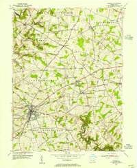
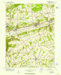
 1955 Manheim1957 Print · USGSMid-century Lancaster County life centers on the borough of Manheim as the local rail and road networks reached their peak. Trace family history through numerous rural landmarks like Gantzs Ch, Mastersonville, and the Shoemaker Cem burial grounds.6 unique versions available
 - 1956 Map of Baltimore
 1956 Baltimore1956 Print · USGSMid-century Maryland and Pennsylvania are captured here during a period of massive suburban and military growth across the Chesapeake region. Genealogists and historians can trace the rail corridors of the Baltimore & Ohio RR and locate landmarks like Fort McHenry or the Aberdeen Proving Ground.
 - 1956 Map of Newark
 1956 Newark1956 Print · USGSThe industrial heart of the Mid-Atlantic is captured here at the dawn of the highway era, tracing the dense corridors between Newark and Philadelphia. Genealogists and local historians can map the rail networks of the Reading RR or locate mid-century military life at Fort Dix Military Reservation.2 unique versions available
Showing maps 1-25 of 41
Top cities of Lancaster County
- Lancaster historical maps
- West Lampeter Township historical maps
- Ephrata historical maps
- Elizabethtown historical maps
- Columbia historical maps
- Lititz historical maps
See more
Frequently asked questions
- What are the different types of historical maps available for Lancaster County?
- What is the oldest map of Lancaster County?
- Where can I purchase historical maps of Lancaster County for my home or office?
- Where can I download high-res historical maps of Lancaster County?
- Are there historical topographic maps available for Lancaster County?
- Is there historical aerial imagery available for Lancaster County?
- Where are historical maps of Lancaster County sourced from?