1900s (20th Century) Maps of Upper Leacock Township, Pennsylvania
Explore 20 historic maps of Upper Leacock Township from the 1900s (20th Century). These maps offer a rare glimpse into what life looked like during the 1900s — showing old roads, neighborhoods, homes, and landmarks that have changed or disappeared over time.
Whether you're researching your family's past, planning a metal detecting trip, or studying how Upper Leacock Township's landscape evolved across the 1900s, these high-resolution maps are a powerful tool for exploring the history of this region.
- Focus on a specific era: All maps on this page are from the 1900s, giving you a focused view of this time period.
- See what’s changed: Compare century-old streets, trails, and buildings to today's modern landscape using overlays and satellite layers.
- Research with precision: Use these maps for genealogy, historical research, land use analysis, or educational projects.
- View, download, or print: Maps are fully viewable online in high resolution, and can be downloaded or printed for your own records.
Start exploring Upper Leacock Township's history through authentic maps from the 1900s. This is your window into the past.
Upper Leacock Township, PA maps
(20)- 1902 Map of Lancaster, 1956 Print
 1902 Lancaster1956 Print · USGSLancaster County at the opening of the twentieth century shows a landscape defined by iron furnaces, milling, and a sophisticated network of electric railways. Genealogists and historians can trace the paths of the New Holland Electric or locate family sites near Gevers Mill and Elizabeth Furnace.
 - 1904 Map of Lancaster
 1904 Lancaster1904 Print · USGSLancaster and its surrounding townships thrive at the turn of the century, depicted here through a complex web of trolley lines and steam railroads. Genealogists can trace family homesteads near old crossroads like Mastersonville or locate early industrial sites at Mount Hope and Geyers Mill.10 unique versions available
 - 1906 Map of New Holland, 1962 Print
 1906 New Holland1962 Print · USGSLancaster County at the start of the twentieth century shows a landscape transitioning from turnpikes to electric railways. Genealogists can trace family roots through an extensive network of rural landmarks, including Heller Church, Red Well School, and the early Waterworks at Ephrata.
 - 1908 Map of New Holland
 1908 New Holland1908 Print · USGSLancaster County at the turn of the century shows a thriving landscape of rural schoolhouses and turnpike villages. Genealogists can locate family landmarks like Middle Creek Church, Heller Church, and dozens of local schools from Stony Hill School to Clay School.6 unique versions available
 - 1941 Map of New Holland
 1941 New Holland1941 Print · USGSLancaster County’s agricultural heartland is documented here just as the modern highway era arrived. Genealogists and local historians can trace family locations through dozens of named rural landmarks like Heller Church, Fetter School, and the Pennsylvania RR corridor.
 - 1943 Map of Lancaster
 1943 Lancaster1943 Print · USGSLancaster County at the height of the second World War reveals a landscape defined by bustling rail hubs and thriving farm villages. Genealogists and historians can trace family roots through numerous small hamlets like Brunnerville, industrial sites at Elizabeth Furnace Gap, and recreation spots like Rocky Spring Park.
 - 1950 Map of Harrisburg, 1952 Print
 1950 Harrisburg1952 Print · USGSMid-century Central Pennsylvania comes alive through its dense rail networks and river valley settlements during the post-war industrial era. Genealogists and historians can trace family roots through hubs like Harrisburg, locate Carlisle Barracks, or follow the Pennsylvania RR through the Lebanon Valley.
 - 1956 Map of Leola, 1957 Print
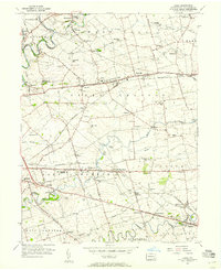 1956 Leola1957 Print · USGSMid-century Lancaster County life centers on the bustling crossroads of Bird in Hand and Leola during this era of post-war growth. Genealogists and historians can trace family-named landmarks like Myers Cem or locate community hubs such as St Johns Ch and Weavertown Sch.5 unique versions available
 - 1956 Map of New Holland, 1957 Print
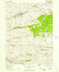 1956 New Holland1957 Print · USGSLancaster County in the mid-fifties shows a landscape of deep-rooted settlements and thriving rural schools. Genealogists can trace family landmarks and community hubs like Intercourse, the Pequea Valley High Sch, and Lady of Lourdes Ch.5 unique versions available
 - 1956 Map of Lancaster, 1958 Print
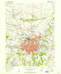 1956 Lancaster1958 Print · USGSMid-century Lancaster and its suburban frontiers are documented here during a period of significant post-war growth. Genealogists and historians can locate family landmarks like the Mennonite Home, Woodward Hill Cemetery, and Franklin and Marshall College.5 unique versions available
 - 1957 Map of Harrisburg
 1957 Harrisburg1957 Print · USGSMid-century Central Pennsylvania comes into focus as a bustling network of rail, river, and mountain ridges. Genealogists and historians can trace the development of the State Capitol and surrounding hubs like Middletown, Columbia, and Pottsville.7 unique versions available
 - 1961 Map of Harrisburg
 1961 Harrisburg1961 Print · USGSCentral Pennsylvania is shown at a mid-century peak of industrial and military activity, from the Susquehanna water gaps to the fertile Dutch Country. Genealogists and historians can trace the rail corridors of the Pennsylvania RR and find landmarks like Carlisle Barracks or the Anthracite Coal Fields.2 unique versions available
 - 1964 Map of Harrisburg
 1964 Harrisburg1964 Print · USGSCentral Pennsylvania in the mid-fifties reveals a landscape shaped by ridge-and-valley geology and critical Cold War infrastructure. Researchers can trace the massive Indiantown Gap Military Reservation or the rail corridors of the Pennsylvania RR and Reading RR.
 - 1984 Map of Harrisburg, 1985 Print
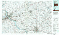 1984 Harrisburg1985 Print · USGSCentral Pennsylvania in the mid-eighties shows a landscape defined by the winding Susquehanna River and the industrial growth of its river towns. Researchers can trace the rail corridors of Amtrak and Conrail or explore the bounds of Fort Indiantown Gap Military Reservation.2 unique versions available
 - 1992 Map of Leola, 1994 Print
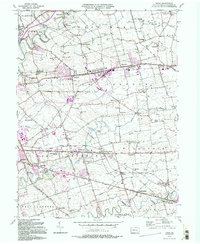 1992 Leola1994 Print · USGSLancaster County's agrarian landscape is captured here in the early 1990s, centered on the historic crossroads of Leola and Bareville. Genealogists and historians can trace family locations near Bird in Hand, Carpenter Ch, and the numerous local schoolhouses like Mill Creek Sch.2 unique versions available
 - 1992 Map of New Holland, 1994 Print
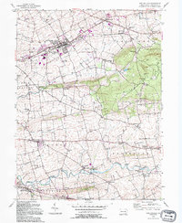 1992 New Holland1994 Print · USGSLancaster County's agricultural heartland is captured here in the late twentieth century, showing a landscape of tight-knit villages and sprawling farms. Researchers can trace family roots through numerous local landmarks like Lady of Lourdes, Zeltenreich Ch, and rural schoolhouses including Hatville Sch.
 - 1995 Map of Lancaster, 1996 Print
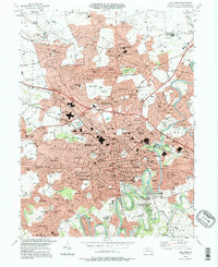 1995 Lancaster1996 Print · USGSLancaster and its northern suburbs are shown in great detail during the mid-nineties, capturing the city's expansion and educational centers. Researchers can locate legacy sites like Franklin and Marshall College, the Stockyards, and Woodward Hill Cemetery.
 - 1997 Map of Lancaster, 2000 Print
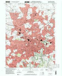 1997 Lancaster2000 Print · USGSLancaster was experiencing significant suburban expansion and institutional growth in the late nineties. Researchers can trace the layout of Franklin and Marshall College, locate family sites at Woodward Hill Cemetery, or explore outlying communities like East Petersburg.
 - 1999 Map of Leola, 2001 Print
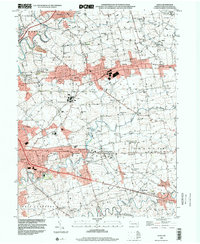 1999 Leola2001 Print · USGSLancaster County at the turn of the millennium shows a fascinating mix of rural tradition and modern infrastructure. Trace family roots and local history across Bird in Hand, Leola, and school sites like Shaeffer Sch.
 - 1999 Map of New Holland, 2001 Print
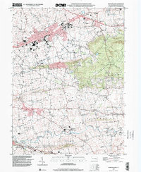 1999 New Holland2001 Print · USGSLancaster County at the close of the millennium shows a preserved rural landscape between the Lincoln Highway and Welsh Mountain. Researchers can trace the heritage of local settlements like Intercourse, Blue Ball, and Paradise alongside numerous historic schoolhouses and country churches.
End of results
Showing maps 1-20 of 20
Top cities near Upper Leacock Township
- Reading historical maps
- Lancaster historical maps
- West Lampeter Township historical maps
- Ephrata historical maps
- Lititz historical maps
- Willow Street historical maps
See more
Top neighborhoods of Upper Leacock Township
- Hunsecker historical maps
- Leola historical maps
- Monterey historical maps
- Stumptown historical maps
- Bareville historical maps
- Leacock historical maps
Frequently asked questions
- What are the different types of historical maps available for Upper Leacock Township?
- What is the oldest map of Upper Leacock Township?
- Where can I purchase historical maps of Upper Leacock Township for my home or office?
- Where can I download high-res historical maps of Upper Leacock Township?
- Are there historical topographic maps available for Upper Leacock Township?
- Is there historical aerial imagery available for Upper Leacock Township?
- Where are historical maps of Upper Leacock Township sourced from?