1950s Maps of Warwick Township, Pennsylvania
Explore 6 historic maps of Warwick Township from the 1950s. These maps offer a rare glimpse into what life looked like during the 1950s — showing old roads, neighborhoods, homes, and landmarks that have changed or disappeared over time.
Whether you're researching your family's past, planning a metal detecting trip, or studying how Warwick Township's landscape evolved across the 1950s, these high-resolution maps are a powerful tool for exploring the history of this region.
- Focus on a specific era: All maps on this page are from the 1950s, giving you a focused view of this time period.
- See what’s changed: Compare century-old streets, trails, and buildings to today's modern landscape using overlays and satellite layers.
- Research with precision: Use these maps for genealogy, historical research, land use analysis, or educational projects.
- View, download, or print: Maps are fully viewable online in high resolution, and can be downloaded or printed for your own records.
Start exploring Warwick Township's history through authentic maps from the 1950s. This is your window into the past.
Warwick Township, PA maps
(6)- 1950 Map of Harrisburg, 1952 Print
 1950 Harrisburg1952 Print · USGSMid-century Central Pennsylvania comes alive through its dense rail networks and river valley settlements during the post-war industrial era. Genealogists and historians can trace family roots through hubs like Harrisburg, locate Carlisle Barracks, or follow the Pennsylvania RR through the Lebanon Valley.
 - 1956 Map of Leola, 1957 Print
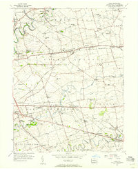 1956 Leola1957 Print · USGSMid-century Lancaster County life centers on the bustling crossroads of Bird in Hand and Leola during this era of post-war growth. Genealogists and historians can trace family-named landmarks like Myers Cem or locate community hubs such as St Johns Ch and Weavertown Sch.5 unique versions available
 - 1956 Map of Lititz, 1957 Print
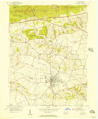 1956 Lititz1957 Print · USGSMid-century Lancaster County comes to life as the industrial borough of Lititz thrives alongside its rural neighbors. Genealogists and researchers can trace local families through many landmarks like Linden Hall Sch, Erbs Ch, and the crossroads of Brickerville.5 unique versions available
 - 1956 Map of Ephrata, 1957 Print
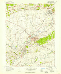 1956 Ephrata1957 Print · USGSMid-century Lancaster County comes to life through this survey of the boroughs and rural townships north of Lancaster. Genealogists and historians can trace family-named landmarks like Durlach Cem or locate community hubs such as Vogansville Sch and Zion Ch.5 unique versions available
 - 1956 Map of Lancaster, 1958 Print
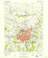 1956 Lancaster1958 Print · USGSMid-century Lancaster and its suburban frontiers are documented here during a period of significant post-war growth. Genealogists and historians can locate family landmarks like the Mennonite Home, Woodward Hill Cemetery, and Franklin and Marshall College.5 unique versions available
 - 1957 Map of Harrisburg
 1957 Harrisburg1957 Print · USGSMid-century Central Pennsylvania comes into focus as a bustling network of rail, river, and mountain ridges. Genealogists and historians can trace the development of the State Capitol and surrounding hubs like Middletown, Columbia, and Pottsville.7 unique versions available
End of results
Showing maps 1-6 of 6
Top cities near Warwick Township
- Lancaster historical maps
- Lebanon historical maps
- West Lampeter Township historical maps
- Ephrata historical maps
- Lititz historical maps
- Willow Street historical maps
See more
Top neighborhoods of Warwick Township
- Halfville historical maps
- Millway historical maps
- Millport historical maps
- Brunnerville historical maps
- Kissel Hill historical maps
- Lexington historical maps
See more
Frequently asked questions
- What are the different types of historical maps available for Warwick Township?
- What is the oldest map of Warwick Township?
- Where can I purchase historical maps of Warwick Township for my home or office?
- Where can I download high-res historical maps of Warwick Township?
- Are there historical topographic maps available for Warwick Township?
- Is there historical aerial imagery available for Warwick Township?
- Where are historical maps of Warwick Township sourced from?