1990s Maps of Warwick Township, Pennsylvania
Explore 7 historic maps of Warwick Township from the 1990s. These maps offer a rare glimpse into what life looked like during the 1990s — showing old roads, neighborhoods, homes, and landmarks that have changed or disappeared over time.
Whether you're researching your family's past, planning a metal detecting trip, or studying how Warwick Township's landscape evolved across the 1990s, these high-resolution maps are a powerful tool for exploring the history of this region.
- Focus on a specific era: All maps on this page are from the 1990s, giving you a focused view of this time period.
- See what’s changed: Compare century-old streets, trails, and buildings to today's modern landscape using overlays and satellite layers.
- Research with precision: Use these maps for genealogy, historical research, land use analysis, or educational projects.
- View, download, or print: Maps are fully viewable online in high resolution, and can be downloaded or printed for your own records.
Start exploring Warwick Township's history through authentic maps from the 1990s. This is your window into the past.
Warwick Township, PA maps
(7)- 1992 Map of Leola, 1994 Print
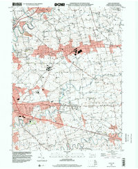
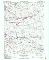 1992 Leola1994 Print · USGSLancaster County's agrarian landscape is captured here in the early 1990s, centered on the historic crossroads of Leola and Bareville. Genealogists and historians can trace family locations near Bird in Hand, Carpenter Ch, and the numerous local schoolhouses like Mill Creek Sch.2 unique versions available
 - 1992 Map of Ephrata, 1995 Print
 1992 Ephrata1995 Print · USGSLancaster County's northern townships appear here during a period of sustained growth, balancing industrial rail access with traditional rural crossroads. Researchers can locate dozens of historic landmarks, from the Reading RR lines in Denver to local congregational sites like Steinmetz Ch and St Pauls Ch.
 - 1995 Map of Lancaster, 1996 Print
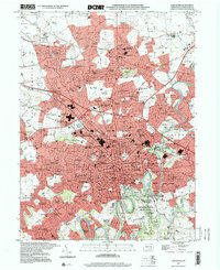
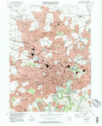 1995 Lancaster1996 Print · USGSLancaster and its northern suburbs are shown in great detail during the mid-nineties, capturing the city's expansion and educational centers. Researchers can locate legacy sites like Franklin and Marshall College, the Stockyards, and Woodward Hill Cemetery.
 - 1995 Map of Lititz, 1996 Print
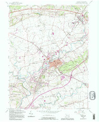
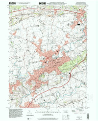
 1995 Lititz1996 Print · USGSThe northern Lancaster County countryside is documented here in the mid-1990s, centered on the borough of Lititz. Genealogists and local historians can locate legacy sites like the Linden Hall Sch, Old Zion Ch, and family landmarks near Kissel Hill.
 - 1997 Map of Lancaster, 2000 Print
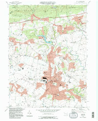
 1997 Lancaster2000 Print · USGSLancaster was experiencing significant suburban expansion and institutional growth in the late nineties. Researchers can trace the layout of Franklin and Marshall College, locate family sites at Woodward Hill Cemetery, or explore outlying communities like East Petersburg.
 - 1999 Map of Leola, 2001 Print
 1999 Leola2001 Print · USGSLancaster County at the turn of the millennium shows a fascinating mix of rural tradition and modern infrastructure. Trace family roots and local history across Bird in Hand, Leola, and school sites like Shaeffer Sch.
 - 1999 Map of Ephrata, 2001 Print
 1999 Ephrata2001 Print · USGSNorthern Lancaster County at the turn of the millennium shows a blend of growing boroughs and deep-rooted rural townships. Researchers can trace historic family landmarks through sites like Mellingers Ch, Hans Graf Sch, and Fairview Cem.
End of results
Showing maps 1-7 of 7
Top cities near Warwick Township
- Lancaster historical maps
- Lebanon historical maps
- West Lampeter Township historical maps
- Ephrata historical maps
- Lititz historical maps
- Willow Street historical maps
See more
Top neighborhoods of Warwick Township
- Halfville historical maps
- Millway historical maps
- Millport historical maps
- Brunnerville historical maps
- Kissel Hill historical maps
- Lexington historical maps
See more
Frequently asked questions
- What are the different types of historical maps available for Warwick Township?
- What is the oldest map of Warwick Township?
- Where can I purchase historical maps of Warwick Township for my home or office?
- Where can I download high-res historical maps of Warwick Township?
- Are there historical topographic maps available for Warwick Township?
- Is there historical aerial imagery available for Warwick Township?
- Where are historical maps of Warwick Township sourced from?