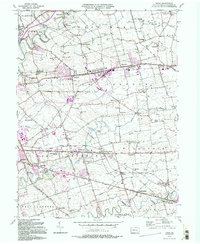
1992 Map of Leola
USGS Topo · Published 1994About this map
Leola and Bareville serve as central hubs in this detailed portrait of Lancaster County's agricultural heartland. The landscape is defined by a dense network of country roads and small communities like Bird in Hand and Smoketown, where the transition from traditional farming to modern residential development is evident. Significant institutional landmarks such as the East Lampeter High Sch and the State Police Barracks are situated alongside long-standing religious sites, including Leacock Ch and St Johns Ch.
Find a feature on this map
78 named features on this map. Tap any name to fly to it.
Don’t see what you’re looking for? This feature index may not catch every label — zoom into the map to look around manually.
Map Details
Editions of this 1992 Leola Map
2 editions found
Other maps of this area

1902 · Lancaster
USGS Topo · 1:62,500

1904 · Lancaster
USGS Topo · 1:62,500

1906 · New Holland
USGS Topo · 1:62,500

1908 · New Holland
USGS Topo · 1:62,500

1912 · Quarryville
USGS Topo · 1:62,500

1912 · Mc Calls Ferry
USGS Topo · 1:62,500

1941 · New Holland
USGS Topo · 1:62,500

1943 · Lancaster
USGS Topo · 1:62,500

1943 · Quarryville
USGS Topo · 1:62,500

1943 · Mc Calls Ferry
USGS Topo · 1:62,500
Featured Places
- West Lampeter Township, PA
- Leacock, Upper Leacock Township
- Paradise Township, PA
- Brownstown, West Earl Township
- Manheim Township, PA