1900s (20th Century) Maps of Lebanon County, Pennsylvania
Explore 66 historic maps of Lebanon County from the 1900s (20th Century). These maps offer a rare glimpse into what life looked like during the 1900s — showing old roads, neighborhoods, homes, and landmarks that have changed or disappeared over time.
Whether you're researching your family's past, planning a metal detecting trip, or studying how Lebanon County's landscape evolved across the 1900s, these high-resolution maps are a powerful tool for exploring the history of this region.
- Focus on a specific era: All maps on this page are from the 1900s, giving you a focused view of this time period.
- See what’s changed: Compare century-old streets, trails, and buildings to today's modern landscape using overlays and satellite layers.
- Research with precision: Use these maps for genealogy, historical research, land use analysis, or educational projects.
- View, download, or print: Maps are fully viewable online in high resolution, and can be downloaded or printed for your own records.
Start exploring Lebanon County's history through authentic maps from the 1900s. This is your window into the past.
Lebanon County, PA maps
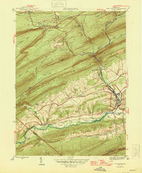
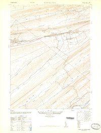
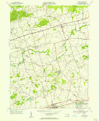
(66)- 1902 Map of Wernersville
 1902 Wernersville1902 Print · USGSCovers Lebanon County, including Clay Township, Bethel Township, and other nearby areas8 unique versions available
 - 1902 Map of Lancaster, 1956 Print
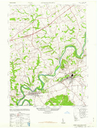
 1902 Lancaster1956 Print · USGSCovers Lebanon County, including Lancaster, West Lampeter Township, and other nearby areas
 - 1904 Map of Lancaster
 1904 Lancaster1904 Print · USGSCovers Lebanon County, including Lancaster, West Lampeter Township, and other nearby areas10 unique versions available
 - 1908 Map of Middletown
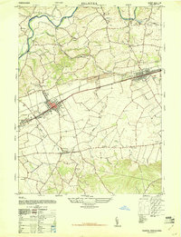
 1908 Middletown1908 Print · USGSCovers Lebanon County, including Hershey, Elizabethtown, and other nearby areas7 unique versions available
 - 1924 Map of Hummelstown
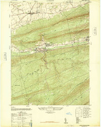
 1924 Hummelstown1924 Print · USGSCovers Lebanon County, including Hershey, Palmyra, and other nearby areas
 - 1943 Map of Lancaster
 1943 Lancaster1943 Print · USGSCovers Lebanon County, including Lancaster, West Lampeter Township, and other nearby areas
 - 1943 Map of Lebanon
 1943 Lebanon1943 Print · USGSCovers Lebanon County, including Lebanon, North Cornwall, and other nearby areas2 unique versions available
 - 1943 Map of Wernersville
 1943 Wernersville1943 Print · USGSCovers Lebanon County, including Clay Township, Bethel Township, and other nearby areas2 unique versions available
 - 1943 Map of Lykens
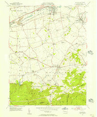
 1943 Lykens1943 Print · USGSCovers Lebanon County, including Hegins Township, Lykens, and other nearby areas
 - 1943 Map of Middletown
 1943 Middletown1943 Print · USGSCovers Lebanon County, including Hershey, Elizabethtown, and other nearby areas
 - 1943 Map of Hummelstown
 1943 Hummelstown1943 Print · USGSCovers Lebanon County, including Hershey, Palmyra, and other nearby areas
 - 1946 Map of Pine Grove
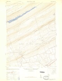
 1946 Pine Grove1946 Print · USGSCovers Lebanon County, including Bethel Township, Hegins Township, and other nearby areas2 unique versions available
 - 1947 Map of Hummelstown
 1947 Hummelstown1947 Print · USGSCovers Lebanon County, including Hershey, Rutherford, and other nearby areas2 unique versions available
 - 1947 Map of Palmyra
 1947 Palmyra1947 Print · USGSCovers Lebanon County, including Hershey, Palmyra, and other nearby areas2 unique versions available
 - 1947 Map of Lykens
 1947 Lykens1947 Print · USGSCovers Lebanon County, including Hegins Township, Lykens, and other nearby areas3 unique versions available
 - 1947 Map of Tower City
 1947 Tower City1947 Print · USGSCovers Lebanon County, including Hegins Township, Williamstown, and other nearby areas3 unique versions available
 - 1947 Map of Manada Gap
 1947 Manada Gap1947 Print · USGSCovers Lebanon County, including East Hanover Township, Jefferson Township, and other nearby areas3 unique versions available
 - 1947 Map of Indiantown Gap
 1947 Indiantown Gap1947 Print · USGSCovers Lebanon County, including East Hanover Township, Union Township, and other nearby areas2 unique versions available
 - 1950 Map of Harrisburg, 1952 Print
 1950 Harrisburg1952 Print · USGSCovers Lebanon County, including Lancaster, Harrisburg, and other nearby areas
 - 1953 Map of Wernersville
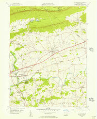
 1953 Wernersville1953 Print · USGSCovers Lebanon County, including Clay Township, Bethel Township, and other nearby areas
 - 1954 Map of Pine Grove, 1956 Print
 1954 Pine Grove1956 Print · USGSCovers Lebanon County, including Bethel Township, Hegins Township, and other nearby areas4 unique versions available
 - 1955 Map of Bethel, 1956 Print
 1955 Bethel1956 Print · USGSCovers Lebanon County, including Bethel Township, Myerstown, and other nearby areas5 unique versions available
 - 1955 Map of Richland, 1956 Print
 1955 Richland1956 Print · USGSCovers Lebanon County, including Clay Township, Richland, and other nearby areas6 unique versions available
 - 1955 Map of Fredericksburg, 1956 Print
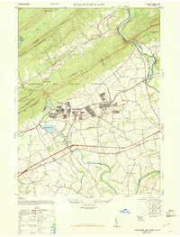
 1955 Fredericksburg1956 Print · USGSCovers Lebanon County, including Bethel Township, Jonestown, and other nearby areas7 unique versions available
 - 1955 Map of Lebanon, 1956 Print
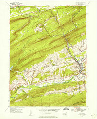
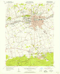 1955 Lebanon1956 Print · USGSCovers Lebanon County, including Lebanon, North Cornwall, and other nearby areas6 unique versions available
Showing maps 1-25 of 66
Top cities of Lebanon County
- Lebanon historical maps
- Palmyra historical maps
- North Cornwall historical maps
- Annville historical maps
- East Hanover Township historical maps
- Myerstown historical maps
See more
Frequently asked questions
- What are the different types of historical maps available for Lebanon County?
- What is the oldest map of Lebanon County?
- Where can I purchase historical maps of Lebanon County for my home or office?
- Where can I download high-res historical maps of Lebanon County?
- Are there historical topographic maps available for Lebanon County?
- Is there historical aerial imagery available for Lebanon County?
- Where are historical maps of Lebanon County sourced from?