Old Maps of Annville, Pennsylvania for Academic Research
Study the evolution of Annville with 29 high-resolution historic maps. Whether you're teaching, researching, or modeling changes in land use, these maps provide essential visual documentation of urban, environmental, and geographic change.
- Analyze long-term change: Track patterns in development, transportation, and natural features.
- Ideal for environmental or urban studies: Support academic projects with primary historical map data.
- Use in the classroom or lab: Educators and researchers rely on these maps to bring historical context to life.
These maps are a powerful tool for teaching, research, and visualizing how Annville has changed over the decades.
Annville, PA maps
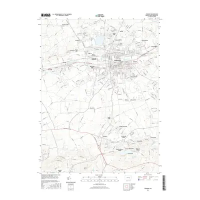
(29)- 1891 Map of Lebanon
 1891 Lebanon1891 Print · USGSLebanon and its surrounding iron-rich valleys are captured here in the late nineteenth century at the height of the local railroad era. Genealogists can trace family lines through old post offices like Greenville (Greble P.O.) or early stops on the Cornwall Railroad.
 - 1892 Map of Hummelstown
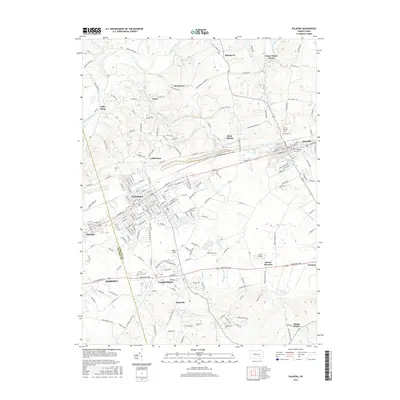
 1892 Hummelstown1892 Print · USGSDauphin and Lebanon Counties were defined by a series of prominent mountain ridges and gap-dependent rail lines in the 1890s. Genealogists can trace family settlements from Hummelstown to Annville, locating landmarks like Walmers Church and Union Deposit.10 unique versions available
 - 1893 Map of Lebanon
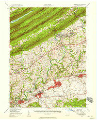
 1893 Lebanon1893 Print · USGSLate nineteenth-century Lebanon County is captured here at the height of its industrial iron and rail era. Genealogists can trace family roots in established centers like Cornwall, Meyerstown, and Schaefferstown, or locate the specific rail stops of the Philadelphia and Reading Railroad.
 - 1899 Map of Lebanon
 1899 Lebanon1899 Print · USGSLebanon County at the close of the century shows a landscape defined by its iron-ore heritage and a bustling network of independent railroads. Genealogists and researchers can trace the old rail lines serving Cornwall, locate long-standing villages like Schaefferstown, and follow the winding course of Tulpehocken Creek.9 unique versions available
 - 1924 Map of Hummelstown
 1924 Hummelstown1924 Print · USGSDauphin and Lebanon Counties in the mid-twenties show a landscape defined by mountain gaps and the reach of the Philadelphia and Reading Railroad. Researchers can trace historic church sites like Walmers Church, early industries at Union Waterworks, and vanished rail stops like Cold Spring.
 - 1943 Map of Lebanon
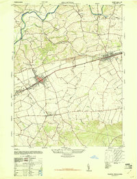
 1943 Lebanon1943 Print · USGSMid-century Pennsylvania life is captured here during the Second World War, showing the expansion of the Lebanon Valley rail and road networks. Genealogists can locate family landmarks such as the Heidelberg Meeting House, Kimmerlings Ch, and numerous rural schools like Monroe Valley Sch.2 unique versions available
 - 1943 Map of Hummelstown
 1943 Hummelstown1943 Print · USGSDauphin and Lebanon counties appear here during the Second World War as military and industrial growth transformed the countryside. Researchers can trace family landmarks and rural infrastructure, from Moonshine Ch and Union Deposit to the Hershey Zoo.
 - 1947 Map of Palmyra
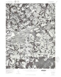
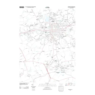
 1947 Palmyra1947 Print · USGSLebanon County towns and rural school districts are captured here in the late 1940s as they grew along the Reading railroad. Researchers can trace ancestral locations through numerous named sites like Gravel Hill Church, Meyersville School, and Palmyra Cemetery.2 unique versions available
 - 1950 Map of Harrisburg, 1952 Print
 1950 Harrisburg1952 Print · USGSMid-century Central Pennsylvania comes alive through its dense rail networks and river valley settlements during the post-war industrial era. Genealogists and historians can trace family roots through hubs like Harrisburg, locate Carlisle Barracks, or follow the Pennsylvania RR through the Lebanon Valley.
 - 1955 Map of Lebanon, 1956 Print
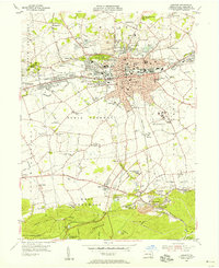 1955 Lebanon1956 Print · USGSMid-century Lebanon and its surrounding furnace villages are detailed in this survey of a shifting industrial landscape. Genealogists can locate family landmarks like Kimmerlings Ch, Zinns Mill, and the Union Canal (Abnd).6 unique versions available
 - 1956 Map of Hummelstown, 1958 Print
 1956 Hummelstown1958 Print · USGSDauphin and Lebanon Counties are shown in the mid-1950s as the chocolate industry and military training shaped the local landscape. Genealogists and historians can trace family roots through labeled landmarks like Balsbaugh Ch, Harper Tavern, and the Manada Furnace.3 unique versions available
 - 1957 Map of Harrisburg
 1957 Harrisburg1957 Print · USGSMid-century Central Pennsylvania comes into focus as a bustling network of rail, river, and mountain ridges. Genealogists and historians can trace the development of the State Capitol and surrounding hubs like Middletown, Columbia, and Pottsville.7 unique versions available
 - 1961 Map of Harrisburg
 1961 Harrisburg1961 Print · USGSCentral Pennsylvania is shown at a mid-century peak of industrial and military activity, from the Susquehanna water gaps to the fertile Dutch Country. Genealogists and historians can trace the rail corridors of the Pennsylvania RR and find landmarks like Carlisle Barracks or the Anthracite Coal Fields.2 unique versions available
 - 1964 Map of Harrisburg
 1964 Harrisburg1964 Print · USGSCentral Pennsylvania in the mid-fifties reveals a landscape shaped by ridge-and-valley geology and critical Cold War infrastructure. Researchers can trace the massive Indiantown Gap Military Reservation or the rail corridors of the Pennsylvania RR and Reading RR.
 - 1969 Map of Palmyra, 1972 Print
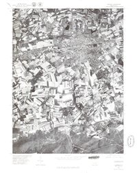
 1969 Palmyra1972 Print · USGSLebanon County is captured in a period of steady growth as the industrial corridor between Palmyra and Annville hums with activity. Researchers can trace historic family landmarks from the Union Canal ruins to Mount Annville Cem and Brindagles Ch.4 unique versions available
 - 1977 Map of Palmyra, 1979 Print
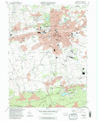
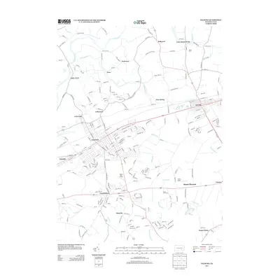
 1977 Palmyra1979 Print · USGSCentral Pennsylvania's agricultural heartland is revealed in the late seventies, showing the growing footprint of Palmyra. Genealogists and historians can trace property lines and field patterns near Campbelltown or along the banks of Swatara Creek.
 - 1977 Map of Lebanon, 1979 Print
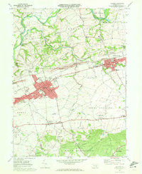
 1977 Lebanon1979 Print · USGSLebanon County and its surrounding countryside are captured in this late 1970s aerial survey, showing the transition from urban centers to forested uplands. Trace the developed streets of Lebanon and Cleona or the rural character of Quentin and Cornwall.
 - 1984 Map of Harrisburg, 1985 Print
 1984 Harrisburg1985 Print · USGSCentral Pennsylvania in the mid-eighties shows a landscape defined by the winding Susquehanna River and the industrial growth of its river towns. Researchers can trace the rail corridors of Amtrak and Conrail or explore the bounds of Fort Indiantown Gap Military Reservation.2 unique versions available
 - 1995 Map of Lebanon, 1996 Print
 1995 Lebanon1996 Print · USGSThe Lebanon area in the mid-nineties reveals a landscape shaped by iron mining and sprawling residential growth. Researchers can trace historic industrial roots at the Cornwall Iron Furnace or find ancestral sites like Kimmerlings Ch and Burd Coleman Village.
 - 2010 Map of Palmyra, 2010 Print
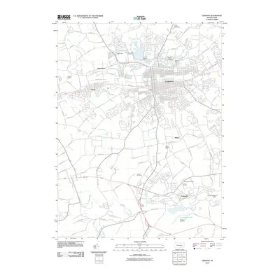
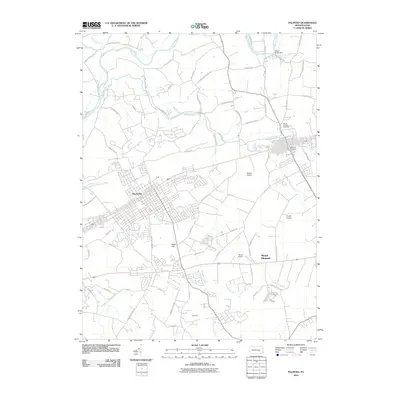 2010 Palmyra2010 Print · USGSCovers Annville, including Hershey, Palmyra, and other nearby areas
 - 2010 Map of Lebanon, 2010 Print
 2010 Lebanon2010 Print · USGSCovers Annville, including Lebanon, North Cornwall, and other nearby areas
 - 2013 Map of Palmyra, 2013 Print
 2013 Palmyra2013 Print · USGSCovers Annville, including Hershey, Palmyra, and other nearby areas
 - 2013 Map of Lebanon, 2013 Print
 2013 Lebanon2013 Print · USGSCovers Annville, including Lebanon, North Cornwall, and other nearby areas
 - 2016 Map of Palmyra, 2016 Print
 2016 Palmyra2016 Print · USGSCovers Annville, including Hershey, Palmyra, and other nearby areas
 - 2016 Map of Lebanon, 2016 Print
 2016 Lebanon2016 Print · USGSCovers Annville, including Lebanon, North Cornwall, and other nearby areas
Showing maps 1-25 of 29
Top cities near Annville
- Lebanon historical maps
- Hershey historical maps
- Elizabethtown historical maps
- Lititz historical maps
- Middletown historical maps
- Mount Joy historical maps
See more
Top neighborhoods of Annville
Frequently asked questions
- What are the different types of historical maps available for Annville?
- What is the oldest map of Annville?
- Where can I purchase historical maps of Annville for my home or office?
- Where can I download high-res historical maps of Annville?
- Are there historical topographic maps available for Annville?
- Is there historical aerial imagery available for Annville?
- Where are historical maps of Annville sourced from?