Old Maps of Swatara Township, Pennsylvania for Hiking & Exploration
Hike through history with 45 historic maps of Swatara Township. Explore old trails, ghost towns, and forgotten backroads — perfect for outdoor adventurers and local explorers.
- Rediscover forgotten places: Map out old mining camps, roads, and footpaths that no longer exist on modern maps.
- Layer with modern tools: Combine with LiDAR or satellite views to plan hikes through historical terrain.
- Made for exploration: Popular among hikers, overlanders, and local history lovers.
Use these maps to find adventure and explore the hidden past of Swatara Township.
Swatara Township, PA maps
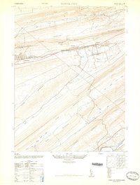
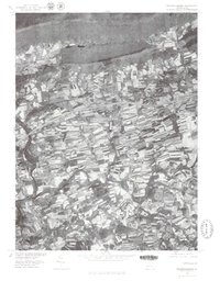
(45)- 1891 Map of Lebanon
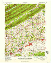
 1891 Lebanon1891 Print · USGSLebanon and its surrounding iron-rich valleys are captured here in the late nineteenth century at the height of the local railroad era. Genealogists can trace family lines through old post offices like Greenville (Greble P.O.) or early stops on the Cornwall Railroad.
 - 1892 Map of Lykens
 1892 Lykens1892 Print · USGSDauphin and Schuylkill counties are shown here in the late nineteenth century as the coal and rail industries shaped the valley floors. Genealogists can trace family roots in mining centers like Williamstown and Lykens or agricultural hamlets such as Rough and Ready.2 unique versions available
 - 1892 Map of Hummelstown
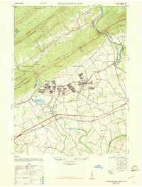
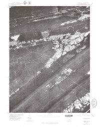
 1892 Hummelstown1892 Print · USGSDauphin and Lebanon Counties were defined by a series of prominent mountain ridges and gap-dependent rail lines in the 1890s. Genealogists can trace family settlements from Hummelstown to Annville, locating landmarks like Walmers Church and Union Deposit.10 unique versions available
 - 1893 Map of Lykens
 1893 Lykens1893 Print · USGSThe anthracite coal region of central Pennsylvania comes to life in the late nineteenth century, showing a landscape defined by mountain ridges and mining railways. Local historians can trace the early industrial footprints of Williamstown and Lykens or find rural homesteads near Klingerstown and Leck Kill.7 unique versions available
 - 1893 Map of Lebanon
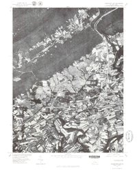
 1893 Lebanon1893 Print · USGSLate nineteenth-century Lebanon County is captured here at the height of its industrial iron and rail era. Genealogists can trace family roots in established centers like Cornwall, Meyerstown, and Schaefferstown, or locate the specific rail stops of the Philadelphia and Reading Railroad.
 - 1899 Map of Lebanon
 1899 Lebanon1899 Print · USGSLebanon County at the close of the century shows a landscape defined by its iron-ore heritage and a bustling network of independent railroads. Genealogists and researchers can trace the old rail lines serving Cornwall, locate long-standing villages like Schaefferstown, and follow the winding course of Tulpehocken Creek.9 unique versions available
 - 1924 Map of Hummelstown
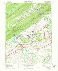
 1924 Hummelstown1924 Print · USGSDauphin and Lebanon Counties in the mid-twenties show a landscape defined by mountain gaps and the reach of the Philadelphia and Reading Railroad. Researchers can trace historic church sites like Walmers Church, early industries at Union Waterworks, and vanished rail stops like Cold Spring.
 - 1943 Map of Lebanon
 1943 Lebanon1943 Print · USGSMid-century Pennsylvania life is captured here during the Second World War, showing the expansion of the Lebanon Valley rail and road networks. Genealogists can locate family landmarks such as the Heidelberg Meeting House, Kimmerlings Ch, and numerous rural schools like Monroe Valley Sch.2 unique versions available
 - 1943 Map of Lykens
 1943 Lykens1943 Print · USGSDauphin and Schuylkill counties are shown in the 1940s as a high-density corridor of anthracite coal production and valley farming. Genealogists and industrial historians can trace the Reading rail lines connecting Williamstown to an Abandoned Colliery and rural landmarks like Himmels Ch.
 - 1943 Map of Hummelstown
 1943 Hummelstown1943 Print · USGSDauphin and Lebanon counties appear here during the Second World War as military and industrial growth transformed the countryside. Researchers can trace family landmarks and rural infrastructure, from Moonshine Ch and Union Deposit to the Hershey Zoo.
 - 1947 Map of Tower City
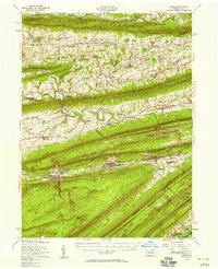
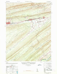
 1947 Tower City1947 Print · USGSThe anthracite coal valleys of Schuylkill and Dauphin Counties are captured here in the late 1940s. Genealogists and historians can trace family locations in Tower City and Williamstown, or locate landmarks like the Porter Township High School and the Union Church.3 unique versions available
 - 1947 Map of Indiantown Gap
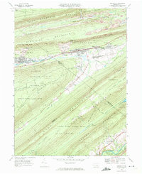
 1947 Indiantown Gap1947 Print · USGSLebanon County is shown during a period of significant military and civic expansion in the late 1940s. Genealogists and historians can trace the foundations of Indiantown Gap alongside local landmarks like Moonshine Church and the newly built State Memorial Lake.2 unique versions available
 - 1950 Map of Harrisburg, 1952 Print
 1950 Harrisburg1952 Print · USGSMid-century Central Pennsylvania comes alive through its dense rail networks and river valley settlements during the post-war industrial era. Genealogists and historians can trace family roots through hubs like Harrisburg, locate Carlisle Barracks, or follow the Pennsylvania RR through the Lebanon Valley.
 - 1955 Map of Fredericksburg, 1956 Print
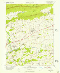 1955 Fredericksburg1956 Print · USGSCentered on Fredericksburg and Jonestown in the mid-1950s, this area shows a productive valley landscape framed by the Blue Mountain ridges. Genealogists can locate family landmarks like Groff Sch, Meckville Ch, and the old crossroads at Bunker Hill or Freeport Mills.7 unique versions available
 - 1955 Map of Lykens, 1958 Print
 1955 Lykens1958 Print · USGSThe anthracite coal valleys of Dauphin and Schuylkill counties are shown here in the mid-1950s, a time of transition for the region's industrial landscape. Genealogists can trace family roots through numerous country landmarks like Himmels Ch, Kissingers Sch, and the Pitman Post Office.2 unique versions available
 - 1956 Map of Hummelstown, 1958 Print
 1956 Hummelstown1958 Print · USGSDauphin and Lebanon Counties are shown in the mid-1950s as the chocolate industry and military training shaped the local landscape. Genealogists and historians can trace family roots through labeled landmarks like Balsbaugh Ch, Harper Tavern, and the Manada Furnace.3 unique versions available
 - 1957 Map of Harrisburg
 1957 Harrisburg1957 Print · USGSMid-century Central Pennsylvania comes into focus as a bustling network of rail, river, and mountain ridges. Genealogists and historians can trace the development of the State Capitol and surrounding hubs like Middletown, Columbia, and Pottsville.7 unique versions available
 - 1961 Map of Harrisburg
 1961 Harrisburg1961 Print · USGSCentral Pennsylvania is shown at a mid-century peak of industrial and military activity, from the Susquehanna water gaps to the fertile Dutch Country. Genealogists and historians can trace the rail corridors of the Pennsylvania RR and find landmarks like Carlisle Barracks or the Anthracite Coal Fields.2 unique versions available
 - 1964 Map of Harrisburg
 1964 Harrisburg1964 Print · USGSCentral Pennsylvania in the mid-fifties reveals a landscape shaped by ridge-and-valley geology and critical Cold War infrastructure. Researchers can trace the massive Indiantown Gap Military Reservation or the rail corridors of the Pennsylvania RR and Reading RR.
 - 1968 Map of Tower City
 1968 Tower City1968 Print · USGSThe anthracite region's industrial footprint is on full display here in the late sixties, where valley towns are hemmed in by massive mountain ridges. Genealogists and historians can trace the foundations of Tower City and Williamstown alongside an Abandoned Coal Breaker and several local schools.
 - 1969 Map of Indiantown Gap, 1972 Print
 1969 Indiantown Gap1972 Print · USGSLebanon County at the close of the 1960s reveals a landscape where military training grounds and mountain trails meet historic canal towns. Researchers can trace the Union Canal, find local landmarks like Moonshine Ch, or explore the development of Indiantown Gap Military Reservation.2 unique versions available
 - 1969 Map of Tower City, 1972 Print
 1969 Tower City1972 Print · USGSSchuylkill and Dauphin counties show a sharp contrast between coal-mining towns and deep mountain forests in the late sixties. Trace the rail-and-road corridor through Tower City and Williamstown or find the remote paths of the Appalachian Trail and Bendigo Airfield.4 unique versions available
 - 1977 Map of Fredericksburg, 1979 Print
 1977 Fredericksburg1979 Print · USGSNorthern Lebanon County in the late seventies reveals a landscape of varied agricultural patterns and traditional settlements. Researchers can trace the development of Jonestown and Fredericksburg or locate features along Swatara Creek.
 - 1977 Map of Tower City, 1979 Print
 1977 Tower City1979 Print · USGSThe western Schuylkill County coal region is seen here in the late seventies, showing how the dramatic mountain ridges shaped local life. Genealogists and local historians can trace the clear street grids and valley footprints of Tower City, Orwin, and Muir.
 - 1977 Map of Indiantown Gap, 1979 Print
 1977 Indiantown Gap1979 Print · USGSLebanon County's landscape in the late seventies reveals the intersection of mountain ridges and valley farming. Trace the early layout of Indiantown Gap and local crossroads like Harper Tavern and Lickdale.
Showing maps 1-25 of 45
Top cities near Swatara Township
- Lebanon historical maps
- Hershey historical maps
- Palmyra historical maps
- North Cornwall historical maps
- Campbelltown historical maps
- Clay Township historical maps
See more
Top neighborhoods of Swatara Township
- Frog's Hollow historical maps
- Mount Ararat historical maps
- Bunker Hill historical maps
- Beverly Heights historical maps
Frequently asked questions
- What are the different types of historical maps available for Swatara Township?
- What is the oldest map of Swatara Township?
- Where can I purchase historical maps of Swatara Township for my home or office?
- Where can I download high-res historical maps of Swatara Township?
- Are there historical topographic maps available for Swatara Township?
- Is there historical aerial imagery available for Swatara Township?
- Where are historical maps of Swatara Township sourced from?