Old Maps of Heidelberg Township, Pennsylvania for Genealogy
Trace your family roots with 40 historic maps of Heidelberg Township. These high-res maps reveal old neighborhoods, homesites, landmarks, and streets — helping you uncover where your ancestors lived and how the area evolved over time.
- Explore historic neighborhoods: Identify where your relatives may have lived in the 1800s or 1900s.
- Compare maps over time: Trace the changes in streets, buildings, and landmarks for multi-generational research.
- Perfect for genealogy & ancestry research: Used by family historians and researchers to map out lineage and migration.
These maps are an incredible resource for exploring your personal connection to Heidelberg Township's past.
Heidelberg Township, PA maps
(40)- 1902 Map of Slatington
 1902 Slatington1902 Print · USGSLehigh County's industrial and quarrying heart comes into focus at the dawn of the 1900s. Researchers can trace the path of the Lehigh Canal and locate family landmarks like Peters Store, Jordan Church, and the Consolidated Quarries.5 unique versions available
 - 1909 Map of Hamburg, 1957 Print
 1909 Hamburg1957 Print · USGSSchuylkill and Berks counties are captured here during the height of the steam era, showing the intricate relationship between the mountain gaps and the rail lines. Genealogists and researchers can trace old postal routes through Wessnersville Stony Run P O, locate the historic Five Locks, and identify family farms near Crystal Cave.
 - 1911 Map of Hamburg
 1911 Hamburg1911 Print · USGSBerks and Schuylkill counties are captured here at a peak of rail-driven rural life just before the Great War. Researchers can trace family roots through specific locales like New Ringgold, Dorset Sta, and the historic Five Locks along the Schuylkill River.5 unique versions available
 - 1922 Map of Mauch Chunk, 1952 Print
 1922 Mauch Chunk1952 Print · USGSThe industrial Lehigh Valley thrives in the early 1920s, dominated by the winding river and two major competing railroad lines. Genealogists can locate old rural landmarks like the Larrytown Poor Farm, Indian Hills School, and the busy rail hub of Mauch Chunk.2 unique versions available
 - 1924 Map of Mauch Chunk
 1924 Mauch Chunk1924 Print · USGSCarbon County in the early twenties is a landscape of industrial power and rural mountain life, dominated by the winding Lehigh River. Genealogists and historians can trace family roots through numerous small schools like Lentz School and old settlements from Mauch Chunk to Palmerton.4 unique versions available
 - 1937 Map of Allentown West
 1937 Allentown West1937 Print · USGSLehigh County at the end of the Depression era reveals a dense network of rural schoolhouses and crossroads hamlets before post-war expansion. Genealogists can trace family names at James Peters Sch or Heidelberg Sch, and locate landmarks like Schantz Spr and Rising Sun.
 - 1942 Map of Allentown West
 1942 Allentown West1942 Print · USGSLehigh County during the early war years displays a landscape of industrial river towns and agrarian crossroads. Researchers can locate dozens of country schools like Snyder Sch, historic landmarks like Cedar Crest College, and the sprawling Trexler Game Preserve.3 unique versions available
 - 1943 Map of Mauch Chunk
 1943 Mauch Chunk1943 Print · USGSThe Lehigh River corridor is captured here during the mid-forties, showing the vital rail and industry centers of Carbon County. Genealogists and researchers can trace dozens of rural schoolhouses and family-named landmarks like the Larrytown Poor Farm, St Pauls Ch, and Three O'clock Spring.
 - 1944 Map of Newark, 1971 Print
 1944 Newark1971 Print · USGSThe industrial corridor from Philadelphia to New York was in a period of massive transition during the mid-forties. Genealogists and researchers can trace the rail lines of the Lehigh Valley RR, locate military installations like Picatinny Arsenal, and explore the early sprawl near Levittown.5 unique versions available
 - 1949 Map of Newark
 1949 Newark1949 Print · USGSThe industrial corridor between Philadelphia and New York comes alive in this post-war survey. Genealogists and historians can trace the massive rail networks of the Reading Railroad and locate major installations like Fort Dix or Picatinny Arsenal.2 unique versions available
 - 1956 Map of Newark
 1956 Newark1956 Print · USGSThe industrial heart of the Mid-Atlantic is captured here at the dawn of the highway era, tracing the dense corridors between Newark and Philadelphia. Genealogists and local historians can map the rail networks of the Reading RR or locate mid-century military life at Fort Dix Military Reservation.2 unique versions available
 - 1956 Map of New Tripoli, 1957 Print
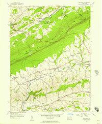 1956 New Tripoli1957 Print · USGSLehigh County's agricultural valleys and the ridge lines of BLUE MOUNTAIN are captured here in the mid-1950s. Researchers can trace the Reading railroad through Lynnport and Wanamakers or locate family sites near New Jerusalem Ch and Ontelaunee Park.7 unique versions available
 - 1956 Map of Hamburg, 1960 Print
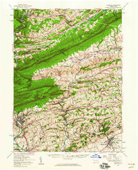 1956 Hamburg1960 Print · USGSPennsylvania's ridge-and-valley country comes to life in the mid-fifties, from the Schuylkill River to the Lehigh border. Genealogists and hikers can trace the Appalachian Trail over Blue Mountain or locate family roots near New Bethel Ch and Crystal Cave.2 unique versions available
 - 1957 Map of Newark
 1957 Newark1957 Print · USGSThe industrial and military heart of the Mid-Atlantic is mapped during its post-war suburban boom. Genealogists and historians can trace the intricate rail corridors of the Reading Railroad and locate key landmarks from Princeton University to Fort Hancock.
 - 1957 Map of Alburtis, 1960 Print
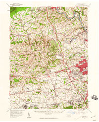 1957 Alburtis1960 Print · USGSLehigh County thrives at mid-century as a hub of heavy industry and suburban expansion along the winding Lehigh River. Trace the rail lines of the Ironton RR, find the early grounds of Dorney Park, or locate family sites near Laurys Station.3 unique versions available
 - 1960 Map of Newark
 1960 Newark1960 Print · USGSThe industrial heart of the Mid-Atlantic is shown at mid-century, stretching from the dense urban centers of Newark and Philadelphia to the Blue Mountain ridges. Researchers can trace historic rail lines, coastal defenses at Fort Hancock, and the riverfront growth of Trenton and Easton.3 unique versions available
 - 1960 Map of Lehighton, 1961 Print
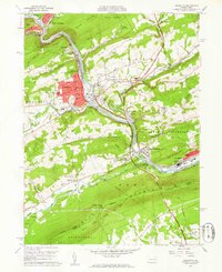 1960 Lehighton1961 Print · USGSCarbon County industrial and mountain landscapes are captured here during the early sixties, centered on the river-and-rail corridor. Genealogists and hikers can trace the Appalachian Trail along the ridge or locate family plots at Packerton Cem and Dinkey Memorial Cem.6 unique versions available
 - 1964 Map of Newark
 1964 Newark1964 Print · USGSGreater New Jersey and eastern Pennsylvania appear at the peak of their industrial and rail-centered development in the mid-sixties. Genealogists and historians can trace the paths of the Pennsylvania RR, identify mid-century landmarks like CAMP KILMER, or follow the Schuylkill River through READING.2 unique versions available
 - 1965 Map of Slatedale, 1966 Print
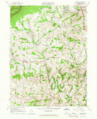 1965 Slatedale1966 Print · USGSLehigh County's northern townships are captured here in the mid-1960s, showing a landscape of slate quarries and ridge-top trails. Researchers can trace historic family landmarks and rural infrastructure from Lehigh Furnace and Peters Sch to the Old Railroad Grade.4 unique versions available
 - 1984 Map of Allentown, 1985 Print
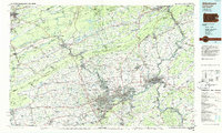 1984 Allentown1985 Print · USGSThe Lehigh Valley and southern Poconos are captured in the mid-eighties as industry and academic life converge along the river corridor. Trace the rail-and-water networks connecting Jim Thorpe and Bethlehem, or explore landmarks like Lehigh University and the Delaware Water Gap.3 unique versions available
 - 1992 Map of Lehighton, 1995 Print
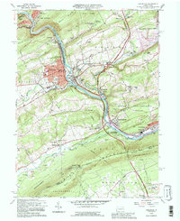 1992 Lehighton1995 Print · USGSThe Lehigh Valley industrial corridor is captured here in the early 1990s, where the river meets the steep ridges of Carbon County. Researchers can trace the legacy of the Packerton Yards, locate ancestral sites like Slatedale Cem, or follow the Appalachian Trail along Blue Mountain.
 - 1997 Map of Lehighton, 1998 Print
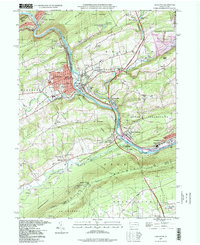 1997 Lehighton1998 Print · USGSCarbon County industrial and river life are captured here in the late twentieth century as the rail lines navigate the narrow Lehigh gap. Genealogists and hikers can trace the Appalachian Trail along the ridge or locate family sites at Packerton Cem and St Peters Ch.
 - 1999 Map of New Tripoli, 2001 Print
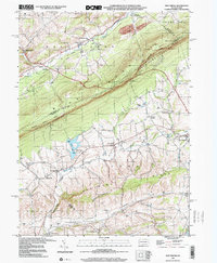 1999 New Tripoli2001 Print · USGSLehigh and Schuylkill counties are captured here at the close of the twentieth century as rural landscapes met conservation efforts. Trace local genealogy and infrastructure through New Jerusalem Ch, Ulrichs Bridge, and the Appalachian Scenic Trail.
 - 1999 Map of Lehighton, 2001 Print
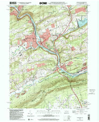 1999 Lehighton2001 Print · USGSThe Lehigh River valley at the close of the twentieth century shows a landscape defined by industrial heritage and modern recreation. Genealogists and historians can trace rail lines through Lizard Creek Junction or locate family sites at Packerton Cem and North Weissport.
 - 1999 Map of Slatedale, 2002 Print
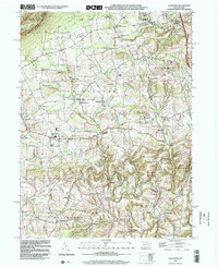 1999 Slatedale2002 Print · USGSLehigh County township life at the end of the century is defined by rural crossroads and the ridge of Blue Mountain. Genealogists and local historians can trace family locations near Heidelberg Ch, Millers Cem, or the early settlements of Lehigh Furnace and Slatedale.
Showing maps 1-25 of 40
Top cities near Heidelberg Township
- Allentown historical maps
- Fullerton historical maps
- Emmaus historical maps
- Northampton historical maps
- Maxatawny Township historical maps
- Tamaqua historical maps
See more
Top neighborhoods of Heidelberg Township
- Jordan Valley historical maps
- Saegersville historical maps
- Diebertsville historical maps
- Lochland historical maps
- Pleasant Corners historical maps
Frequently asked questions
- What are the different types of historical maps available for Heidelberg Township?
- What is the oldest map of Heidelberg Township?
- Where can I purchase historical maps of Heidelberg Township for my home or office?
- Where can I download high-res historical maps of Heidelberg Township?
- Are there historical topographic maps available for Heidelberg Township?
- Is there historical aerial imagery available for Heidelberg Township?
- Where are historical maps of Heidelberg Township sourced from?