2020s Maps of Lynn Township, Pennsylvania
Explore 4 historic maps of Lynn Township from the 2020s. These maps offer a rare glimpse into what life looked like during the 2020s — showing old roads, neighborhoods, homes, and landmarks that have changed or disappeared over time.
Whether you're researching your family's past, planning a metal detecting trip, or studying how Lynn Township's landscape evolved across the 2020s, these high-resolution maps are a powerful tool for exploring the history of this region.
- Focus on a specific era: All maps on this page are from the 2020s, giving you a focused view of this time period.
- See what’s changed: Compare century-old streets, trails, and buildings to today's modern landscape using overlays and satellite layers.
- Research with precision: Use these maps for genealogy, historical research, land use analysis, or educational projects.
- View, download, or print: Maps are fully viewable online in high resolution, and can be downloaded or printed for your own records.
Start exploring Lynn Township's history through authentic maps from the 2020s. This is your window into the past.
Lynn Township, PA maps
(4)- 2023 Map of New Tripoli, 2023 Print
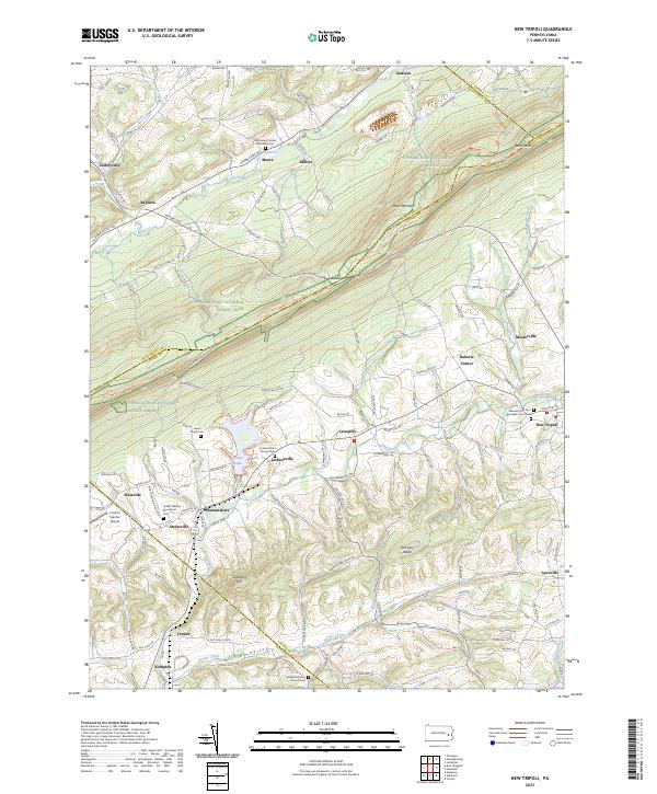 2023 New Tripoli2023 Print · USGSLehigh County and its surrounding highlands are captured here in the 2020s, showing a landscape defined by the ridgeline of Blue Mountain. Genealogists can trace family names at the Ebenezer Old Cem or find historic settlements like Lynnport and Wanamakers.
 - 2023 Map of Slatedale, 2023 Print
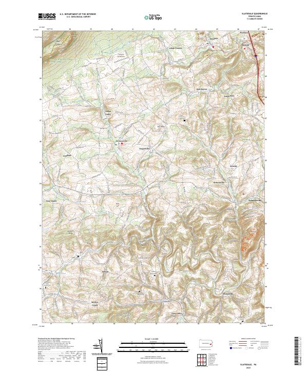 2023 Slatedale2023 Print · USGSLehigh County's rural heartland is documented here in the early twenty-first century, spanning from the ridge of Blue Mountain down to historic valley hamlets. Genealogists and local historians can trace family plots at Heidelberg Union Cem or explore sites like Lehigh Furnace and Werleys Corner.
 - 2023 Map of Kutztown, 2023 Print
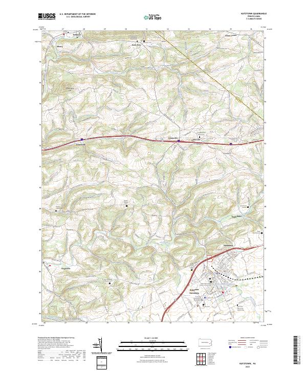 2023 Kutztown2023 Print · USGSNorthern Berks County remains a landscape of historic family farms and university life in the early twenty-first century. Researchers can trace ancestral roots through sites like Zion Moselem Church Cem or find the Spohn Family Cem near Sacony Creek.
 - 2023 Map of New Ringgold, 2023 Print
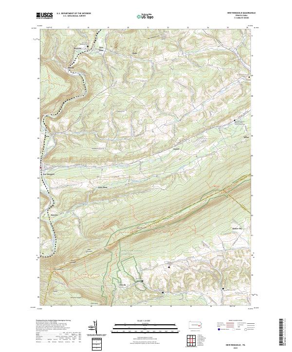 2023 New Ringgold2023 Print · USGSThe ridges and valleys of eastern Pennsylvania are detailed here as they appear today, centering on the historic borough of New Ringgold. Researchers can trace old family sites and rural congregations at Zion Stone Church Cem and the Snyders Evangelical Cem along the slopes of Blue Mountain.
End of results
Showing maps 1-4 of 4
Top cities near Lynn Township
- Maxatawny Township historical maps
- Tamaqua historical maps
- Longswamp Township historical maps
- Palmerton historical maps
- Lehighton historical maps
- Kutztown historical maps
See more
Top neighborhoods of Lynn Township
- Raberts Corner historical maps
- Schneidersville historical maps
- Slateville historical maps
- Wanamakers historical maps
- Lynnport historical maps
- New Tripoli historical maps
See more
Frequently asked questions
- What are the different types of historical maps available for Lynn Township?
- What is the oldest map of Lynn Township?
- Where can I purchase historical maps of Lynn Township for my home or office?
- Where can I download high-res historical maps of Lynn Township?
- Are there historical topographic maps available for Lynn Township?
- Is there historical aerial imagery available for Lynn Township?
- Where are historical maps of Lynn Township sourced from?