Old Maps of Whitehall, Pennsylvania for Academic Research
Study the evolution of Whitehall with 28 high-resolution historic maps. Whether you're teaching, researching, or modeling changes in land use, these maps provide essential visual documentation of urban, environmental, and geographic change.
- Analyze long-term change: Track patterns in development, transportation, and natural features.
- Ideal for environmental or urban studies: Support academic projects with primary historical map data.
- Use in the classroom or lab: Educators and researchers rely on these maps to bring historical context to life.
These maps are a powerful tool for teaching, research, and visualizing how Whitehall has changed over the decades.
Whitehall, PA maps
(28)- 1894 Map of Allentown
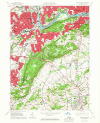
 1894 Allentown1894 Print · USGSThe Lehigh Valley's industrial heartland is caught in a moment of rapid Victorian-era growth along the river and canal corridor. Genealogists and local historians can trace the early footprints of Allentown and Nazareth, or locate vanished rail stops along the Lehigh Valley R.R. and Central R.R. of N.J.10 unique versions available
 - 1902 Map of Slatington
 1902 Slatington1902 Print · USGSLehigh County's industrial and quarrying heart comes into focus at the dawn of the 1900s. Researchers can trace the path of the Lehigh Canal and locate family landmarks like Peters Store, Jordan Church, and the Consolidated Quarries.5 unique versions available
 - 1937 Map of Allentown West
 1937 Allentown West1937 Print · USGSLehigh County at the end of the Depression era reveals a dense network of rural schoolhouses and crossroads hamlets before post-war expansion. Genealogists can trace family names at James Peters Sch or Heidelberg Sch, and locate landmarks like Schantz Spr and Rising Sun.
 - 1939 Map of Allentown
 1939 Allentown1939 Print · USGSThe Lehigh Valley thrives as an industrial and aviation hub in the mid-1930s, where rail lines and early airfields meet historic Pennsylvania townships. Researchers can trace family roots through dozens of rural landmarks like Washington Sch, Christian Springs, and the Vera Cruz Sta.4 unique versions available
 - 1942 Map of Allentown West
 1942 Allentown West1942 Print · USGSLehigh County during the early war years displays a landscape of industrial river towns and agrarian crossroads. Researchers can locate dozens of country schools like Snyder Sch, historic landmarks like Cedar Crest College, and the sprawling Trexler Game Preserve.3 unique versions available
 - 1943 Map of Bethlehem
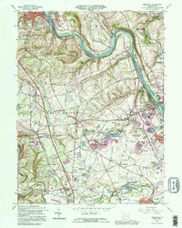
 1943 Bethlehem1943 Print · USGSNorthampton and Lehigh counties hummed with industry and river commerce during the early war years. Researchers can trace the path of the Lehigh Valley RR, locate family-named landmarks like Chief Tatamy, and find rural schools such as Mexico School and Poplar Valley Sch.
 - 1944 Map of Newark, 1971 Print
 1944 Newark1971 Print · USGSThe industrial corridor from Philadelphia to New York was in a period of massive transition during the mid-forties. Genealogists and researchers can trace the rail lines of the Lehigh Valley RR, locate military installations like Picatinny Arsenal, and explore the early sprawl near Levittown.5 unique versions available
 - 1949 Map of Newark
 1949 Newark1949 Print · USGSThe industrial corridor between Philadelphia and New York comes alive in this post-war survey. Genealogists and historians can trace the massive rail networks of the Reading Railroad and locate major installations like Fort Dix or Picatinny Arsenal.2 unique versions available
 - 1956 Map of Newark
 1956 Newark1956 Print · USGSThe industrial heart of the Mid-Atlantic is captured here at the dawn of the highway era, tracing the dense corridors between Newark and Philadelphia. Genealogists and local historians can map the rail networks of the Reading RR or locate mid-century military life at Fort Dix Military Reservation.2 unique versions available
 - 1957 Map of Newark
 1957 Newark1957 Print · USGSThe industrial and military heart of the Mid-Atlantic is mapped during its post-war suburban boom. Genealogists and historians can trace the intricate rail corridors of the Reading Railroad and locate key landmarks from Princeton University to Fort Hancock.
 - 1957 Map of Allentown, 1960 Print
 1957 Allentown1960 Print · USGSThe Lehigh Valley in the late fifties was a powerhouse of rail and industry centered on the river's winding path. Genealogists and local historians can trace the footprint of the State Hospital, early schools like Moravian College, and rural markers like Christ Springs Ch.3 unique versions available
 - 1957 Map of Alburtis, 1960 Print
 1957 Alburtis1960 Print · USGSLehigh County thrives at mid-century as a hub of heavy industry and suburban expansion along the winding Lehigh River. Trace the rail lines of the Ironton RR, find the early grounds of Dorney Park, or locate family sites near Laurys Station.3 unique versions available
 - 1960 Map of Newark
 1960 Newark1960 Print · USGSThe industrial heart of the Mid-Atlantic is shown at mid-century, stretching from the dense urban centers of Newark and Philadelphia to the Blue Mountain ridges. Researchers can trace historic rail lines, coastal defenses at Fort Hancock, and the riverfront growth of Trenton and Easton.3 unique versions available
 - 1964 Map of Newark
 1964 Newark1964 Print · USGSGreater New Jersey and eastern Pennsylvania appear at the peak of their industrial and rail-centered development in the mid-sixties. Genealogists and historians can trace the paths of the Pennsylvania RR, identify mid-century landmarks like CAMP KILMER, or follow the Schuylkill River through READING.2 unique versions available
 - 1964 Map of Cementon, 1966 Print
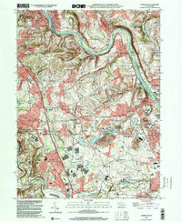
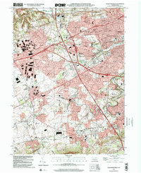
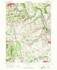 1964 Cementon1966 Print · USGSThe Lehigh Valley's industrial heart is captured here in the mid-1960s, showing a landscape shaped by river commerce and heavy quarrying. Genealogists and historians can trace the Lehigh Valley Railroad through Cementon or locate Old Union Cem and the Mary Immaculate Missionary College.3 unique versions available
 - 1964 Map of Catasauqua, 1966 Print
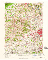
 1964 Catasauqua1966 Print · USGSThe Lehigh Valley in the mid-sixties reveals a landscape of industrial river towns and emerging suburban developments near the regional airport. Genealogists and historians can trace family roots through numerous sites like Cedar Hill Memorial Park, Schoenersville, and the State Hospital Farm.6 unique versions available
 - 1964 Map of Allentown West, 1966 Print
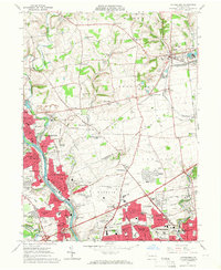
 1964 Allentown West1966 Print · USGSLehigh County experiences a post-war suburban boom in the mid-1960s as Allentown expands westward toward established boroughs. Trace the development of Macungie and Alburtis or locate local landmarks like Muhlenberg College, Trexlertown Airport, and Woodlawn Cemetery.7 unique versions available
 - 1964 Map of Allentown East, 1967 Print
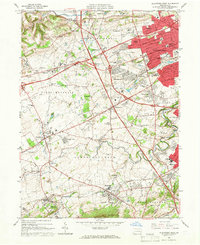
 1964 Allentown East1967 Print · USGSLehigh County and its industrial hubs thrive in the 1960s as suburban expansion reaches the slopes of South Mountain. Researchers can trace the path of the Lehigh Canal, locate the Carmelite Monastery, or explore the rail yards at Emmaus Junction.5 unique versions available
 - 1984 Map of Allentown, 1985 Print
 1984 Allentown1985 Print · USGSThe Lehigh Valley and southern Poconos are captured in the mid-eighties as industry and academic life converge along the river corridor. Trace the rail-and-water networks connecting Jim Thorpe and Bethlehem, or explore landmarks like Lehigh University and the Delaware Water Gap.3 unique versions available
 - 1992 Map of Cementon, 1995 Print
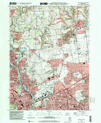
 1992 Cementon1995 Print · USGSThe Lehigh Valley corridor shows its industrial character in the 1990s as quarries and suburban growth meet historic settlements. Trace local family roots and early industry near Cementon, the Dewey Heights Quarry, and the Old Union Cem.
 - 1999 Map of Cementon, 2001 Print
 1999 Cementon2001 Print · USGSLehigh Valley industry and residential growth are captured here at the turn of the millennium. Genealogists can trace family roots through historic settlements like Egypt, Balliettsville, and Laurys Station, or locate ancestors at Union Cem.
 - 1999 Map of Allentown East, 2001 Print
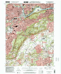 1999 Allentown East2001 Print · USGSThe Lehigh Valley at the turn of the twenty-first century shows a fascinating blend of urban density and rural transition. Researchers can trace the industrial heritage of Allentown and find local landmarks like Lehigh University, the Carmelite Monastery, and Friedensville.
 - 1999 Map of Allentown West, 2001 Print
 1999 Allentown West2001 Print · USGSThe Lehigh Valley at the turn of the millennium shows a blend of suburban growth and industrial heritage. Genealogists can trace old family sites near St Josephs Ch, while historians can locate the Lock Ridge Park and Furnace Museum or Dorney Park.
 - 1999 Map of Catasauqua, 2001 Print
 1999 Catasauqua2001 Print · USGSThe Lehigh Valley at the close of the millennium shows the dense urban integration of Allentown and Bethlehem. Genealogists can trace family sites at Allen Union Cem or Fairview Cem while following the historic tracks of the Lehigh Valley RR.
 - 2023 Map of Cementon, 2023 Print
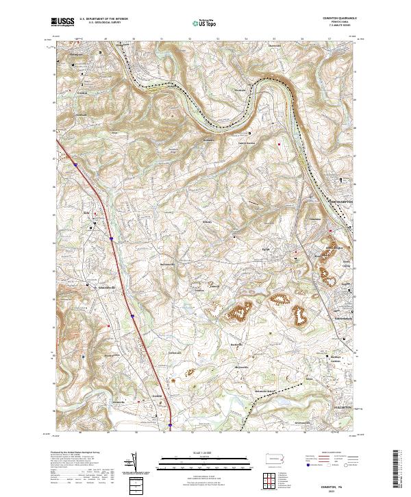 2023 Cementon2023 Print · USGSThe Lehigh River valley comes to life here at the dawn of the 2020s, showcasing a dense network of river-towns and industrial rail corridors. Genealogists and historians can locate numerous family burial sites and historical markers, including the Lehigh County Massacre Gravesite and Neffs Union Cem.
Showing maps 1-25 of 28
Top cities near Whitehall
- Allentown historical maps
- Bethlehem historical maps
- Easton historical maps
- Fullerton historical maps
- Emmaus historical maps
- Lower Saucon Township historical maps
See more
Top neighborhoods of Whitehall
- Arlington Knolls historical maps
- Mickleys Gardens historical maps
- Stiles historical maps
- West Catasauqua historical maps
- North Coplay historical maps
- Evergreen Park historical maps
See more
Frequently asked questions
- What are the different types of historical maps available for Whitehall?
- What is the oldest map of Whitehall?
- Where can I purchase historical maps of Whitehall for my home or office?
- Where can I download high-res historical maps of Whitehall?
- Are there historical topographic maps available for Whitehall?
- Is there historical aerial imagery available for Whitehall?
- Where are historical maps of Whitehall sourced from?