Old Maps of Bear Creek Township, Pennsylvania
Explore 74 old maps of Bear Creek Township, spanning from 1889 to today. These high-resolution historic maps reveal how streets, neighborhoods, landmarks, and natural features evolved over time — perfect for genealogy, metal detecting, research, and local history exploration.
What you can do with these maps:
- See how Bear Creek Township changed over time: Compare historical maps to modern-day views to trace roads, homesites, rail lines & more.
- View detailed metadata: Each map includes creators, publishers, year, scale, and archive source.
- Overlay maps with satellite & LiDAR: Visualize the past alongside modern tools to explore terrain & human change.
- Trusted historical sources: Maps sourced from the USGS, Library of Congress, and other archives.
- Access maps your way: View online, download high-res files, or order prints for personal or research use.
Start exploring old maps of Bear Creek Township to uncover forgotten places, hidden landmarks, and the deep history beneath your feet.
Bear Creek Township, PA maps
(74)- 1889 Map of Scranton, 1954 Print
 1889 Scranton1954 Print · USGSThe industrial heart of the Lackawanna Valley is captured here during its late 19th-century boom, showing the dense rail networks and coal towns of the era. Genealogists can trace family roots through early street grids in Scranton and Dunmore or smaller settlements like Barberstown and Priceburg.
 - 1891 Map of Wilkesbarre
 1891 Wilkesbarre1891 Print · USGSLuzerne County's industrial heartland is caught here at the height of the anthracite era, where the coal-and-rail economy dominated the Wyoming Valley. Genealogists and historians can trace the specific layouts of coal patches like Sugar Notch and Moffatt Patch or follow the path of the Lehigh Valley R. R. across the ridges.2 unique versions available
 - 1891 Map of Scranton
 1891 Scranton1891 Print · USGSThe Lackawanna Valley thrived at the peak of the coal era when rail lines and mine patches crowded the riverbanks. Genealogists and industrial historians can trace the early footprints of Scranton, Dunmore, and Old Forge alongside the Delaware and Hudson Canal Co R R.
 - 1893 Map of Pittston
 1893 Pittston1893 Print · USGSThe industrial Wyoming Valley and the rural uplands of the Susquehanna meet in this late nineteenth-century survey. Researchers can trace the complex rail networks of Pittston and West Pittston or locate family roots in settlements like Forty Fort, Maltby, and Falls.9 unique versions available
 - 1893 Map of Scranton
 1893 Scranton1893 Print · USGSLackawanna County's anthracite heartland is shown in detail during the late nineteenth-century industrial boom. Genealogists and historians can trace the early street grids of Scranton and Dunmore or locate smaller settlements like Old Forge and Barber Town.7 unique versions available
 - 1894 Map of Wilkesbarre
 1894 Wilkesbarre1894 Print · USGSThe northern anthracite coal fields and rugged ridge-and-valley terrain of Luzerne County are captured here in the 1890s. Researchers can trace early railroad alignments through Sugar Notch or locate long-standing settlements like White Haven and Ashley.8 unique versions available
 - 1922 Map of Stoddartsville, 1958 Print
 1922 Stoddartsville1958 Print · USGSThe Pennsylvania Poconos at the turn of the century show a landscape of high timber ridges and early mountain resorts. Genealogists and hikers can trace the original paths to Stoddartsville, identify the old Fayette School, or follow the Wilkes-Barre and Eastern rail line.2 unique versions available
 - 1924 Map of Stoddartsville
 1924 Stoddartsville1924 Print · USGSUpper Carbon and Monroe counties are shown in the early twenties as a landscape of timbered hills and headwater streams. Genealogists can locate old rural landmarks like Bradys Switch, the Leonardsville settlement, and the Locust Ridge School.5 unique versions available
 - 1943 Map of Scranton
 1943 Scranton1943 Print · USGSNortheastern Pennsylvania’s coal and rail corridor comes to life in the 1940s, showcasing the dense urban industrial centers of the Wyoming Valley. Genealogists can locate family landmarks like the Fayette School and Locust Ridge School or trace the early paths of the DL & W and Erie railroads.
 - 1943 Map of Stoddartsville
 1943 Stoddartsville1943 Print · USGSThe Pocono Plateau at the height of the Second World War shows a landscape defined by river valleys and developing recreation preserves. Genealogists and local historians can trace rural schoolhouses and small settlements like Stoddartsville, Albrightsville, and the Fishery Sch.
 - 1946 Map of Avoca, 1959 Print
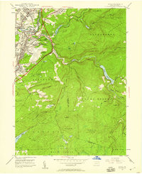 1946 Avoca1959 Print · USGSThe coal-rich Lackawanna Valley is shown here just after the war, as heavy industry and new aviation infrastructure transformed the landscape. Researchers can trace the extensive rail networks and local landmarks like the Consolidated Breaker, Belian Village, and Sacred Heart Cem.5 unique versions available
 - 1947 Map of Wilkes-Barre East, 1959 Print
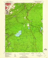 1947 Wilkes-Barre East1959 Print · USGSWilkes-Barre and the eastern ridges of the Wyoming Valley are shown in the post-war era as the anthracite coal industry shaped the landscape. Genealogists can trace family connections at Georgetown, Laurel Run, and Holy Trinity Cem, or locate landmarks like Ochre Mill and Oliver Sch.7 unique versions available
 - 1947 Map of Pittston, 1961 Print
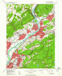 1947 Pittston1961 Print · USGSLuzerne County's industrial heartland is captured here in the late 1940s, showing the dense rail-and-river corridor of the Wyoming Valley. Genealogists can trace family roots through numerous local landmarks, including the Wyoming Monument, St Joseph Cem, and the Port Griffith Sch.4 unique versions available
 - 1947 Map of White Haven, 1966 Print
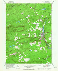 1947 White Haven1966 Print · USGSThe Lehigh River valley in the late 1940s is a landscape defined by industry and rail, where coal mining and transportation intersect. Genealogists can trace family roots through settlements like White Haven and Tannery, or locate local landmarks like Ripple Sch and St Patrick Cem.4 unique versions available
 - 1949 Map of Avoca
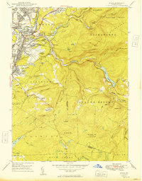 1949 Avoca1949 Print · USGSPost-war Luzerne and Lackawanna counties reveal a landscape of anthracite heritage and rising aviation. Trace family roots at Old Forge Cem, locate the Consolidated Breaker, or explore the rail networks around Hillside Junction.2 unique versions available
 - 1949 Map of Pittston
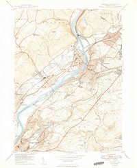 1949 Pittston1949 Print · USGSThe Wyoming Valley industrial corridor is captured here at a post-war peak, showing the heavy rail-and-river network of the coal regions. Researchers can trace historic family landmarks from the Wyoming Monument to the Wyoming Camp Ground and St Joseph Cem.2 unique versions available
 - 1950 Map of Wilkes-Barre East
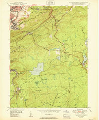 1950 Wilkes-Barre East1950 Print · USGSLuzerne County at the midpoint of the century shows a landscape defined by coal extraction, mountain railroading, and upland resorts. Genealogists and researchers can trace family landmarks like Oliver Mills, Llewellyn Corners, and the historic Holy Trinity Cem.2 unique versions available
 - 1950 Map of White Haven
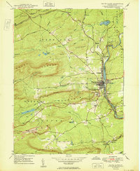 1950 White Haven1950 Print · USGSThe industrial Lehigh River corridor is captured here just after the war, showing the vital rail and mining networks of the day. Researchers can trace family sites at White Haven or Pond Creek, and locate features like the Ripple Sch and Jefferson Hospital.2 unique versions available
 - 1950 Map of Scranton, 1952 Print
 1950 Scranton1952 Print · USGSMid-century Northeast Pennsylvania and the Hudson Valley come alive in this survey of the tri-state region. Genealogists and historians can trace the dense rail networks of the Erie RR and DL&W RR between industrial hubs like Scranton and Wilkes-Barre.
 - 1953 Map of Scranton
 1953 Scranton1953 Print · USGSNortheastern Pennsylvania and the Catskills are shown in great detail during the early fifties, a time when rail lines and river valleys dictated the region's growth. Genealogists and historians can trace the industrial hearts of Scranton and Wilkes-Barre or locate remote landmarks like High Point and Lake Wallenpaupack.
 - 1959 Map of Scranton
 1959 Scranton1959 Print · USGSThe northern coalfields and the Hudson Valley meet in this mid-century survey of the Pennsylvania and New York borderlands. Genealogists and historians can trace the intricate rail networks of the Erie Railroad and the vast waters of Lake Wallenpaupack.2 unique versions available
 - 1962 Map of Scranton, 1977 Print
 1962 Scranton1977 Print · USGSThe industrial heart of eastern Pennsylvania and the New York Catskills are captured here in the early sixties. Genealogists and historians can trace the dense valley settlements from Scranton to Wilkes-Barre and the rail lines of the Erie Lackawanna Railroad.2 unique versions available
 - 1965 Map of Scranton
 1965 Scranton1965 Print · USGSThe tri-state highlands of Pennsylvania, New York, and New Jersey come alive in the mid-sixties as industry and recreation converge. Trace the intricate rail lines of the Erie Lackawanna RR or locate landmarks like the U S Military Academy.2 unique versions available
 - 1965 Map of Pleasant View Summit, 1967 Print
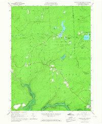 1965 Pleasant View Summit1967 Print · USGSThe Luzerne County highlands in the mid-sixties are shown here as a landscape of conservation and water management. You can trace the Francis E Walter Reservoir, the historic settlement at Stoddartsville, and an Old Railroad Grade.4 unique versions available
 - 1966 Map of Hickory Run, 1967 Print
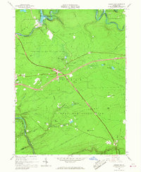 1966 Hickory Run1967 Print · USGSCarbon County is captured during its mid-century transition into a recreational hub as the new interstate highway system intersects old mountain roads. Trace the evolution of this landscape from the Central Railroad of New Jersey to the Boulder Field and Hickory Run State Park.3 unique versions available
Showing maps 1-25 of 74
Top cities near Bear Creek Township
- Scranton historical maps
- Wilkes-Barre historical maps
- Hazleton historical maps
- Kingston historical maps
- Nanticoke historical maps
- Plains Township historical maps
See more
Top neighborhoods of Bear Creek Township
- Liewellyn Corners historical maps
- Llewellyn Corners historical maps
- Pleasant View Summit historical maps
- Forest Park historical maps
Frequently asked questions
- What are the different types of historical maps available for Bear Creek Township?
- What is the oldest map of Bear Creek Township?
- Where can I purchase historical maps of Bear Creek Township for my home or office?
- Where can I download high-res historical maps of Bear Creek Township?
- Are there historical topographic maps available for Bear Creek Township?
- Is there historical aerial imagery available for Bear Creek Township?
- Where are historical maps of Bear Creek Township sourced from?