2020s Maps of Bear Creek Township, Pennsylvania
Explore 6 historic maps of Bear Creek Township from the 2020s. These maps offer a rare glimpse into what life looked like during the 2020s — showing old roads, neighborhoods, homes, and landmarks that have changed or disappeared over time.
Whether you're researching your family's past, planning a metal detecting trip, or studying how Bear Creek Township's landscape evolved across the 2020s, these high-resolution maps are a powerful tool for exploring the history of this region.
- Focus on a specific era: All maps on this page are from the 2020s, giving you a focused view of this time period.
- See what’s changed: Compare century-old streets, trails, and buildings to today's modern landscape using overlays and satellite layers.
- Research with precision: Use these maps for genealogy, historical research, land use analysis, or educational projects.
- View, download, or print: Maps are fully viewable online in high resolution, and can be downloaded or printed for your own records.
Start exploring Bear Creek Township's history through authentic maps from the 2020s. This is your window into the past.
Bear Creek Township, PA maps
(6)- 2023 Map of White Haven, 2023 Print
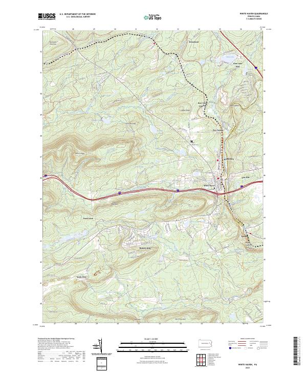 2023 White Haven2023 Print · USGSThe Lehigh River corridor near White Haven is documented here in the early twenty-first century, showing a landscape shaped by coal-era industry and modern recreation. Trace local family roots at Laurel Cem or explore historical settlements like Tannery and Middleburg along the water.
 - 2023 Map of Pleasant View Summit, 2023 Print
 2023 Pleasant View Summit2023 Print · USGSLuzerne County's high forest plateaus are captured here in the early twenty-first century, showing the rugged headwaters of the Lehigh. Researchers can locate the Stoddartsville Cem and the Falls of the Lehigh near the village of Stoddartsville.
 - 2023 Map of Pittston, 2023 Print
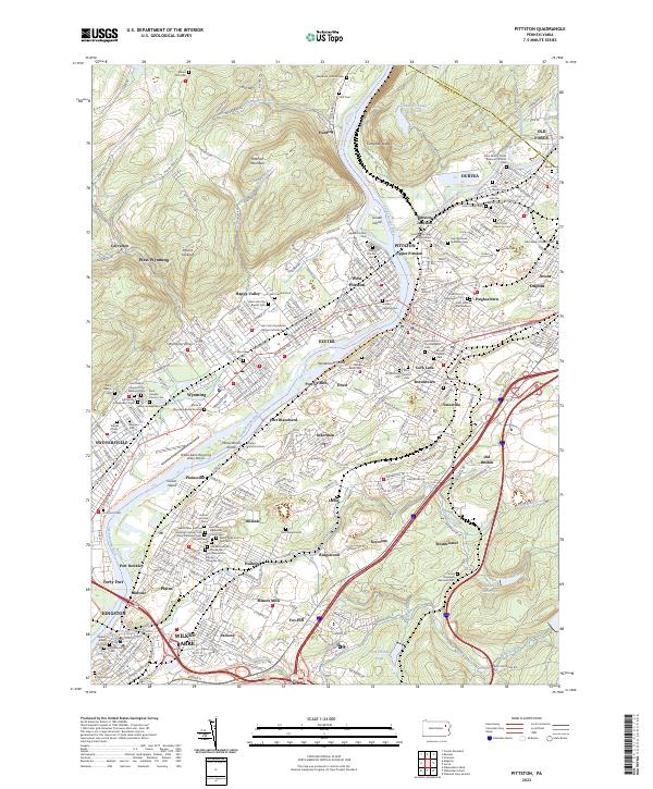 2023 Pittston2023 Print · USGSThe Wyoming Valley's industrial river corridor is shown in detail during the early 2020s, from Duryea to Wilkes-Barre. Genealogists can trace numerous ethnic parish sites, including Saint Marys Polish National Catholic Cem and the Battle of Wyoming Burial Ground.
 - 2023 Map of Wilkes-Barre East, 2023 Print
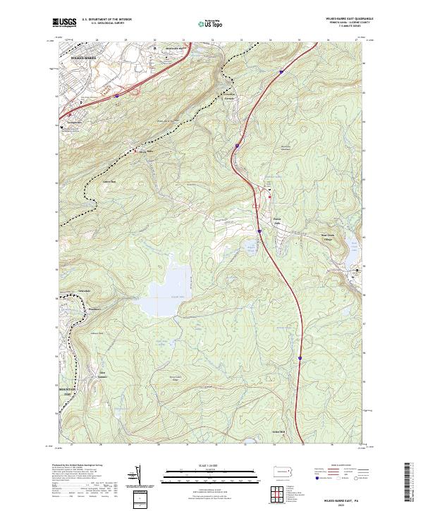 2023 Wilkes-Barre East2023 Print · USGSThe Wyoming Valley transitions into the Pocono highlands in this recent survey of the Luzerne County landscape. Genealogists can locate several historic burial grounds like Saint Francis of Assisi Cem, while hikers can trace the terrain around Crystal Lake and Arbutus Peak.
 - 2023 Map of Avoca, 2023 Print
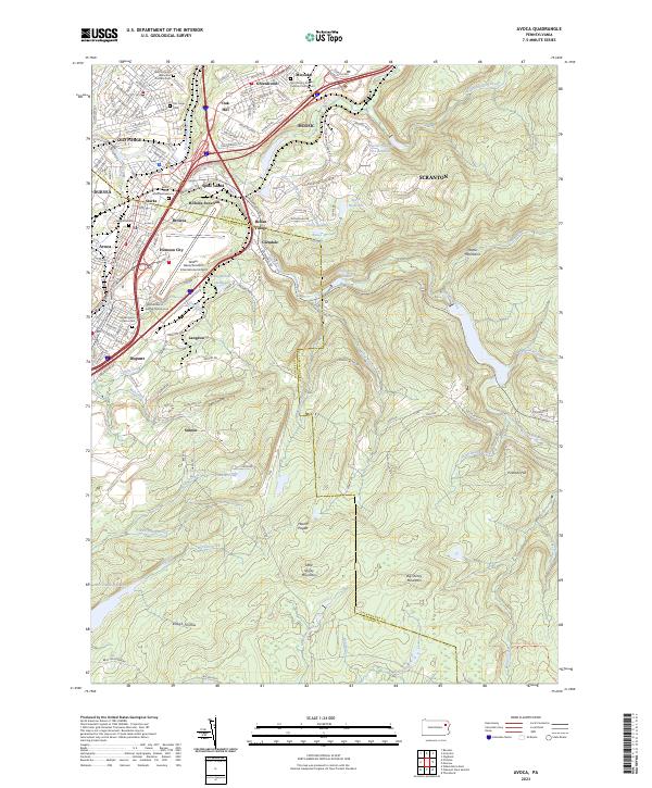 2023 Avoca2023 Print · USGSThe industrial corridor between Scranton and Wilkes-Barre comes into sharp focus during this modern era of development. Trace local family history through numerous churchyards like Saints Peter and Paul Cem or explore the rail-and-river geography of Spike Island and Hillside Junction.
 - 2023 Map of Hickory Run, 2023 Print
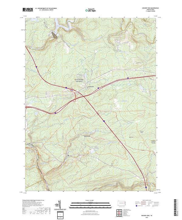 2023 Hickory Run2023 Print · USGSThe high plateau of the Carbon County Poconos is captured here in the early twenty-first century, showing a landscape defined by state park lands and residential enclaves. Researchers can locate the Hickory Run Cem and trace the many drainages like Sand Spring Run and Tobyhanna Creek.
End of results
Showing maps 1-6 of 6
Top cities near Bear Creek Township
- Scranton historical maps
- Wilkes-Barre historical maps
- Hazleton historical maps
- Kingston historical maps
- Nanticoke historical maps
- Plains Township historical maps
See more
Top neighborhoods of Bear Creek Township
- Forest Park historical maps
- Pleasant View Summit historical maps
- Liewellyn Corners historical maps
- Llewellyn Corners historical maps
Frequently asked questions
- What are the different types of historical maps available for Bear Creek Township?
- What is the oldest map of Bear Creek Township?
- Where can I purchase historical maps of Bear Creek Township for my home or office?
- Where can I download high-res historical maps of Bear Creek Township?
- Are there historical topographic maps available for Bear Creek Township?
- Is there historical aerial imagery available for Bear Creek Township?
- Where are historical maps of Bear Creek Township sourced from?