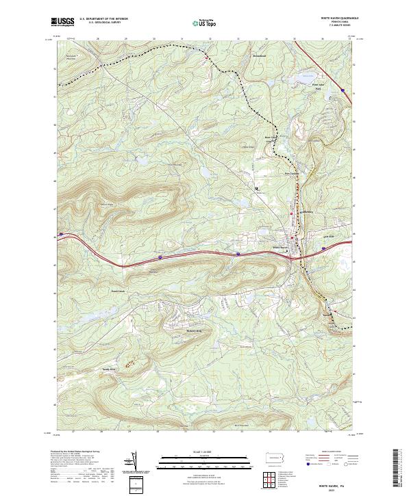
2023 Map of White Haven
USGS Topo · Published 2023About this map
White Haven serves as the central hub of this modern topographic study, situated along the Lehigh River at the boundary between Luzerne and Carbon Counties. The landscape is defined by the steep descent toward the river valley, where historical transport routes like the D&L Trl and various railroad corridors once funneled the region’s timber and coal. Higher elevations are marked by Nescopeck Mountain and Mount Yeager, while the northern portion shows the recreational development around Penn Lake Park and Sunrise Lake.
Find a feature on this map
143 named features on this map. Tap any name to fly to it.
Don’t see what you’re looking for? This feature index may not catch every label — zoom into the map to look around manually.
Map Details
Editions of this 2023 White Haven Map
This is the sole edition of this map. No revisions or reprints were ever made.
Other maps of this area

1889 · Hazleton
USGS Topo · 1:62,500

1891 · Wilkesbarre
USGS Topo · 1:62,500

1891 · Hazleton
USGS Topo · 1:62,500

1893 · Hazleton
USGS Topo · 1:62,500

1894 · Wilkesbarre
USGS Topo · 1:62,500

1922 · Mauch Chunk
USGS Topo · 1:62,500

1922 · Stoddartsville
USGS Topo · 1:62,500

1924 · Stoddartsville
USGS Topo · 1:62,500

1924 · Mauch Chunk
USGS Topo · 1:62,500

1943 · Scranton
USGS Topo · 1:125,000