Old Maps of Butler Township, Pennsylvania for Genealogy
Trace your family roots with 70 historic maps of Butler Township. These high-res maps reveal old neighborhoods, homesites, landmarks, and streets — helping you uncover where your ancestors lived and how the area evolved over time.
- Explore historic neighborhoods: Identify where your relatives may have lived in the 1800s or 1900s.
- Compare maps over time: Trace the changes in streets, buildings, and landmarks for multi-generational research.
- Perfect for genealogy & ancestry research: Used by family historians and researchers to map out lineage and migration.
These maps are an incredible resource for exploring your personal connection to Butler Township's past.
Butler Township, PA maps
(70)- 1889 Map of Hazleton, 1956 Print
 1889 Hazleton1956 Print · USGSThe Pennsylvania coal fields are seen at their industrial height in the late 1880s, revealing a landscape defined by anthracite and iron rails. Genealogists and historians can trace the early footprints of Hazleton, the company town of Eckley, and the rail-heavy corridors of Lansford and Tamaqua.
 - 1891 Map of Wilkesbarre
 1891 Wilkesbarre1891 Print · USGSLuzerne County's industrial heartland is caught here at the height of the anthracite era, where the coal-and-rail economy dominated the Wyoming Valley. Genealogists and historians can trace the specific layouts of coal patches like Sugar Notch and Moffatt Patch or follow the path of the Lehigh Valley R. R. across the ridges.2 unique versions available
 - 1891 Map of Hazleton
 1891 Hazleton1891 Print · USGSThe anthracite coal region comes alive in the late nineteenth century, showing a landscape defined by ridges and rail lines. Genealogists and historians can trace the early footprints of Hazleton, the gravity-rail heritage at Summit Hill, and the bustling yards of Lansford or Tamaqua.
 - 1892 Map of Mahanoy
 1892 Mahanoy1892 Print · USGSSchuylkill and Luzerne counties are captured here at a peak of industrial development during the 1890s coal era. Researchers can trace the massive rail networks serving Shenandoah, Mahanoy City, and lost junctions like Silver Brook Junction.
 - 1893 Map of Hazleton
 1893 Hazleton1893 Print · USGSThe anthracite coal region of Northeastern Pennsylvania is captured here in the late nineteenth century, during its industrial peak. Genealogists and historians can trace the early rail networks and company patches like Lansford, Summit Hill, and the coal-rich village of Eckley.8 unique versions available
 - 1893 Map of Mahanoy, 1898 Print
 1893 Mahanoy1898 Print · USGSSchuylkill and Luzerne counties are shown at the height of the coal era, revealing a landscape etched by mining and rail commerce. Genealogists and industrial historians can trace the specific neighborhoods of Shenandoah, Mahanoy City, and the railway junctions at Tamanend and Delano.7 unique versions available
 - 1894 Map of Shickshinny
 1894 Shickshinny1894 Print · USGSLuzerne County at the height of the coal and canal era reveals a landscape shaped by river transport and mountain ridges. Trace the remnants of the Pennsylvania Canal and locate long-standing river crossings like Hicks Ferry and Beach Haven Ferry.6 unique versions available
 - 1894 Map of Wilkesbarre
 1894 Wilkesbarre1894 Print · USGSThe northern anthracite coal fields and rugged ridge-and-valley terrain of Luzerne County are captured here in the 1890s. Researchers can trace early railroad alignments through Sugar Notch or locate long-standing settlements like White Haven and Ashley.8 unique versions available
 - 1943 Map of Scranton
 1943 Scranton1943 Print · USGSNortheastern Pennsylvania’s coal and rail corridor comes to life in the 1940s, showcasing the dense urban industrial centers of the Wyoming Valley. Genealogists can locate family landmarks like the Fayette School and Locust Ridge School or trace the early paths of the DL & W and Erie railroads.
 - 1944 Map of Newark, 1971 Print
 1944 Newark1971 Print · USGSThe industrial corridor from Philadelphia to New York was in a period of massive transition during the mid-forties. Genealogists and researchers can trace the rail lines of the Lehigh Valley RR, locate military installations like Picatinny Arsenal, and explore the early sprawl near Levittown.5 unique versions available
 - 1946 Map of Sybertsville
 1946 Sybertsville1946 Print · USGSLuzerne County's rural townships are captured here just after the war, showing a landscape defined by small farms and local schoolhouses. Genealogists can trace family connections to landmarks like St Johns, Moyers Grove, and the Whitebread Sch.2 unique versions available
 - 1947 Map of Hazleton, 1962 Print
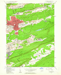 1947 Hazleton1962 Print · USGSThe Pennsylvania coal fields and the industrial hubs of Luzerne County are captured here just after the war. Researchers can trace the rail-and-mine landscape of Ashmore Yards, Lattimer Mines, and the borough of McAdoo.5 unique versions available
 - 1948 Map of Freeland, 1969 Print
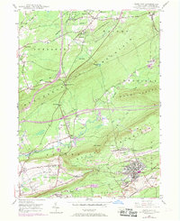 1948 Freeland1969 Print · USGSLuzerne County's anthracite region is captured here during a period of industrial change after the war. Local historians can trace the development of Freeland and Upper Lehigh alongside the rail networks of the Central RR of New Jersey and the Lehigh Valley RR.3 unique versions available
 - 1949 Map of Newark
 1949 Newark1949 Print · USGSThe industrial corridor between Philadelphia and New York comes alive in this post-war survey. Genealogists and historians can trace the massive rail networks of the Reading Railroad and locate major installations like Fort Dix or Picatinny Arsenal.2 unique versions available
 - 1949 Map of Conyngham
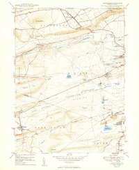 1949 Conyngham1949 Print · USGSThe northern reaches of the coal country show a landscape shaped by ridge-traversing railroads and mining towns in the late 1940s. Genealogists can locate family sites in West Hazleton, Sheppton, or the colliery-linked Harwood (Harwood Mines PO).2 unique versions available
 - 1950 Map of Hazleton
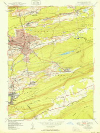 1950 Hazleton1950 Print · USGSThe anthracite coal region of Pennsylvania comes into sharp focus during the post-war era. Researchers can trace the extensive rail networks of the Lehigh Valley and identify localized mining communities like Lattimer Mines (PO) and Coxes Village.2 unique versions available
 - 1950 Map of Freeland
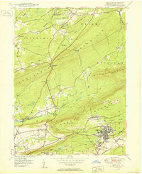 1950 Freeland1950 Print · USGSLuzerne County's anthracite country is documented here in the mid-century, showing the intensive mining operations and rail networks around the borough of Freeland. Researchers can trace the industrial landscape of Upper Lehigh or locate local landmarks like Honey Hole, Kis-Lyn, and St Ann Cem.2 unique versions available
 - 1950 Map of Harrisburg, 1952 Print
 1950 Harrisburg1952 Print · USGSMid-century Central Pennsylvania comes alive through its dense rail networks and river valley settlements during the post-war industrial era. Genealogists and historians can trace family roots through hubs like Harrisburg, locate Carlisle Barracks, or follow the Pennsylvania RR through the Lebanon Valley.
 - 1950 Map of Scranton, 1952 Print
 1950 Scranton1952 Print · USGSMid-century Northeast Pennsylvania and the Hudson Valley come alive in this survey of the tri-state region. Genealogists and historians can trace the dense rail networks of the Erie RR and DL&W RR between industrial hubs like Scranton and Wilkes-Barre.
 - 1953 Map of Scranton
 1953 Scranton1953 Print · USGSNortheastern Pennsylvania and the Catskills are shown in great detail during the early fifties, a time when rail lines and river valleys dictated the region's growth. Genealogists and historians can trace the industrial hearts of Scranton and Wilkes-Barre or locate remote landmarks like High Point and Lake Wallenpaupack.
 - 1954 Map of Williamsport
 1954 Williamsport1954 Print · USGSNorth-central Pennsylvania in the mid-fifties is defined by the winding West Branch Susquehanna River and its industrial valley. Local historians can trace the massive Susquehanna Ordnance Depot and the extensive rail networks of the Pennsylvania Railroad.
 - 1955 Map of Conyngham, 1956 Print
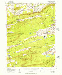 1955 Conyngham1956 Print · USGSThe anthracite coal fields of Luzerne and Schuylkill counties are shown here in the mid-fifties, just as strip mining began to reshape the ridges. Genealogists and historians can locate family homes in Oneida, Sheppton, or Kelayres, and trace the rail lines of the Reading and Lehigh Valley railroads.6 unique versions available
 - 1955 Map of Sybertsville, 1957 Print
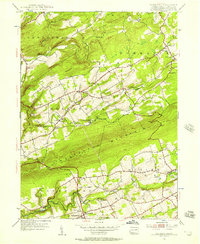 1955 Sybertsville1957 Print · USGSLuzerne County's rural townships are shown here in the mid-1950s, defined by the prominent ridge of Nescopeck Mountain. Genealogists and local historians can locate family-named sites such as Groover Cem and country landmarks like Brainerd Ch and the Township Sch.4 unique versions available
 - 1955 Map of Shickshinny, 1960 Print
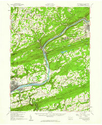 1955 Shickshinny1960 Print · USGSThe Susquehanna River valley and the anthracite coal region appear in fine detail during the mid-fifties. Researchers can trace old rail corridors, family cemeteries like St Alberts Cem, and smaller settlements such as Mocanaqua or Patterson Grove.
 - 1955 Map of Mahanoy, 1960 Print
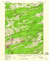 1955 Mahanoy1960 Print · USGSThe anthracite coalfields of Schuylkill County are shown in full industrial operation during the mid-1950s. Researchers can locate specific colliery sites and landmarks like Harwood, the Mahanoy Tunnel, and the lone Peddlars Grave.
Showing maps 1-25 of 70
Top cities near Butler Township
- Wilkes-Barre historical maps
- Hazleton historical maps
- Kingston historical maps
- Nanticoke historical maps
- Plains Township historical maps
- Tamaqua historical maps
See more
Top neighborhoods of Butler Township
- Drums historical maps
- Edgewood historical maps
- Rumbels historical maps
- Nescopeck Pass historical maps
- Saint Johns historical maps
- Sand Spring historical maps
See more
Frequently asked questions
- What are the different types of historical maps available for Butler Township?
- What is the oldest map of Butler Township?
- Where can I purchase historical maps of Butler Township for my home or office?
- Where can I download high-res historical maps of Butler Township?
- Are there historical topographic maps available for Butler Township?
- Is there historical aerial imagery available for Butler Township?
- Where are historical maps of Butler Township sourced from?