Old Maps of Jackson Township, Pennsylvania for Genealogy
Trace your family roots with 23 historic maps of Jackson Township. These high-res maps reveal old neighborhoods, homesites, landmarks, and streets — helping you uncover where your ancestors lived and how the area evolved over time.
- Explore historic neighborhoods: Identify where your relatives may have lived in the 1800s or 1900s.
- Compare maps over time: Trace the changes in streets, buildings, and landmarks for multi-generational research.
- Perfect for genealogy & ancestry research: Used by family historians and researchers to map out lineage and migration.
These maps are an incredible resource for exploring your personal connection to Jackson Township's past.
Jackson Township, PA maps
(23)- 1921 Map of Trout Run, 1957 Print
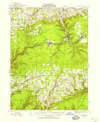
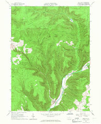
 1921 Trout Run1957 Print · USGSThe Lycoming Creek valley in the 1920s served as a vital transit and industrial corridor north of Williamsport. Genealogists and local historians can trace family ties through dozens of named rural schools, including Beech Grove School and Chestnut Grove School, or locate early industry at Balls Mills.3 unique versions available
 - 1923 Map of Trout Run
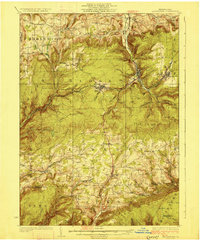
 1923 Trout Run1923 Print · USGSLycoming County in the early 1920s shows a mountain landscape defined by small valley settlements and a dense network of country schools. You can trace family roots at Anthony Church or locate vanished industrial sites like the Nail Factory and Balls Mills.4 unique versions available
 - 1925 Map of Blossburg, 1958 Print
 1925 Blossburg1958 Print · USGSTioga County’s coal and timber country is captured here during the 1920s, when the Tioga River and Erie R R drove the local economy. Researchers can locate dozens of country schoolhouses, rural churches like Burt Church, and early industrial sites such as Blacks Mill.2 unique versions available
 - 1927 Map of Blossburg
 1927 Blossburg1927 Print · USGSTioga County's coal country and rural townships are captured here in the mid-1920s, showing the height of the mountain rail and mining era. Genealogists can locate family-named sites like Blacks Mill, Hart Church, and vanished schoolhouses such as Culver School.4 unique versions available
 - 1944 Map of Blossburg
 1944 Blossburg1944 Print · USGSTioga County during the mid-1940s reveals a landscape of industrial coal towns and remote ridge-top schoolhouses. Genealogists and historians can trace family roots through numerous local landmarks, including Blacks Mill, the Erie Railroad, and several rural sites like Nauvoo or Beuter School.
 - 1944 Map of Trout Run
 1944 Trout Run1944 Print · USGSLycoming County during the mid-forties reveals a landscape of high ridges and narrow creek valleys connected by the Pennsylvania RR. Genealogists and local historians can trace dozens of rural school sites like Steam Mill School or locate family landmarks such as Horner Hollow and the Salladasburg PO.
 - 1954 Map of Williamsport
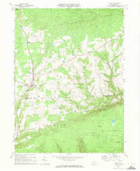
 1954 Williamsport1954 Print · USGSNorth-central Pennsylvania in the mid-fifties is defined by the winding West Branch Susquehanna River and its industrial valley. Local historians can trace the massive Susquehanna Ordnance Depot and the extensive rail networks of the Pennsylvania Railroad.
 - 1960 Map of Williamsport
 1960 Williamsport1960 Print · USGSNorth-central Pennsylvania in the mid-twentieth century was a vital corridor of rail and river industry stretching from the New York line to the coal regions. Genealogists can trace the rail networks of the Pennsylvania RR and Lehigh Valley RR connecting towns like Williamsport, Towanda, and Lock Haven.
 - 1962 Map of Williamsport, 1966 Print
 1962 Williamsport1966 Print · USGSNorth-central Pennsylvania was a landscape of industrial river hubs and vast state woodlands in the early sixties. Researchers can trace the path of the Pennsylvania Railroad through Williamsport and explore the remote reaches of Bucktail State Park.5 unique versions available
 - 1965 Map of Williamsport
 1965 Williamsport1965 Print · USGSNorth-central Pennsylvania in the mid-1960s is defined by the industrial river towns and vast timberlands of the Allegheny Plateau. Researchers can trace historic rail lines like the Erie Lackawanna and Reading as they thread through Williamsport, Lock Haven, and Jersey Shore.
 - 1965 Map of White Pine, 1967 Print
 1965 White Pine1967 Print · USGSLycoming County highlands in the mid-1960s reveal a landscape of secluded mountain hollows and scattered upland farms. Genealogists can trace family footprints at Persun Cem and the Cogan House Sch, or locate old settlements like Steam Valley and White Pine.3 unique versions available
 - 1965 Map of Trout Run, 1967 Print
 1965 Trout Run1967 Print · USGSLycoming County mountain life in the mid-sixties is centered on the rail-and-river corridor at Trout Run and Fields Station. Genealogists and historians can locate rural landmarks like Rose Valley Sch, Steam Valley Ch, and the winding Pennsylvania Railroad.3 unique versions available
 - 1966 Map of Williamsport
 1966 Williamsport1966 Print · USGSThe Susquehanna Valley was a hub of transit and industry in the mid-seventies, where the river's West Branch connected major college towns and timberlands. Researchers can trace historical rail lines like the Reading or locate regional landmarks from Jersey Shore to Ricketts Glen State Park.
 - 1969 Map of Liberty, 1972 Print
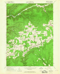
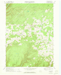
 1969 Liberty1972 Print · USGSThe Pennsylvania highlands near the Tioga and Lycoming border are captured here just before the 1970s. Researchers can locate family landmarks like Friedens Ch, the Joint High Sch in Liberty, and various camps along Roaring Branch.3 unique versions available
 - 1969 Map of Nauvoo, 1973 Print
 1969 Nauvoo1973 Print · USGSThe northern Pennsylvania high country is documented here in the late sixties, where small settlements like Nauvoo and Hartfield sit at the edge of the Tioga State Forest. Genealogists and researchers can trace local landmarks like Beuters Ch or the Old Babb Railroad Grade.3 unique versions available
 - 1977 Map of Nauvoo, 1979 Print
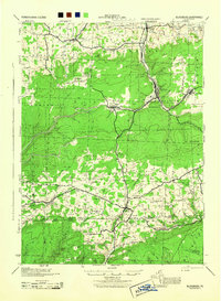
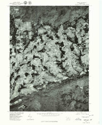
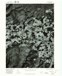 1977 Nauvoo1979 Print · USGSDuring the late seventies, this rural Tioga County landscape was captured in fine detail via aerial photography. Researchers can pinpoint specific homesteads and land boundaries near Nauvoo, Hartfield, and Plank.
 - 1977 Map of Liberty, 1979 Print
 1977 Liberty1979 Print · USGSPennsylvania's Northern Tier comes into focus during the late 1970s through this detailed orthophoto mapping of Tioga County. Genealogists and local historians can trace exact property lines and field patterns surrounding the settlements of Liberty, Sebring, and East Point.
 - 1981 Map of Wellsboro, 1982 Print
 1981 Wellsboro1982 Print · USGSNorthern Pennsylvania in the early eighties shows a landscape of deep river gorges and vast state forests. Trace the rail lines of Conrail and explore old settlements from Coudersport to the Pine Creek Gorge.
 - 1984 Map of Williamsport West, 1985 Print
 1984 Williamsport West1985 Print · USGSCentral Pennsylvania in the mid-eighties was a landscape of dense state forests and industrious river towns along the West Branch Susquehanna River. Trace the rail lines of Conrail through Renovo or locate the historic grounds of Lock Haven State College.2 unique versions available
 - 2023 Map of Liberty, 2023 Print
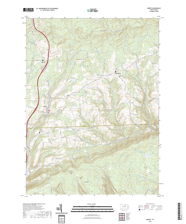 2023 Liberty2023 Print · USGSThe borderlands of Tioga and Lycoming counties remain a rugged rural landscape in the twenty-first century. Genealogists and local researchers can trace family lines through numerous sites like Friedens Lutheran Church Cem, Jew Hill, and the small community of East Point.
 - 2023 Map of Nauvoo, 2023 Print
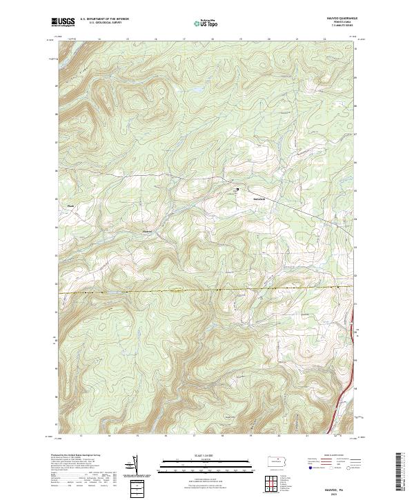 2023 Nauvoo2023 Print · USGSSettlements in the Tioga and Lycoming county borderlands are shown here in modern detail, illustrating a landscape of high ridges and deep hollows. Researchers can trace family sites near Nauvoo, locate the Salem Lutheran Cem, and follow the drainages of Zimmerman Creek and Blacks Creek.
 - 2023 Map of White Pine, 2023 Print
 2023 White Pine2023 Print · USGSThe rural uplands of Lycoming County are shown here in the 2020s, a landscape defined by isolated settlements and deep mountain hollows. Genealogists can locate several historic burial grounds including Cogan House Cem and Summit Cem near White Pine.
 - 2023 Map of Trout Run, 2023 Print
 2023 Trout Run2023 Print · USGSLycoming County’s highlands are captured here in the early twenty-first century, centered on the settlement of Trout Run. Researchers can trace family history through local landmarks like Steam Valley Cem, Rose Valley Cem, and the high reaches of Kinney Ridge.
End of results
Showing maps 1-23 of 23
Top cities near Jackson Township
- Wellsboro historical maps
- Blossburg historical maps
- Morris Township historical maps
- Liberty historical maps
- Duncan Township historical maps
Top neighborhoods of Jackson Township
Frequently asked questions
- What are the different types of historical maps available for Jackson Township?
- What is the oldest map of Jackson Township?
- Where can I purchase historical maps of Jackson Township for my home or office?
- Where can I download high-res historical maps of Jackson Township?
- Are there historical topographic maps available for Jackson Township?
- Is there historical aerial imagery available for Jackson Township?
- Where are historical maps of Jackson Township sourced from?