2020s Maps of Muncy Township, Pennsylvania
Explore 3 historic maps of Muncy Township from the 2020s. These maps offer a rare glimpse into what life looked like during the 2020s — showing old roads, neighborhoods, homes, and landmarks that have changed or disappeared over time.
Whether you're researching your family's past, planning a metal detecting trip, or studying how Muncy Township's landscape evolved across the 2020s, these high-resolution maps are a powerful tool for exploring the history of this region.
- Focus on a specific era: All maps on this page are from the 2020s, giving you a focused view of this time period.
- See what’s changed: Compare century-old streets, trails, and buildings to today's modern landscape using overlays and satellite layers.
- Research with precision: Use these maps for genealogy, historical research, land use analysis, or educational projects.
- View, download, or print: Maps are fully viewable online in high resolution, and can be downloaded or printed for your own records.
Start exploring Muncy Township's history through authentic maps from the 2020s. This is your window into the past.
Muncy Township, PA maps
(3)- 2023 Map of Huntersville, 2023 Print
 2023 Huntersville2023 Print · USGSLycoming County’s ridge-and-valley landscape is documented here in recent years, showing the intersection of timberlands and rural community life. Genealogists and historians can locate family plots at Fairfield Cem or Webster Cem and trace the paths around Huntersville.
 - 2023 Map of Hughesville, 2023 Print
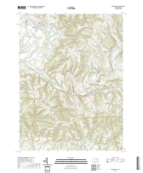 2023 Hughesville2023 Print · USGSThe area around Hughesville in the 2020s shows a complex geography of ridges and creek valleys at the convergence of four counties. Genealogists can locate family burial sites at Saint James Cem or Moreland Lutheran Cem and trace old homesteads near Clarkstown.
 - 2023 Map of Muncy, 2023 Print
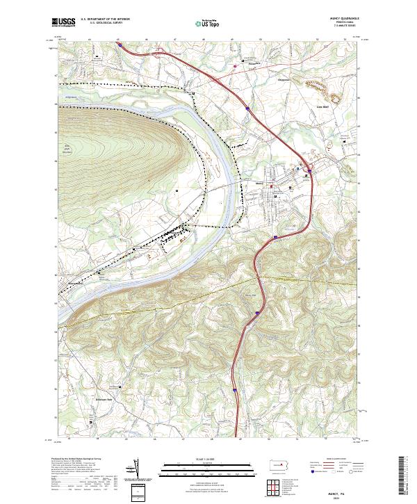 2023 Muncy2023 Print · USGSTracing the West Branch Susquehanna River through Lycoming County, this survey shows the regional hubs of Muncy and Montgomery in the early twenty-first century. Researchers can locate numerous historic burial sites such as Hill Burial Grounds and the Friends Meeting House in Pennsdale.
End of results
Showing maps 1-3 of 3
Top cities near Muncy Township
- Williamsport historical maps
- South Williamsport historical maps
- Montoursville historical maps
- White Deer Township historical maps
- Kenmar historical maps
- Montgomery historical maps
See more
Top neighborhoods of Muncy Township
Frequently asked questions
- What are the different types of historical maps available for Muncy Township?
- What is the oldest map of Muncy Township?
- Where can I purchase historical maps of Muncy Township for my home or office?
- Where can I download high-res historical maps of Muncy Township?
- Are there historical topographic maps available for Muncy Township?
- Is there historical aerial imagery available for Muncy Township?
- Where are historical maps of Muncy Township sourced from?