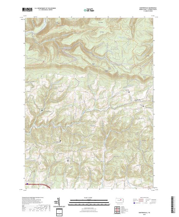
2023 Map of Huntersville
USGS Topo · Published 2023About this map
Huntersville sits at the heart of this Lycoming County landscape, where the southern edge of the Allegheny Ridge meets a complex network of stream-carved hollows. This area is defined by the sharp vertical relief between peaks like Stimets Knob and Smiths Knob and the deep drainage of Loyalsock Creek. The mapping reveals a distinct settlement pattern where human activity is concentrated along ridge-top roads and narrow valley floors, while the northern reaches are dominated by the Loyalsock Trl and various snowmobile paths. For those looking at the area's local history, the map provides precise locations for several small burial grounds, including the Fairfield Cem, Webster Cem, and the Huntersville Trinity Cem. The presence of the Church of the Good Shepherd Cem and Saint James Lutheran Church Cem suggests established rural congregations that have long served the scattered agricultural and timber communities of this region.
Find a feature on this map
97 named features on this map. Tap any name to fly to it.
Don’t see what you’re looking for? This feature index may not catch every label — zoom into the map to look around manually.
Map Details
Editions of this 2023 Huntersville Map
This is the sole edition of this map. No revisions or reprints were ever made.
Other maps of this area

1924 · Milton
USGS Topo · 1:62,500

1927 · Eagles Mere
USGS Topo · 1:48,000

1930 · Warrensville
USGS Topo · 1:62,500

1932 · Eagle Mere
USGS Topo · 1:62,500

1934 · Warrensville
USGS Topo · 1:62,500

1935 · Hughesville
USGS Topo · 1:62,500

1953 · Hughesville
USGS Topo · 1:62,500

1953 · Warrensville
USGS Topo · 1:62,500

1953 · Eagles Mere
USGS Topo · 1:62,500

1953 · Milton
USGS Topo · 1:62,500
Featured Places
- Muncy Township, PA
- Dewey Corner, Upper Fairfield Township
- Fairfield Township, PA
- Plunketts Creek Township, PA
- Gamble Township, PA