
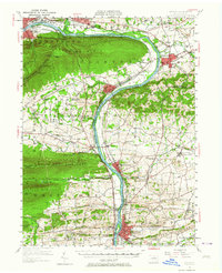
1953 Map of Milton
USGS Topo · Published 1956About this map
The West Branch Susquehanna River carves a deep valley through the ridge-and-valley province of Central Pennsylvania, dominated by the massive presence of Bald Eagle Mountain. By the early 1950s, the region shows a dense network of river-oriented industrial towns including Milton, Watsontown, and Montgomery. This survey captures the rural landscape before major interstate development, where numerous small country schools like Yokum School and Robin School still dotted the crossroads. A significant portion of the western terrain is occupied by the U S Military Reservation, while the industrial history of the valley is anchored by features such as the Old Furnace near White Deer Creek. The landscape transition from the steep North White Deer Ridge to the fertile agricultural plains of the Muncy Hills illustrates the distinct geographic divide that shaped local settlement patterns for generations.
Find a feature on this map
107 named features on this map. Tap any name to fly to it.
Don’t see what you’re looking for? This feature index may not catch every label — zoom into the map to look around manually.
Map Details
Editions of this 1953 Milton Map
2 editions found
Other maps of this area

1892 · Shamokin
USGS Topo · 1:62,500

1893 · Sunbury
USGS Topo · 1:62,500

1893 · Shamokin
USGS Topo · 1:62,500

1921 · Williamsport
USGS Topo · 1:48,000

1921 · Trout Run
USGS Topo · 1:62,500

1923 · Trout Run
USGS Topo · 1:62,500

1923 · Williamsport
USGS Topo · 1:62,500

1924 · Milton
USGS Topo · 1:62,500

1927 · Eagles Mere
USGS Topo · 1:48,000

1930 · Warrensville
USGS Topo · 1:62,500
Featured Places
- Williamsport, PA
- South Williamsport, PA
- Montoursville, PA
- White Deer Township, PA
- Kenmar, Loyalsock Township