Old Maps of Marvindale, Hamlin Township for Genealogy
Trace your family roots with 13 historic maps of Marvindale. These high-res maps reveal old neighborhoods, homesites, landmarks, and streets — helping you uncover where your ancestors lived and how the area evolved over time.
- Explore historic neighborhoods: Identify where your relatives may have lived in the 1800s or 1900s.
- Compare maps over time: Trace the changes in streets, buildings, and landmarks for multi-generational research.
- Perfect for genealogy & ancestry research: Used by family historians and researchers to map out lineage and migration.
These maps are an incredible resource for exploring your personal connection to Marvindale's past.
Marvindale, Hamlin Township maps
(13)- 1935 Map of Mt. Jewett
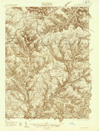 1935 Mt. Jewett1935 Print · USGSElk and McKean counties at the height of the Great Depression reveal a landscape shaped by competing timber and rail interests. Researchers can trace the junction of three major railroads and find vanished operations at Burning Well and Instanter.3 unique versions available
 - 1940 Map of Mt. Jewett
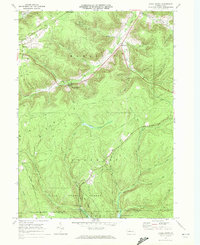
 1940 Mt. Jewett1940 Print · USGSNorthern Pennsylvania’s timber and rail country is captured here during the mid-1930s, showing a landscape defined by industrial development. Researchers can locate vanished rural infrastructure like the Stenstrom Sch, the CCC Camp, and specific rail stops at Dahoga and Instanter.3 unique versions available
 - 1957 Map of Warren, 1964 Print
 1957 Warren1964 Print · USGSThe northern Pennsylvania oil and timber country comes into focus in the mid-fifties, showing the region before modern highway expansions. Trace the industrial rail networks of the Pennsylvania RR and the early Allegheny River Reservoir near Warren and Oil City.4 unique versions available
 - 1958 Map of Warren
 1958 Warren1958 Print · USGSNorthern Pennsylvania’s timber and oil country is captured here during the late fifties, showing the interplay of industrial valleys and vast state forests. Genealogists can trace family connections across the Cornplanter Indian Reservation or through rail hubs like Oil City and Saint Marys.
 - 1959 Map of Warren
 1959 Warren1959 Print · USGSNorthern Pennsylvania's oil and timber country comes alive in this late-fifties study of the forest-clad plateaus. Trace the historic Cornplanter (Indian Reservation), the sprawling Oil Field, and the rail lines of the Pennsylvania RR.2 unique versions available
 - 1969 Map of Hazel Hurst, 1972 Print
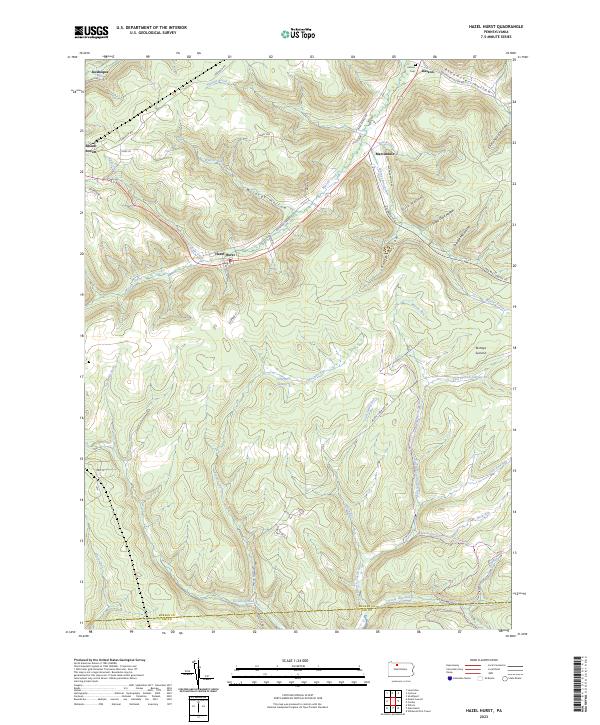
 1969 Hazel Hurst1972 Print · USGSMcKean and Elk Counties are shown during a period of industrial change in the late 1960s, documenting a landscape of gas fields and timbered ridges. Genealogists and historians can trace the paths of the Baltimore and Ohio Railroad and old settlements like Hazel Hurst and Marvindale.
 - 1971 Map of Warren
 1971 Warren1971 Print · USGSNorth Central Pennsylvania is captured here in the early seventies, showing a landscape defined by industrial centers and massive state forests. Genealogists and historians can trace the rail lines of the Penn Central and Erie Lackawanna connecting towns like Warren, Kane, and Du Bois.
 - 1980 Map of Bradford, 1982 Print
 1980 Bradford1982 Print · USGSNorthern Pennsylvania's oil country and deep forests are captured here during the 1980s. Genealogists and researchers can trace rail-side settlements like Kushequa, Gifford, and Lewis Run or locate specific Oil and Gas Field sites across the plateau.
 - 2010 Map of Hazel Hurst, 2010 Print
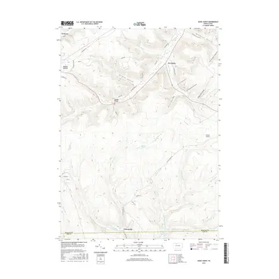
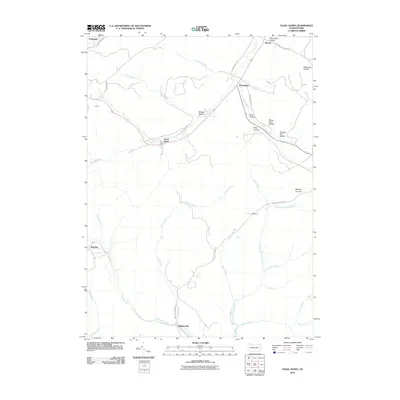 2010 Hazel Hurst2010 Print · USGSCovers Marvindale, including Mount Jewett, Kasson, and other nearby areas
 - 2013 Map of Hazel Hurst, 2013 Print
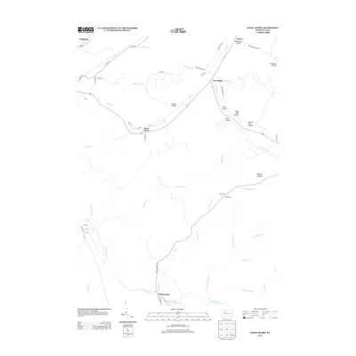 2013 Hazel Hurst2013 Print · USGSCovers Marvindale, including Mount Jewett, Kasson, and other nearby areas
 - 2016 Map of Hazel Hurst, 2016 Print
 2016 Hazel Hurst2016 Print · USGSCovers Marvindale, including Mount Jewett, Kasson, and other nearby areas
 - 2019 Map of Hazel Hurst, 2019 Print
 2019 Hazel Hurst2019 Print · USGSCovers Marvindale, including Mount Jewett, Kasson, and other nearby areas
 - 2023 Map of Hazel Hurst, 2023 Print
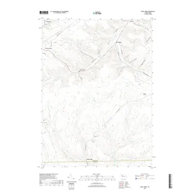
 2023 Hazel Hurst2023 Print · USGSModern McKean County at the edge of the Elk County line shows a landscape of deep timbered hollows and high summits. Genealogists and hikers can trace old routes like Railroad Grade Rd, find the Kasson Cem, or explore the upper East Branch Clarion River.
End of results
Showing maps 1-13 of 13
Top cities near Marvindale
- Saint Marys historical maps
- Bradford historical maps
- Lafayette Township historical maps
- Liberty Township historical maps
- Smethport historical maps
- Mount Jewett historical maps
See more
Frequently asked questions
- What are the different types of historical maps available for Marvindale?
- What is the oldest map of Marvindale?
- Where can I purchase historical maps of Marvindale for my home or office?
- Where can I download high-res historical maps of Marvindale?
- Are there historical topographic maps available for Marvindale?
- Is there historical aerial imagery available for Marvindale?
- Where are historical maps of Marvindale sourced from?