2020s Maps of South Pymatuning Township, Pennsylvania
Explore 2 historic maps of South Pymatuning Township from the 2020s. These maps offer a rare glimpse into what life looked like during the 2020s — showing old roads, neighborhoods, homes, and landmarks that have changed or disappeared over time.
Whether you're researching your family's past, planning a metal detecting trip, or studying how South Pymatuning Township's landscape evolved across the 2020s, these high-resolution maps are a powerful tool for exploring the history of this region.
- Focus on a specific era: All maps on this page are from the 2020s, giving you a focused view of this time period.
- See what’s changed: Compare century-old streets, trails, and buildings to today's modern landscape using overlays and satellite layers.
- Research with precision: Use these maps for genealogy, historical research, land use analysis, or educational projects.
- View, download, or print: Maps are fully viewable online in high resolution, and can be downloaded or printed for your own records.
Start exploring South Pymatuning Township's history through authentic maps from the 2020s. This is your window into the past.
South Pymatuning Township, PA maps
(2)- 2023 Map of Sharpsville, 2023 Print
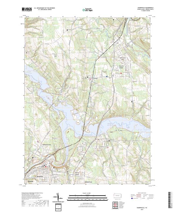 2023 Sharpsville2023 Print · USGSSharpsville and the Shenango River valley appear here in their modern context, showing a landscape defined by the expansive Shenango River Lake. Researchers can trace local lineages through numerous burial sites like Riverside Cem, Transfer Cem, and Fell Cem.
 - 2023 Map of Orangeville, 2023 Print
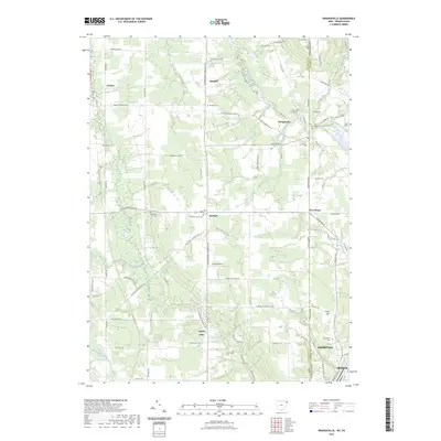 2023 Orangeville2023 Print · USGSThe Ohio-Pennsylvania state line corridor near Orangeville is captured in this recent survey, showcasing a landscape of rural hamlets and creek valleys. Researchers can trace local lineages through Artherholt Cem or explore the geography around Yankee Lake and Hartford.
End of results
Showing maps 1-2 of 2
Top cities near South Pymatuning Township
- Youngstown historical maps
- Hermitage historical maps
- Sharon historical maps
- Girard historical maps
- Brookfield historical maps
- Brookfield Township historical maps
See more
Top neighborhoods of South Pymatuning Township
Frequently asked questions
- What are the different types of historical maps available for South Pymatuning Township?
- What is the oldest map of South Pymatuning Township?
- Where can I purchase historical maps of South Pymatuning Township for my home or office?
- Where can I download high-res historical maps of South Pymatuning Township?
- Are there historical topographic maps available for South Pymatuning Township?
- Is there historical aerial imagery available for South Pymatuning Township?
- Where are historical maps of South Pymatuning Township sourced from?