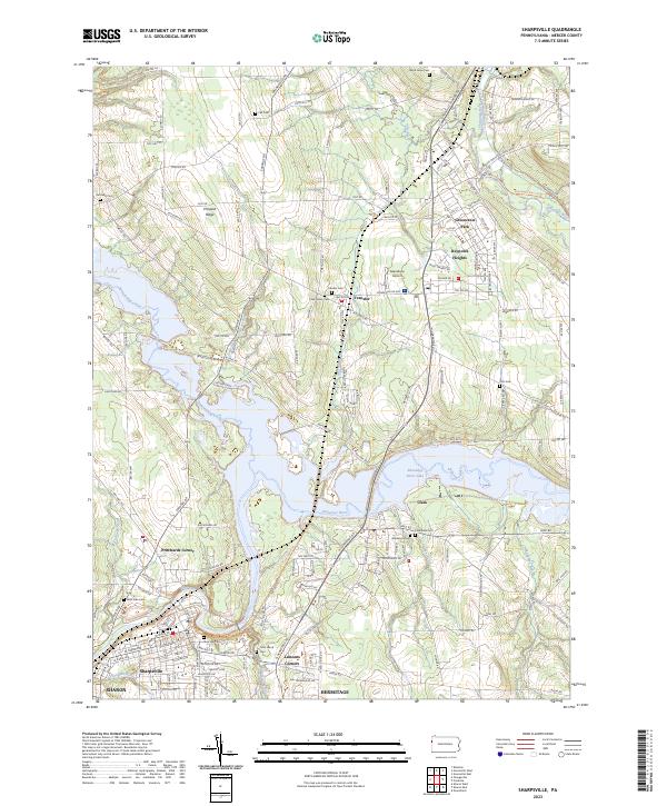
2023 Map of Sharpsville
USGS Topo · Published 2023About this map
The Shenango River and the broad expanse of the Shenango River Lake dominate this Mercer County landscape, shaping the development of Sharpsville and the neighboring community of Clark. The river’s path is flanked by numerous historic burial grounds, including Riverside Cem and West Side Cem, which serve as significant markers for local genealogical research. In the northern reaches, the terrain rises toward Prospect Ridge and the rural crossroads of Transfer, where small aviation history is noted at the Napodano Airport.
Find a feature on this map
128 named features on this map. Tap any name to fly to it.
Don’t see what you’re looking for? This feature index may not catch every label — zoom into the map to look around manually.
Map Details
Editions of this 2023 Sharpsville Map
This is the sole edition of this map. No revisions or reprints were ever made.
Other maps of this area

1905 · Neshannock
USGS Topo · 1:62,500

1906 · Youngstown
USGS Topo · 1:62,500

1907 · Neshannock
USGS Topo · 1:62,500

1907 · Kinsman
USGS Topo · 1:62,500

1908 · Shenango
USGS Topo · 1:62,500

1908 · Youngstown
USGS Topo · 1:62,500

1950 · Cleveland
USGS Topo · 1:250,000

1954 · Sharon West
USGS Topo · 1:24,000

1956 · Cleveland
USGS Topo · 1:250,000

1958 · Sharpsville
USGS Topo · 1:24,000