Old Maps of Wolf Creek Township, Pennsylvania for Academic Research
Study the evolution of Wolf Creek Township with 33 high-resolution historic maps. Whether you're teaching, researching, or modeling changes in land use, these maps provide essential visual documentation of urban, environmental, and geographic change.
- Analyze long-term change: Track patterns in development, transportation, and natural features.
- Ideal for environmental or urban studies: Support academic projects with primary historical map data.
- Use in the classroom or lab: Educators and researchers rely on these maps to bring historical context to life.
These maps are a powerful tool for teaching, research, and visualizing how Wolf Creek Township has changed over the decades.
Wolf Creek Township, PA maps
(33)- 1910 Map of Hilliards, 1956 Print
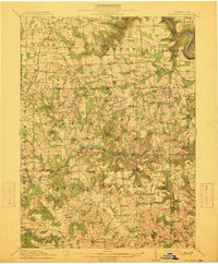
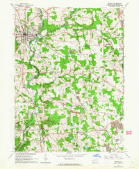
 1910 Hilliards1956 Print · USGSButler and Venango Counties come into focus during this early twentieth-century survey of western Pennsylvania's hill country. Researchers can trace the era's rural infrastructure through dozens of sites like Mechanicsville Wesley PO, Rankin Church, and the Boyer's Annandale Sta.
 - 1912 Map of Hilliards
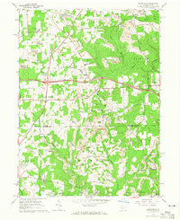
 1912 Hilliards1912 Print · USGSButler and Venango Counties at the height of the rail era are shown here in intricate detail. Genealogists can trace family names across dozens of rural institutions, from Wesley PO and Sutton Mill to the remote Whiskerville.4 unique versions available
 - 1913 Map of Mercer
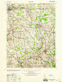
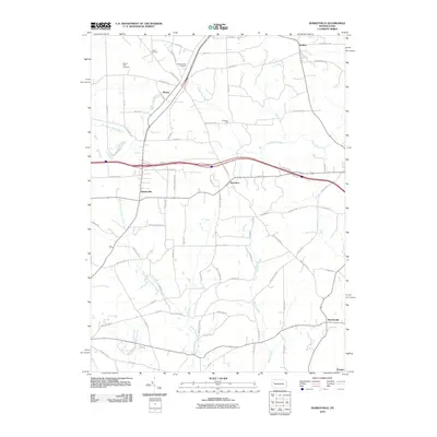
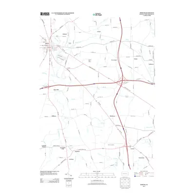
 1913 Mercer1913 Print · USGSMercer and Grove City anchor this early twentieth-century landscape during a period of coal mining and railway expansion. Genealogists can trace family roots through numerous local schools like Bottle Hill School and rural settlements such as Pardoe and Amsterdam.6 unique versions available
 - 1939 Map of Mercer, 1959 Print
 1939 Mercer1959 Print · USGSWestern Pennsylvania during the late 1930s shows a landscape of thriving coal mining, manufacturing, and education. Researchers can trace the rail-and-river economy through the Pennsylvania railroad lines, the Number Five Mine, and the local Normal School.
 - 1943 Map of Mercer
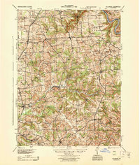
 1943 Mercer1943 Print · USGSMid-century Mercer County and northern Lawrence County are captured here as vital hubs of Pennsylvania rail and milling. Researchers can trace the legacy of local industry at Kimbles Mills, the Number Five Mine, and the Slippery Rock State Normal School.
 - 1944 Map of Hilliards
 1944 Hilliards1944 Print · USGSThe rural borderlands of Butler and Venango counties are captured here in the mid-1940s, showing a landscape of small farming hamlets and rail-side industry. Genealogists can locate family landmarks such as the Anderson Stone House, Gillmans Mill, and dozens of local schoolhouses like Pike Sch.
 - 1950 Map of Cleveland
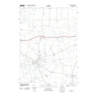
 1950 Cleveland1950 Print · USGSCovers Wolf Creek Township, including Cleveland, Akron, and other nearby areas
 - 1956 Map of Cleveland, 1967 Print
 1956 Cleveland1967 Print · USGSNortheast Ohio and Western Pennsylvania are shown at their industrial height during the mid-fifties, from the steel mills to the lakeshore. Researchers can trace the massive Ravenna Arsenal, the Ohio Turnpike, and vanished rail sidings of the B & O RR.3 unique versions available
 - 1957 Map of Warren, 1964 Print
 1957 Warren1964 Print · USGSThe northern Pennsylvania oil and timber country comes into focus in the mid-fifties, showing the region before modern highway expansions. Trace the industrial rail networks of the Pennsylvania RR and the early Allegheny River Reservoir near Warren and Oil City.4 unique versions available
 - 1958 Map of Warren
 1958 Warren1958 Print · USGSNorthern Pennsylvania’s timber and oil country is captured here during the late fifties, showing the interplay of industrial valleys and vast state forests. Genealogists can trace family connections across the Cornplanter Indian Reservation or through rail hubs like Oil City and Saint Marys.
 - 1959 Map of Warren
 1959 Warren1959 Print · USGSNorthern Pennsylvania's oil and timber country comes alive in this late-fifties study of the forest-clad plateaus. Trace the historic Cornplanter (Indian Reservation), the sprawling Oil Field, and the rail lines of the Pennsylvania RR.2 unique versions available
 - 1961 Map of Grove City, 1963 Print
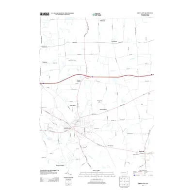
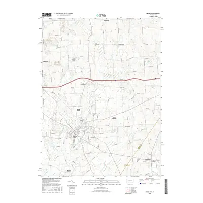
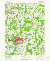 1961 Grove City1963 Print · USGSGrove City and Harrisville are shown in the early 1960s as industrial rail centers and college towns. Researchers can trace the Bessemer and Lake Erie line past Grove City College, Ebenezer Church, and local strip mines.4 unique versions available
 - 1961 Map of Mercer, 1964 Print
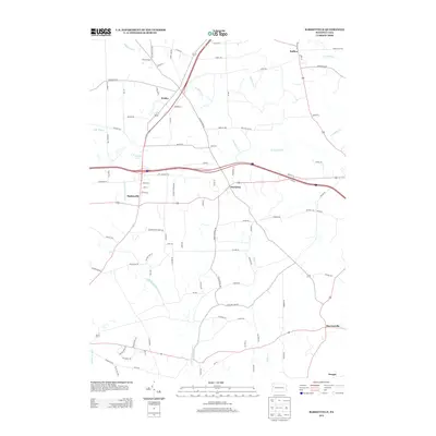
 1961 Mercer1964 Print · USGSIn the early 1960s, the Mercer area of Pennsylvania was a hub of rail transport and heavy industry. Genealogists and historians can trace family roots through Findley Cem, local landmarks like Nazareth Ch, and industry sites like the Number Five Mine.4 unique versions available
 - 1962 Map of Cleveland
 1962 Cleveland1962 Print · USGSNortheast Ohio and the Pennsylvania borderlands appear here during the industrial peak of the early sixties. Genealogists and historians can trace the expansive rail lines of the Nickel Plate Road and the growth of suburbs from Parma to Lyndhurst.
 - 1963 Map of Barkeyville, 1965 Print
 1963 Barkeyville1965 Print · USGSVenango and Butler counties are captured in the early 1960s, showing a landscape defined by traditional rural settlements and an intensive oil and coal industry. Researchers can trace family sites at Mt Irwin Cem and Victory Joint Sch or locate old operations in the Bullion and Clintonville Oil Fields.4 unique versions available
 - 1971 Map of Warren
 1971 Warren1971 Print · USGSNorth Central Pennsylvania is captured here in the early seventies, showing a landscape defined by industrial centers and massive state forests. Genealogists and historians can trace the rail lines of the Penn Central and Erie Lackawanna connecting towns like Warren, Kane, and Du Bois.
 - 1983 Map of Oil City, 1984 Print
 1983 Oil City1984 Print · USGSThe Allegheny and Clarion river valleys are shown in the early eighties as a hub of rail lines and conservation lands. Genealogists can trace family connections in Oil City and Franklin or locate rural sites like the Pennsylvania State Hospital and School and Coal City.
 - 1986 Map of Youngstown, 1988 Print
 1986 Youngstown1988 Print · USGSThe industrial corridor of the Mahoning Valley and the collegiate towns of Western Pennsylvania are captured here in the mid-eighties. Researchers can trace the rail lines of the Conrail network or locate historical sites like Churchill and Crown Hill Cem.2 unique versions available
 - 2010 Map of Grove City, 2010 Print
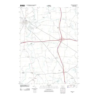
 2010 Grove City2010 Print · USGSCovers Wolf Creek Township, including Grove City, Harrisville, and other nearby areas
 - 2010 Map of Mercer, 2010 Print
 2010 Mercer2010 Print · USGSCovers Wolf Creek Township, including Mercer, Jackson Township, and other nearby areas
 - 2010 Map of Barkeyville, 2010 Print
 2010 Barkeyville2010 Print · USGSCovers Wolf Creek Township, including Barkeyville, Irwin Township, and other nearby areas
 - 2013 Map of Barkeyville, 2013 Print
 2013 Barkeyville2013 Print · USGSCovers Wolf Creek Township, including Barkeyville, Irwin Township, and other nearby areas
 - 2013 Map of Grove City, 2013 Print
 2013 Grove City2013 Print · USGSCovers Wolf Creek Township, including Grove City, Harrisville, and other nearby areas
 - 2013 Map of Mercer, 2013 Print
 2013 Mercer2013 Print · USGSCovers Wolf Creek Township, including Mercer, Jackson Township, and other nearby areas
 - 2016 Map of Grove City, 2016 Print
 2016 Grove City2016 Print · USGSCovers Wolf Creek Township, including Grove City, Harrisville, and other nearby areas
Showing maps 1-25 of 33
Top cities near Wolf Creek Township
- Grove City historical maps
- Franklin historical maps
- Sugarcreek historical maps
- Slippery Rock historical maps
- Mercer historical maps
- Rockland Township historical maps
See more
Top neighborhoods of Wolf Creek Township
Frequently asked questions
- What are the different types of historical maps available for Wolf Creek Township?
- What is the oldest map of Wolf Creek Township?
- Where can I purchase historical maps of Wolf Creek Township for my home or office?
- Where can I download high-res historical maps of Wolf Creek Township?
- Are there historical topographic maps available for Wolf Creek Township?
- Is there historical aerial imagery available for Wolf Creek Township?
- Where are historical maps of Wolf Creek Township sourced from?