Old Maps of Mifflin County, Pennsylvania for Academic Research
Study the evolution of Mifflin County with 141 high-resolution historic maps. Whether you're teaching, researching, or modeling changes in land use, these maps provide essential visual documentation of urban, environmental, and geographic change.
- Analyze long-term change: Track patterns in development, transportation, and natural features.
- Ideal for environmental or urban studies: Support academic projects with primary historical map data.
- Use in the classroom or lab: Educators and researchers rely on these maps to bring historical context to life.
These maps are a powerful tool for teaching, research, and visualizing how Mifflin County has changed over the decades.
Mifflin County, PA maps
(141)- 1919 Map of Mattawana
 1919 Mattawana1919 Print · USGSCentral Pennsylvania's ridge-and-valley network is captured here at the end of the Great War, showing a landscape defined by small mill towns and diverging rail lines. Genealogists can trace family names and ancestral homes in McCulloch Mills, E. Waterford, and Blairs Mills.
 - 1919 Map of Menno
 1919 Menno1919 Print · USGSHuntingdon County is shown at the end of the first World War, when small-town industry and rail travel still dictated the local rhythm. Genealogists and historians can locate family-named landmarks like McAlevys Fort, Cornpropst Mills, and the Union Church near the county line.
 - 1922 Map of Mt Union
 1922 Mt Union1922 Print · USGSThe Juniata River valley in the early 1920s reveals a landscape shaped by the Pennsylvania RR and early motor routes like the Lincoln Highway. Genealogists can trace dozens of rural schoolhouses and vanished post offices, including Red Fork PO, Shirleysburg, and Lucy Furnace School.2 unique versions available
 - 1924 Map of Mt. Union
 1924 Mt. Union1924 Print · USGSMount Union and the central Juniata River valley are shown here in the mid-twenties as the rail-and-river economy flourished. Genealogists can locate dozens of named rural schools like Smoke School and old post offices such as Shade Valley P.O.4 unique versions available
 - 1924 Map of Centre Hall, 1958 Print
 1924 Centre Hall1958 Print · USGSCentral Pennsylvania's ridge-and-valley landscape is captured here in the 1920s, showing a world of limestone springs and mountain gaps. Genealogists can locate family homesteads near Old Fort, Tusseyville, and dozens of rural schoolhouses like Gentzel School.2 unique versions available
 - 1924 Map of Lewistown, 1958 Print
 1924 Lewistown1958 Print · USGSMifflin County settlements line the river and valley floor during the mid-1920s, showing the region's transition from agrarian mills to industrial rail hubs. Researchers can locate vanished rural landmarks such as Union Mills, Emma Chapel, and numerous family-named sites like Strodes Mills.2 unique versions available
 - 1925 Map of Mifflintown
 1925 Mifflintown1925 Print · USGSJuniata County in the mid-1920s is a landscape of river-oriented towns and remote mountain gaps. Genealogists and historians can trace family roots through numerous local landmarks like Peach Blossom School, Jericho Mills, and the village of Mifflintown.
 - 1927 Map of Lewisburg
 1927 Lewisburg1927 Print · USGSThe central Pennsylvania landscape in the 1920s is defined here by the winding Juniata River and the industrial hubs of Lewistown and Burnham. Local historians can trace old river crossings like Lafolds Ford or the many rural schoolhouses like Yoder School and Brice School.5 unique versions available
 - 1929 Map of Centre Hall
 1929 Centre Hall1929 Print · USGSCentral Pennsylvania's ridge-and-valley country is shown here in the late 1920s as a landscape of rural schools and water mills. Genealogists can trace family footprints at Old Fort, Penn Cave, and dozens of school sites like Gentzel School.4 unique versions available
 - 1934 Map of Mifflintown, 1962 Print
 1934 Mifflintown1962 Print · USGSThe Juniata River valley and the ridges of the Pennsylvania heartland appear here in the mid-1930s. Researchers can trace the path of the Pennsylvania RR through Mifflintown or locate family landmarks like Raubs Mills, Seawra Cave, and Church Hill Sch.
 - 1935 Map of Allensville, 1958 Print
 1935 Allensville1958 Print · USGSThe ridge-and-valley country of central Pennsylvania is captured here in the mid-1930s as the local economy shifted toward conservation and forestry. Researchers can find traditional crossroads like McAlevys Fort, local landmarks such as Compropst Mill, and depression-era Owl Gap CCC Camp sites.2 unique versions available
 - 1936 Map of East Waterford
 1936 East Waterford1936 Print · USGSThe ridge-and-valley corridor of Juniata and Perry Counties is captured here in the mid-1930s, showing a landscape defined by narrow mountain gaps and small milling hubs. Researchers can trace ancestral roots through dozens of rural schools and churches, including McCulloughs Mills, Honey Grove, and Fairview Ch and Sch.2 unique versions available
 - 1937 Map of Mifflintown
 1937 Mifflintown1937 Print · USGSJuniata County in the mid-1930s shows a landscape of tight-knit valley communities and mountain gaps along the Juniata River. Genealogists and historians can trace family locations near dozens of rural landmarks, including Oakland Mills, Port Royal, and the Old Port Sch.3 unique versions available
 - 1937 Map of Millheim
 1937 Millheim1937 Print · USGSThe Seven Mountains region of central Pennsylvania is shown here in the late thirties, when rural valleys were tied together by narrow gaps. Researchers can locate family landmarks like Wolfs Chapel, Lose Sch, and vanished stopovers such as Wolfs Store.
 - 1938 Map of Allensville
 1938 Allensville1938 Print · USGSCentral Pennsylvania's valleys and ridges were a hive of rural industry and New Deal activity in the mid-1930s. Researchers can locate vanished schoolhouses and industrial sites like Greenwood Furnace, Cornpropst Mill, and the Mount Gap CCC Camp.3 unique versions available
 - 1941 Map of Millheim
 1941 Millheim1941 Print · USGSCentral Pennsylvania's ridge-and-valley landscape is documented here just before the mid-century, showing a network of mountain gaps and small valley settlements. Researchers can locate family landmarks like Wolfs Chapel, the Hironimus Sch, and the BM Sawmill along the banks of Penns Creek.3 unique versions available
 - 1941 Map of East Waterford
 1941 East Waterford1941 Print · USGSThe Ridge-and-Valley province of Central Pennsylvania appears here in the years before the war, dominated by the great parallel spans of Tuscarora Mountain. Genealogists can locate family sites among numerous rural institutions like Pine Glen Ch, McCullochs Mills, and the CCC Camp at East Waterford.3 unique versions available
 - 1943 Map of Lewistown
 1943 Lewistown1943 Print · USGSCentral Pennsylvania's rugged ridge-and-valley landscape is documented here during the mid-forties, showing the deep integration of rail lines and mountain gaps. Genealogists can trace family footprints through numerous rural landmarks like Emma Chapel, Mattern Junction, and the McNitt School.
 - 1944 Map of Mt. Union
 1944 Mt. Union1944 Print · USGSThe Juniata River valley and the ridges of Huntingdon and Mifflin counties are shown here at the peak of the rail era. Genealogists and historians can trace the locations of dozens of vanished schoolhouses like Lucy Furnace Sch and rural outposts like Atkinson Mills or Mapleton Depot.
 - 1950 Map of Harrisburg, 1952 Print
 1950 Harrisburg1952 Print · USGSMid-century Central Pennsylvania comes alive through its dense rail networks and river valley settlements during the post-war industrial era. Genealogists and historians can trace family roots through hubs like Harrisburg, locate Carlisle Barracks, or follow the Pennsylvania RR through the Lebanon Valley.
 - 1957 Map of Harrisburg
 1957 Harrisburg1957 Print · USGSMid-century Central Pennsylvania comes into focus as a bustling network of rail, river, and mountain ridges. Genealogists and historians can trace the development of the State Capitol and surrounding hubs like Middletown, Columbia, and Pottsville.7 unique versions available
 - 1957 Map of Millheim, 1959 Print
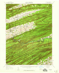 1957 Millheim1959 Print · USGSThe Pennsylvania Ridge-and-Valley landscape comes to life in the late 1950s, showing the intersection of rural agriculture and state forestry. Researchers can trace historic church sites like St Peters Ch or find recreation spots at Poe Valley State Park and Camp Hironimus.3 unique versions available
 - 1959 Map of Mc Clure, 1960 Print
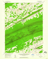 1959 Mc Clure1960 Print · USGSJuniata and Snyder counties are captured here in the late fifties, showing a landscape defined by the towering ridges of the Appalachians. Genealogists and local historians can locate rural landmarks like Bakers Ch, Raubs Mills, and the Covered Bridge on Middle Creek.3 unique versions available
 - 1959 Map of Mifflintown, 1960 Print
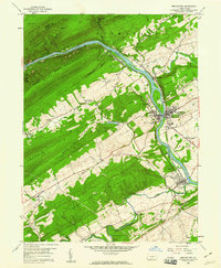 1959 Mifflintown1960 Print · USGSJuniata County boroughs and riverfront settlements are captured here in the late fifties as modern highways began to parallel the historic rail lines. Researchers can trace family sites at Church Hill Cem, locate the old Drive-in Theater, and explore the layout of Mifflintown and Port Royal.5 unique versions available
 - 1959 Map of Alfarata, 1960 Print
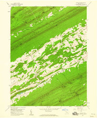 1959 Alfarata1960 Print · USGSThe central Pennsylvania ridges near the Mifflin-Juniata border are shown here during the late fifties, revealing a landscape of isolated valley settlements and upland state forests. Genealogists and researchers can locate family-named landmarks like Lawyers Ch, Paintersville, and the Old Railroad Grade.4 unique versions available
Showing maps 1-25 of 141
Top cities of Mifflin County
- Lewistown historical maps
- Granville Township historical maps
- Decatur Township historical maps
- Burnham historical maps
- Menno Township historical maps
- Juniata Terrace historical maps
See more
Frequently asked questions
- What are the different types of historical maps available for Mifflin County?
- What is the oldest map of Mifflin County?
- Where can I purchase historical maps of Mifflin County for my home or office?
- Where can I download high-res historical maps of Mifflin County?
- Are there historical topographic maps available for Mifflin County?
- Is there historical aerial imagery available for Mifflin County?
- Where are historical maps of Mifflin County sourced from?