1990s Maps of Paradise Township, Pennsylvania
Explore 7 historic maps of Paradise Township from the 1990s. These maps offer a rare glimpse into what life looked like during the 1990s — showing old roads, neighborhoods, homes, and landmarks that have changed or disappeared over time.
Whether you're researching your family's past, planning a metal detecting trip, or studying how Paradise Township's landscape evolved across the 1990s, these high-resolution maps are a powerful tool for exploring the history of this region.
- Focus on a specific era: All maps on this page are from the 1990s, giving you a focused view of this time period.
- See what’s changed: Compare century-old streets, trails, and buildings to today's modern landscape using overlays and satellite layers.
- Research with precision: Use these maps for genealogy, historical research, land use analysis, or educational projects.
- View, download, or print: Maps are fully viewable online in high resolution, and can be downloaded or printed for your own records.
Start exploring Paradise Township's history through authentic maps from the 1990s. This is your window into the past.
Paradise Township, PA maps
(7)- 1993 Map of East Stroudsburg
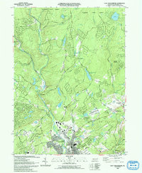 1993 East Stroudsburg1993 Print · USGSThe Pennsylvania Poconos in the early nineties show a landscape of growing mountain communities and secluded lakes. Genealogists can trace family names at Mt Zion Ch or explore the streets of East Stroudsburg and the settlement at Analomink.
 - 1994 Map of Skytop, 1995 Print
 1994 Skytop1995 Print · USGSMonroe and Pike Counties were centers for forest recreation and mountain retreats in the mid-1990s. Researchers can trace old woods roads and find family landmarks like the McComas Cem and early camp sites at Lake Lenape or Otter Lake.
 - 1994 Map of Buck Hill Falls, 1995 Print
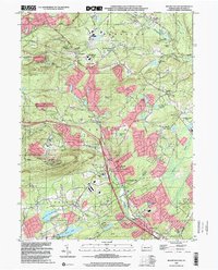
 1994 Buck Hill Falls1995 Print · USGSMonroe County was undergoing significant residential growth in the mid-1990s while maintaining its deep-rooted resort identity. Genealogists and local historians can trace family locations near Buck Hill Falls, Mountainhome, and St Anne Ch or locate landmarks like the Pocono Playhouse.
 - 1997 Map of Skytop, 2000 Print
 1997 Skytop2000 Print · USGSMonroe and Pike Counties are shown here during the late twentieth century, when this region of the Poconos was defined by its vast state forests and mountain retreats. Researchers can trace land use at Skytop, locate the McComas Cem, and find old camps like Camp William Penn.
 - 1997 Map of Buck Hill Falls, 2000 Print
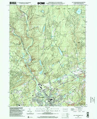
 1997 Buck Hill Falls2000 Print · USGSMonroe County enters the millennium as a premier mountain destination, balancing vast conservation lands with growing resort villages. Researchers can trace local development around Mountainhome, the Pocono Playhouse, and the historical church at St Anna Ch.
 - 1999 Map of Mount Pocono, 2001 Print
 1999 Mount Pocono2001 Print · USGSMonroe County’s resort and mountain landscape is captured here just before the turn of the millennium, showing a unique mix of recreation and local industry. Researchers can trace family roots through sites like Keokee Cemetery or locate landmarks such as St Marys Villa and Camelback Mountain.
 - 1999 Map of East Stroudsburg, 2002 Print
 1999 East Stroudsburg2002 Print · USGSThe Pocono foothills come alive in the late nineties, showing a landscape defined by the winding Brodhead Creek and the Erie Lackawanna RR. Trace local history through landmarks like Mt Zion Ch, the Gravel Pit, and the Alpine Mtn Ski Area.
End of results
Showing maps 1-7 of 7
Top cities near Paradise Township
- East Stroudsburg historical maps
- Tobyhanna historical maps
- Stroudsburg historical maps
- Blooming Grove Township historical maps
- Knowlton Township historical maps
- Mount Pocono historical maps
See more
Top neighborhoods of Paradise Township
- Henryville historical maps
- Wiscasset historical maps
- Parkside historical maps
- Paradise Valley historical maps
- East Swiftwater historical maps
Frequently asked questions
- What are the different types of historical maps available for Paradise Township?
- What is the oldest map of Paradise Township?
- Where can I purchase historical maps of Paradise Township for my home or office?
- Where can I download high-res historical maps of Paradise Township?
- Are there historical topographic maps available for Paradise Township?
- Is there historical aerial imagery available for Paradise Township?
- Where are historical maps of Paradise Township sourced from?