2020s Maps of Smithfield Township, Pennsylvania
Explore 4 historic maps of Smithfield Township from the 2020s. These maps offer a rare glimpse into what life looked like during the 2020s — showing old roads, neighborhoods, homes, and landmarks that have changed or disappeared over time.
Whether you're researching your family's past, planning a metal detecting trip, or studying how Smithfield Township's landscape evolved across the 2020s, these high-resolution maps are a powerful tool for exploring the history of this region.
- Focus on a specific era: All maps on this page are from the 2020s, giving you a focused view of this time period.
- See what’s changed: Compare century-old streets, trails, and buildings to today's modern landscape using overlays and satellite layers.
- Research with precision: Use these maps for genealogy, historical research, land use analysis, or educational projects.
- View, download, or print: Maps are fully viewable online in high resolution, and can be downloaded or printed for your own records.
Start exploring Smithfield Township's history through authentic maps from the 2020s. This is your window into the past.
Smithfield Township, PA maps
(4)- 2023 Map of Stroudsburg, 2023 Print
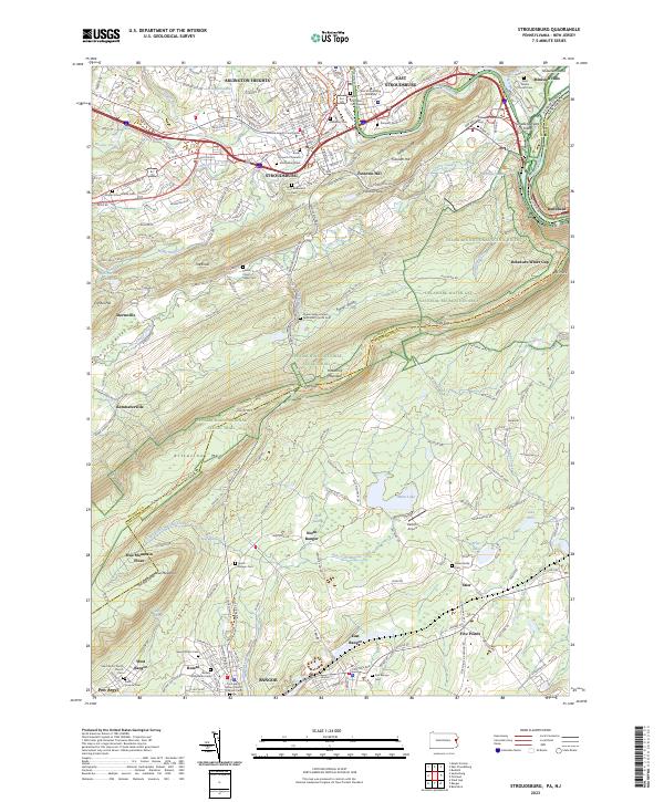 2023 Stroudsburg2023 Print · USGSThe Pocono foothills meet the Lehigh Valley in the early 2020s, showing a landscape defined by the Delaware Water Gap and rising university towns. Researchers can locate local landmarks like the Monroe County Courthouse, Minsi Lake, and the Shafer Schoolhouse Cem.
 - 2023 Map of Portland, 2023 Print
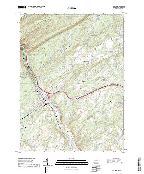 2023 Portland2023 Print · USGSThe Delaware River borderlands between Pennsylvania and New Jersey appear in detail just as the twenty-first century enters its third decade. Genealogists and hikers can trace historic crossings like Dills Ferry or locate the Old Beck Cem along the slopes of Kittatinny Mtn.
 - 2023 Map of East Stroudsburg, 2023 Print
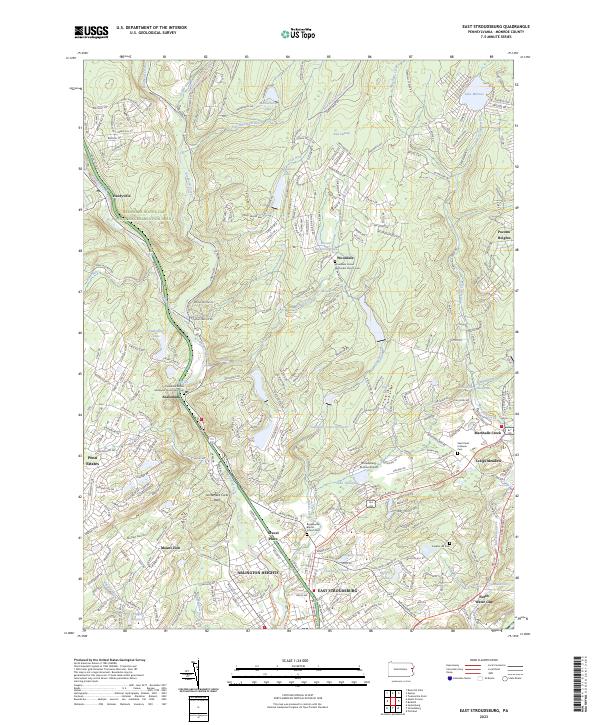 2023 East Stroudsburg2023 Print · USGSEast Stroudsburg and the surrounding Poconos foothills are mapped here in the early 2020s, showing a landscape of established towns and newer residential clusters. Genealogists can locate several local burial grounds, such as Saint Pauls Lutheran Cem and Franklin Hill Cem.
 - 2023 Map of Bushkill, 2023 Print
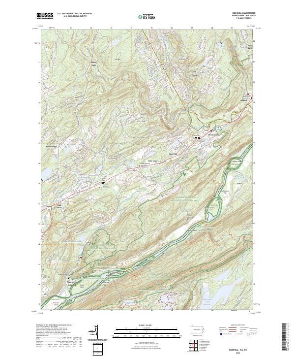 2023 Bushkill2023 Print · USGSThe Delaware River valley at the New Jersey border shows a landscape where conservation meets historic river settlements. Genealogists and hikers can trace the Appalachian Trail or locate family sites like the Sons of Israel Cem and Sand Hill Cem.
End of results
Showing maps 1-4 of 4
Top cities near Smithfield Township
- East Stroudsburg historical maps
- Delaware historical maps
- Blairstown historical maps
- Stroudsburg historical maps
- Bangor historical maps
- Stillwater Township historical maps
See more
Top neighborhoods of Smithfield Township
- Marshalls Creek historical maps
- Minisink Hills historical maps
- Twin Falls historical maps
- Shawnee on Delaware historical maps
- North Water Gap historical maps
- Craigs Meadow historical maps
Frequently asked questions
- What are the different types of historical maps available for Smithfield Township?
- What is the oldest map of Smithfield Township?
- Where can I purchase historical maps of Smithfield Township for my home or office?
- Where can I download high-res historical maps of Smithfield Township?
- Are there historical topographic maps available for Smithfield Township?
- Is there historical aerial imagery available for Smithfield Township?
- Where are historical maps of Smithfield Township sourced from?