Old Maps of Stockertown, Northampton County for Hiking & Exploration
Hike through history with 29 historic maps of Stockertown. Explore old trails, ghost towns, and forgotten backroads — perfect for outdoor adventurers and local explorers.
- Rediscover forgotten places: Map out old mining camps, roads, and footpaths that no longer exist on modern maps.
- Layer with modern tools: Combine with LiDAR or satellite views to plan hikes through historical terrain.
- Made for exploration: Popular among hikers, overlanders, and local history lovers.
Use these maps to find adventure and explore the hidden past of Stockertown.
Stockertown, Northampton County maps
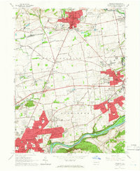
(29)- 1891 Map of Delaware Water Gap
 1891 Delaware Water Gap1891 Print · USGSCovers Stockertown, including East Stroudsburg, Blairstown, and other nearby areas
 - 1893 Map of Delaware Water Gap
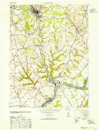
 1893 Delaware Water Gap1893 Print · USGSCovers Stockertown, including East Stroudsburg, Blairstown, and other nearby areas12 unique versions available
 - 1894 Map of Allentown
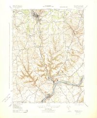
 1894 Allentown1894 Print · USGSCovers Stockertown, including Allentown, Bethlehem, and other nearby areas10 unique versions available
 - 1914 Map of Wind Gap, 1956 Print
 1914 Wind Gap1956 Print · USGSCovers Stockertown, including Pen Argyl, Wind Gap, and other nearby areas
 - 1916 Map of Wind Gap
 1916 Wind Gap1916 Print · USGSCovers Stockertown, including Pen Argyl, Wind Gap, and other nearby areas7 unique versions available
 - 1936 Map of Delaware Water Gap
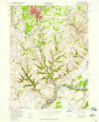
 1936 Delaware Water Gap1936 Print · USGSCovers Stockertown, including East Stroudsburg, Blairstown, and other nearby areas4 unique versions available
 - 1939 Map of Allentown
 1939 Allentown1939 Print · USGSCovers Stockertown, including Allentown, Bethlehem, and other nearby areas4 unique versions available
 - 1941 Map of Delaware Water Gap
 1941 Delaware Water Gap1941 Print · USGSCovers Stockertown, including East Stroudsburg, Blairstown, and other nearby areas
 - 1942 Map of Delaware Water Gap
 1942 Delaware Water Gap1942 Print · USGSCovers Stockertown, including East Stroudsburg, Blairstown, and other nearby areas3 unique versions available
 - 1943 Map of Bangor
 1943 Bangor1943 Print · USGSCovers Stockertown, including Bangor, Harmony Township, and other nearby areas
 - 1943 Map of Wind Gap
 1943 Wind Gap1943 Print · USGSCovers Stockertown, including Pen Argyl, Wind Gap, and other nearby areas
 - 1943 Map of Bethlehem
 1943 Bethlehem1943 Print · USGSCovers Stockertown, including Allentown, Bethlehem, and other nearby areas
 - 1944 Map of Newark, 1971 Print
 1944 Newark1971 Print · USGSCovers Stockertown, including New York, Philadelphia, and other nearby areas5 unique versions available
 - 1949 Map of Newark
 1949 Newark1949 Print · USGSCovers Stockertown, including New York, Philadelphia, and other nearby areas3 unique versions available
 - 1953 Map of Bangor
 1953 Bangor1953 Print · USGSCovers Stockertown, including Bangor, Harmony Township, and other nearby areas
 - 1956 Map of Newark
 1956 Newark1956 Print · USGSCovers Stockertown, including New York, Philadelphia, and other nearby areas2 unique versions available
 - 1956 Map of Bangor, 1958 Print
 1956 Bangor1958 Print · USGSCovers Stockertown, including Bangor, Harmony Township, and other nearby areas6 unique versions available
 - 1957 Map of Newark
 1957 Newark1957 Print · USGSCovers Stockertown, including New York, Philadelphia, and other nearby areas
 - 1957 Map of Allentown, 1960 Print
 1957 Allentown1960 Print · USGSCovers Stockertown, including Allentown, Bethlehem, and other nearby areas3 unique versions available
 - 1960 Map of Newark
 1960 Newark1960 Print · USGSCovers Stockertown, including New York, Philadelphia, and other nearby areas3 unique versions available
 - 1960 Map of Wind Gap, 1962 Print
 1960 Wind Gap1962 Print · USGSCovers Stockertown, including Pen Argyl, Wind Gap, and other nearby areas5 unique versions available
 - 1964 Map of Newark
 1964 Newark1964 Print · USGSCovers Stockertown, including New York, Philadelphia, and other nearby areas2 unique versions available
 - 1964 Map of Nazareth, 1966 Print
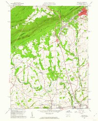
 1964 Nazareth1966 Print · USGSCovers Stockertown, including Bethlehem, Easton, and other nearby areas6 unique versions available
 - 1976 Map of Wind Gap, 1978 Print
 1976 Wind Gap1978 Print · USGSCovers Stockertown, including Pen Argyl, Wind Gap, and other nearby areas
 - 1984 Map of Allentown, 1985 Print
 1984 Allentown1985 Print · USGSCovers Stockertown, including Allentown, Bethlehem, and other nearby areas3 unique versions available
Showing maps 1-25 of 29
Frequently asked questions
- What are the different types of historical maps available for Stockertown?
- What is the oldest map of Stockertown?
- Where can I purchase historical maps of Stockertown for my home or office?
- Where can I download high-res historical maps of Stockertown?
- Are there historical topographic maps available for Stockertown?
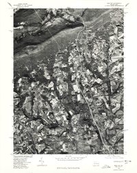
- Is there historical aerial imagery available for Stockertown?
- Where are historical maps of Stockertown sourced from?