Old Maps of Stockertown, Northampton County for Metal Detecting
Plan your next treasure hunt with 29 historic maps of Stockertown. Find old homesites, ghost towns, trails, and gathering spots that may be lost to time — perfect for identifying promising metal detecting locations.
- Locate forgotten sites: Uncover places like long-lost settlements, abandoned rail lines, or gathering spots.
- Plan better hunts: Use map overlays combined with LiDAR or satellite views to narrow in on historically rich areas.
- Made for detectorists: Thousands of hobbyists use these maps to discover relics, coins, and hidden history.
Use these historic maps to boost your research and find new opportunities beneath the surface of Stockertown.
Stockertown, Northampton County maps
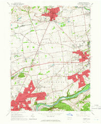
(29)- 1891 Map of Delaware Water Gap
 1891 Delaware Water Gap1891 Print · USGSCovers Stockertown, including East Stroudsburg, Blairstown, and other nearby areas
 - 1893 Map of Delaware Water Gap
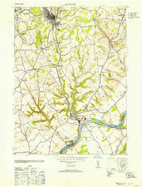
 1893 Delaware Water Gap1893 Print · USGSCovers Stockertown, including East Stroudsburg, Blairstown, and other nearby areas12 unique versions available
 - 1894 Map of Allentown
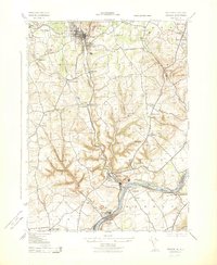
 1894 Allentown1894 Print · USGSCovers Stockertown, including Allentown, Bethlehem, and other nearby areas10 unique versions available
 - 1914 Map of Wind Gap, 1956 Print
 1914 Wind Gap1956 Print · USGSCovers Stockertown, including Pen Argyl, Wind Gap, and other nearby areas
 - 1916 Map of Wind Gap
 1916 Wind Gap1916 Print · USGSCovers Stockertown, including Pen Argyl, Wind Gap, and other nearby areas7 unique versions available
 - 1936 Map of Delaware Water Gap
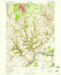
 1936 Delaware Water Gap1936 Print · USGSCovers Stockertown, including East Stroudsburg, Blairstown, and other nearby areas4 unique versions available
 - 1939 Map of Allentown
 1939 Allentown1939 Print · USGSCovers Stockertown, including Allentown, Bethlehem, and other nearby areas4 unique versions available
 - 1941 Map of Delaware Water Gap
 1941 Delaware Water Gap1941 Print · USGSCovers Stockertown, including East Stroudsburg, Blairstown, and other nearby areas
 - 1942 Map of Delaware Water Gap
 1942 Delaware Water Gap1942 Print · USGSCovers Stockertown, including East Stroudsburg, Blairstown, and other nearby areas3 unique versions available
 - 1943 Map of Bangor
 1943 Bangor1943 Print · USGSCovers Stockertown, including Bangor, Harmony Township, and other nearby areas
 - 1943 Map of Wind Gap
 1943 Wind Gap1943 Print · USGSCovers Stockertown, including Pen Argyl, Wind Gap, and other nearby areas
 - 1943 Map of Bethlehem
 1943 Bethlehem1943 Print · USGSCovers Stockertown, including Allentown, Bethlehem, and other nearby areas
 - 1944 Map of Newark, 1971 Print
 1944 Newark1971 Print · USGSCovers Stockertown, including New York, Philadelphia, and other nearby areas5 unique versions available
 - 1949 Map of Newark
 1949 Newark1949 Print · USGSCovers Stockertown, including New York, Philadelphia, and other nearby areas3 unique versions available
 - 1953 Map of Bangor
 1953 Bangor1953 Print · USGSCovers Stockertown, including Bangor, Harmony Township, and other nearby areas
 - 1956 Map of Newark
 1956 Newark1956 Print · USGSCovers Stockertown, including New York, Philadelphia, and other nearby areas2 unique versions available
 - 1956 Map of Bangor, 1958 Print
 1956 Bangor1958 Print · USGSCovers Stockertown, including Bangor, Harmony Township, and other nearby areas6 unique versions available
 - 1957 Map of Newark
 1957 Newark1957 Print · USGSCovers Stockertown, including New York, Philadelphia, and other nearby areas
 - 1957 Map of Allentown, 1960 Print
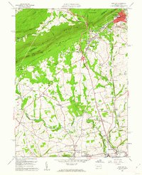
 1957 Allentown1960 Print · USGSCovers Stockertown, including Allentown, Bethlehem, and other nearby areas3 unique versions available
 - 1960 Map of Newark
 1960 Newark1960 Print · USGSCovers Stockertown, including New York, Philadelphia, and other nearby areas3 unique versions available
 - 1960 Map of Wind Gap, 1962 Print
 1960 Wind Gap1962 Print · USGSCovers Stockertown, including Pen Argyl, Wind Gap, and other nearby areas5 unique versions available
 - 1964 Map of Newark
 1964 Newark1964 Print · USGSCovers Stockertown, including New York, Philadelphia, and other nearby areas2 unique versions available
 - 1964 Map of Nazareth, 1966 Print
 1964 Nazareth1966 Print · USGSCovers Stockertown, including Bethlehem, Easton, and other nearby areas6 unique versions available
 - 1976 Map of Wind Gap, 1978 Print
 1976 Wind Gap1978 Print · USGSCovers Stockertown, including Pen Argyl, Wind Gap, and other nearby areas
 - 1984 Map of Allentown, 1985 Print
 1984 Allentown1985 Print · USGSCovers Stockertown, including Allentown, Bethlehem, and other nearby areas3 unique versions available
Showing maps 1-25 of 29
Frequently asked questions
- What are the different types of historical maps available for Stockertown?
- What is the oldest map of Stockertown?
- Where can I purchase historical maps of Stockertown for my home or office?
- Where can I download high-res historical maps of Stockertown?
- Are there historical topographic maps available for Stockertown?
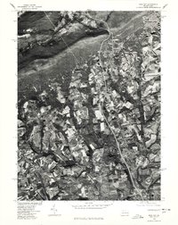
- Is there historical aerial imagery available for Stockertown?
- Where are historical maps of Stockertown sourced from?