1900s (20th Century) Maps of Stockertown, Northampton County
Explore 26 historic maps of Stockertown from the 1900s (20th Century). These maps offer a rare glimpse into what life looked like during the 1900s — showing old roads, neighborhoods, homes, and landmarks that have changed or disappeared over time.
Whether you're researching your family's past, planning a metal detecting trip, or studying how Stockertown's landscape evolved across the 1900s, these high-resolution maps are a powerful tool for exploring the history of this region.
- Focus on a specific era: All maps on this page are from the 1900s, giving you a focused view of this time period.
- See what’s changed: Compare century-old streets, trails, and buildings to today's modern landscape using overlays and satellite layers.
- Research with precision: Use these maps for genealogy, historical research, land use analysis, or educational projects.
- View, download, or print: Maps are fully viewable online in high resolution, and can be downloaded or printed for your own records.
Start exploring Stockertown's history through authentic maps from the 1900s. This is your window into the past.
Stockertown, Northampton County maps
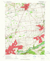
(26)- 1914 Map of Wind Gap, 1956 Print
 1914 Wind Gap1956 Print · USGSCovers Stockertown, including Pen Argyl, Wind Gap, and other nearby areas
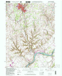
 - 1916 Map of Wind Gap
 1916 Wind Gap1916 Print · USGSCovers Stockertown, including Pen Argyl, Wind Gap, and other nearby areas7 unique versions available
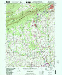
 - 1936 Map of Delaware Water Gap
 1936 Delaware Water Gap1936 Print · USGSCovers Stockertown, including East Stroudsburg, Blairstown, and other nearby areas4 unique versions available
 - 1939 Map of Allentown
 1939 Allentown1939 Print · USGSCovers Stockertown, including Allentown, Bethlehem, and other nearby areas4 unique versions available
 - 1941 Map of Delaware Water Gap
 1941 Delaware Water Gap1941 Print · USGSCovers Stockertown, including East Stroudsburg, Blairstown, and other nearby areas
 - 1942 Map of Delaware Water Gap
 1942 Delaware Water Gap1942 Print · USGSCovers Stockertown, including East Stroudsburg, Blairstown, and other nearby areas3 unique versions available
 - 1943 Map of Bangor
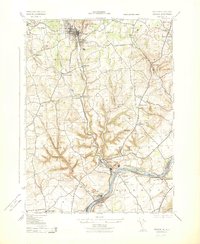 1943 Bangor1943 Print · USGSCovers Stockertown, including Bangor, Harmony Township, and other nearby areas
 - 1943 Map of Wind Gap
 1943 Wind Gap1943 Print · USGSCovers Stockertown, including Pen Argyl, Wind Gap, and other nearby areas
 - 1943 Map of Bethlehem
 1943 Bethlehem1943 Print · USGSCovers Stockertown, including Allentown, Bethlehem, and other nearby areas
 - 1944 Map of Newark, 1971 Print
 1944 Newark1971 Print · USGSCovers Stockertown, including New York, Philadelphia, and other nearby areas5 unique versions available
 - 1949 Map of Newark
 1949 Newark1949 Print · USGSCovers Stockertown, including New York, Philadelphia, and other nearby areas3 unique versions available
 - 1953 Map of Bangor
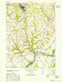 1953 Bangor1953 Print · USGSCovers Stockertown, including Bangor, Harmony Township, and other nearby areas
 - 1956 Map of Newark
 1956 Newark1956 Print · USGSCovers Stockertown, including New York, Philadelphia, and other nearby areas2 unique versions available
 - 1956 Map of Bangor, 1958 Print
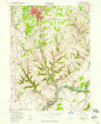 1956 Bangor1958 Print · USGSCovers Stockertown, including Bangor, Harmony Township, and other nearby areas6 unique versions available
 - 1957 Map of Newark
 1957 Newark1957 Print · USGSCovers Stockertown, including New York, Philadelphia, and other nearby areas
 - 1957 Map of Allentown, 1960 Print
 1957 Allentown1960 Print · USGSCovers Stockertown, including Allentown, Bethlehem, and other nearby areas3 unique versions available
 - 1960 Map of Newark
 1960 Newark1960 Print · USGSCovers Stockertown, including New York, Philadelphia, and other nearby areas3 unique versions available
 - 1960 Map of Wind Gap, 1962 Print
 1960 Wind Gap1962 Print · USGSCovers Stockertown, including Pen Argyl, Wind Gap, and other nearby areas5 unique versions available
 - 1964 Map of Newark
 1964 Newark1964 Print · USGSCovers Stockertown, including New York, Philadelphia, and other nearby areas2 unique versions available
 - 1964 Map of Nazareth, 1966 Print
 1964 Nazareth1966 Print · USGSCovers Stockertown, including Bethlehem, Easton, and other nearby areas6 unique versions available
 - 1976 Map of Wind Gap, 1978 Print
 1976 Wind Gap1978 Print · USGSCovers Stockertown, including Pen Argyl, Wind Gap, and other nearby areas
 - 1984 Map of Allentown, 1985 Print
 1984 Allentown1985 Print · USGSCovers Stockertown, including Allentown, Bethlehem, and other nearby areas3 unique versions available
 - 1997 Map of Bangor, 1999 Print
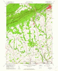
 1997 Bangor1999 Print · USGSCovers Stockertown, including Bangor, Harmony Township, and other nearby areas
 - 1997 Map of Wind Gap, 1999 Print
 1997 Wind Gap1999 Print · USGSCovers Stockertown, including Pen Argyl, Wind Gap, and other nearby areas
 - 1999 Map of Wind Gap, 2001 Print
 1999 Wind Gap2001 Print · USGSCovers Stockertown, including Pen Argyl, Wind Gap, and other nearby areas
Showing maps 1-25 of 26
Frequently asked questions
- What are the different types of historical maps available for Stockertown?
- What is the oldest map of Stockertown?
- Where can I purchase historical maps of Stockertown for my home or office?
- Where can I download high-res historical maps of Stockertown?
- Are there historical topographic maps available for Stockertown?
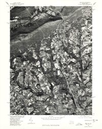
- Is there historical aerial imagery available for Stockertown?
- Where are historical maps of Stockertown sourced from?