1900s (20th Century) Maps of Wynnefield Heights, Philadelphia
Explore 25 historic maps of Wynnefield Heights from the 1900s (20th Century). These maps offer a rare glimpse into what life looked like during the 1900s — showing old roads, neighborhoods, homes, and landmarks that have changed or disappeared over time.
Whether you're researching your family's past, planning a metal detecting trip, or studying how Wynnefield Heights's landscape evolved across the 1900s, these high-resolution maps are a powerful tool for exploring the history of this region.
- Focus on a specific era: All maps on this page are from the 1900s, giving you a focused view of this time period.
- See what’s changed: Compare century-old streets, trails, and buildings to today's modern landscape using overlays and satellite layers.
- Research with precision: Use these maps for genealogy, historical research, land use analysis, or educational projects.
- View, download, or print: Maps are fully viewable online in high resolution, and can be downloaded or printed for your own records.
Start exploring Wynnefield Heights's history through authentic maps from the 1900s. This is your window into the past.
Wynnefield Heights, Philadelphia maps
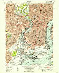
(25)- 1901 Map of Camden
 1901 Camden1901 Print · USGSCovers Wynnefield Heights, including Philadelphia, Upper Darby, and other nearby areas3 unique versions available
 - 1920 Map of Philadelphia
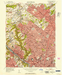
 1920 Philadelphia1920 Print · USGSCovers Wynnefield Heights, including Philadelphia, Upper Darby, and other nearby areas
 - 1942 Map of Norristown
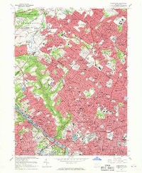
 1942 Norristown1942 Print · USGSCovers Wynnefield Heights, including Philadelphia, Abington Township, and other nearby areas
 - 1942 Map of Camden
 1942 Camden1942 Print · USGSCovers Wynnefield Heights, including Philadelphia, Upper Darby, and other nearby areas
 - 1943 Map of Philadelphia
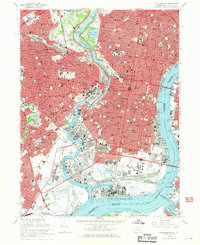
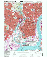
 1943 Philadelphia1943 Print · USGSCovers Wynnefield Heights, including Philadelphia, Upper Darby, and other nearby areas
 - 1944 Map of Newark, 1971 Print
 1944 Newark1971 Print · USGSCovers Wynnefield Heights, including New York, Philadelphia, and other nearby areas5 unique versions available
 - 1946 Map of Wilmington, 1948 Print
 1946 Wilmington1948 Print · USGSCovers Wynnefield Heights, including Philadelphia, Toms River, and other nearby areas2 unique versions available
 - 1949 Map of Newark
 1949 Newark1949 Print · USGSCovers Wynnefield Heights, including New York, Philadelphia, and other nearby areas3 unique versions available
 - 1949 Map of Philadelphia, 1953 Print
 1949 Philadelphia1953 Print · USGSCovers Wynnefield Heights, including Philadelphia, Upper Darby, and other nearby areas2 unique versions available
 - 1952 Map of Germantown, 1954 Print
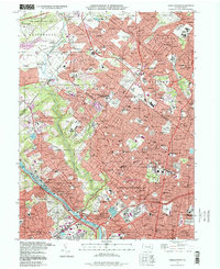
 1952 Germantown1954 Print · USGSCovers Wynnefield Heights, including Philadelphia, Abington Township, and other nearby areas2 unique versions available
 - 1955 Map of Wilmington
 1955 Wilmington1955 Print · USGSCovers Wynnefield Heights, including Philadelphia, Toms River, and other nearby areas
 - 1956 Map of Newark
 1956 Newark1956 Print · USGSCovers Wynnefield Heights, including New York, Philadelphia, and other nearby areas2 unique versions available
 - 1957 Map of Wilmington
 1957 Wilmington1957 Print · USGSCovers Wynnefield Heights, including Philadelphia, Toms River, and other nearby areas2 unique versions available
 - 1957 Map of Newark
 1957 Newark1957 Print · USGSCovers Wynnefield Heights, including New York, Philadelphia, and other nearby areas
 - 1959 Map of Wilmington
 1959 Wilmington1959 Print · USGSCovers Wynnefield Heights, including Philadelphia, Toms River, and other nearby areas3 unique versions available
 - 1960 Map of Newark
 1960 Newark1960 Print · USGSCovers Wynnefield Heights, including New York, Philadelphia, and other nearby areas3 unique versions available
 - 1964 Map of Newark
 1964 Newark1964 Print · USGSCovers Wynnefield Heights, including New York, Philadelphia, and other nearby areas2 unique versions available
 - 1966 Map of Wilmington, 1968 Print
 1966 Wilmington1968 Print · USGSCovers Wynnefield Heights, including Philadelphia, Toms River, and other nearby areas4 unique versions available
 - 1967 Map of Germantown, 1969 Print
 1967 Germantown1969 Print · USGSCovers Wynnefield Heights, including Philadelphia, Abington Township, and other nearby areas4 unique versions available
 - 1967 Map of Philadelphia, 1970 Print
 1967 Philadelphia1970 Print · USGSCovers Wynnefield Heights, including Philadelphia, Upper Darby, and other nearby areas6 unique versions available
 - 1972 Map of Wilmington, 1976 Print
 1972 Wilmington1976 Print · USGSCovers Wynnefield Heights, including Philadelphia, Toms River, and other nearby areas2 unique versions available
 - 1984 Map of Wilmington, 1986 Print
 1984 Wilmington1986 Print · USGSCovers Wynnefield Heights, including Philadelphia, Upper Darby, and other nearby areas2 unique versions available
 - 1984 Map of Reading, 1986 Print
 1984 Reading1986 Print · USGSCovers Wynnefield Heights, including Philadelphia, Reading, and other nearby areas2 unique versions available
 - 1995 Map of Philadelphia, 1999 Print
 1995 Philadelphia1999 Print · USGSCovers Wynnefield Heights, including Philadelphia, Upper Darby, and other nearby areas
 - 1997 Map of Germantown, 1998 Print
 1997 Germantown1998 Print · USGSCovers Wynnefield Heights, including Philadelphia, Abington Township, and other nearby areas
End of results
Showing maps 1-25 of 25
Frequently asked questions
- What are the different types of historical maps available for Wynnefield Heights?
- What is the oldest map of Wynnefield Heights?
- Where can I purchase historical maps of Wynnefield Heights for my home or office?
- Where can I download high-res historical maps of Wynnefield Heights?
- Are there historical topographic maps available for Wynnefield Heights?
- Is there historical aerial imagery available for Wynnefield Heights?
- Where are historical maps of Wynnefield Heights sourced from?