Old Maps of Wynnefield Heights, Philadelphia for Metal Detecting
Plan your next treasure hunt with 33 historic maps of Wynnefield Heights. Find old homesites, ghost towns, trails, and gathering spots that may be lost to time — perfect for identifying promising metal detecting locations.
- Locate forgotten sites: Uncover places like long-lost settlements, abandoned rail lines, or gathering spots.
- Plan better hunts: Use map overlays combined with LiDAR or satellite views to narrow in on historically rich areas.
- Made for detectorists: Thousands of hobbyists use these maps to discover relics, coins, and hidden history.
Use these historic maps to boost your research and find new opportunities beneath the surface of Wynnefield Heights.
Wynnefield Heights, Philadelphia maps
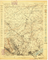
(33)- 1891 Map of Philadelphia
 1891 Philadelphia1891 Print · USGSCovers Wynnefield Heights, including Philadelphia, Upper Darby, and other nearby areas
 - 1893 Map of Germantown
 1893 Germantown1893 Print · USGSCovers Wynnefield Heights, including Philadelphia, Abington Township, and other nearby areas
 - 1894 Map of Philadelphia, 1958 Print
 1894 Philadelphia1958 Print · USGSCovers Wynnefield Heights, including Philadelphia, Upper Darby, and other nearby areas
 - 1894 Map of Germantown, 1961 Print
 1894 Germantown1961 Print · USGSCovers Wynnefield Heights, including Philadelphia, Abington Township, and other nearby areas
 - 1896 Map of Germantown
 1896 Germantown1896 Print · USGSCovers Wynnefield Heights, including Philadelphia, Abington Township, and other nearby areas
 - 1896 Map of Philadelphia
 1896 Philadelphia1896 Print · USGSCovers Wynnefield Heights, including Philadelphia, Upper Darby, and other nearby areas
 - 1898 Map of Philadelphia
 1898 Philadelphia1898 Print · USGSCovers Wynnefield Heights, including Philadelphia, Upper Darby, and other nearby areas9 unique versions available
 - 1899 Map of Germantown
 1899 Germantown1899 Print · USGSCovers Wynnefield Heights, including Philadelphia, Abington Township, and other nearby areas9 unique versions available
 - 1901 Map of Camden
 1901 Camden1901 Print · USGSCovers Wynnefield Heights, including Philadelphia, Upper Darby, and other nearby areas3 unique versions available
 - 1920 Map of Philadelphia
 1920 Philadelphia1920 Print · USGSCovers Wynnefield Heights, including Philadelphia, Upper Darby, and other nearby areas
 - 1942 Map of Norristown
 1942 Norristown1942 Print · USGSCovers Wynnefield Heights, including Philadelphia, Abington Township, and other nearby areas
 - 1942 Map of Camden
 1942 Camden1942 Print · USGSCovers Wynnefield Heights, including Philadelphia, Upper Darby, and other nearby areas
 - 1943 Map of Philadelphia
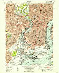
 1943 Philadelphia1943 Print · USGSCovers Wynnefield Heights, including Philadelphia, Upper Darby, and other nearby areas
 - 1944 Map of Newark, 1971 Print
 1944 Newark1971 Print · USGSCovers Wynnefield Heights, including New York, Philadelphia, and other nearby areas5 unique versions available
 - 1946 Map of Wilmington, 1948 Print
 1946 Wilmington1948 Print · USGSCovers Wynnefield Heights, including Philadelphia, Toms River, and other nearby areas2 unique versions available
 - 1949 Map of Newark
 1949 Newark1949 Print · USGSCovers Wynnefield Heights, including New York, Philadelphia, and other nearby areas3 unique versions available
 - 1949 Map of Philadelphia, 1953 Print
 1949 Philadelphia1953 Print · USGSCovers Wynnefield Heights, including Philadelphia, Upper Darby, and other nearby areas2 unique versions available
 - 1952 Map of Germantown, 1954 Print
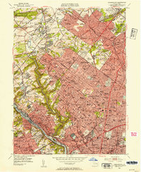 1952 Germantown1954 Print · USGSCovers Wynnefield Heights, including Philadelphia, Abington Township, and other nearby areas2 unique versions available
 - 1955 Map of Wilmington
 1955 Wilmington1955 Print · USGSCovers Wynnefield Heights, including Philadelphia, Toms River, and other nearby areas
 - 1956 Map of Newark
 1956 Newark1956 Print · USGSCovers Wynnefield Heights, including New York, Philadelphia, and other nearby areas2 unique versions available
 - 1957 Map of Wilmington
 1957 Wilmington1957 Print · USGSCovers Wynnefield Heights, including Philadelphia, Toms River, and other nearby areas2 unique versions available
 - 1957 Map of Newark
 1957 Newark1957 Print · USGSCovers Wynnefield Heights, including New York, Philadelphia, and other nearby areas
 - 1959 Map of Wilmington
 1959 Wilmington1959 Print · USGSCovers Wynnefield Heights, including Philadelphia, Toms River, and other nearby areas3 unique versions available
 - 1960 Map of Newark
 1960 Newark1960 Print · USGSCovers Wynnefield Heights, including New York, Philadelphia, and other nearby areas3 unique versions available
 - 1964 Map of Newark
 1964 Newark1964 Print · USGSCovers Wynnefield Heights, including New York, Philadelphia, and other nearby areas2 unique versions available
Showing maps 1-25 of 33
Frequently asked questions
- What are the different types of historical maps available for Wynnefield Heights?
- What is the oldest map of Wynnefield Heights?
- Where can I purchase historical maps of Wynnefield Heights for my home or office?
- Where can I download high-res historical maps of Wynnefield Heights?
- Are there historical topographic maps available for Wynnefield Heights?
- Is there historical aerial imagery available for Wynnefield Heights?
- Where are historical maps of Wynnefield Heights sourced from?