Old Maps of Wynnefield Heights, Philadelphia for Genealogy
Trace your family roots with 33 historic maps of Wynnefield Heights. These high-res maps reveal old neighborhoods, homesites, landmarks, and streets — helping you uncover where your ancestors lived and how the area evolved over time.
- Explore historic neighborhoods: Identify where your relatives may have lived in the 1800s or 1900s.
- Compare maps over time: Trace the changes in streets, buildings, and landmarks for multi-generational research.
- Perfect for genealogy & ancestry research: Used by family historians and researchers to map out lineage and migration.
These maps are an incredible resource for exploring your personal connection to Wynnefield Heights's past.
Wynnefield Heights, Philadelphia maps
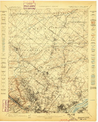
(33)- 1891 Map of Philadelphia
 1891 Philadelphia1891 Print · USGSCovers Wynnefield Heights, including Philadelphia, Upper Darby, and other nearby areas
 - 1893 Map of Germantown
 1893 Germantown1893 Print · USGSCovers Wynnefield Heights, including Philadelphia, Abington Township, and other nearby areas
 - 1894 Map of Philadelphia, 1958 Print
 1894 Philadelphia1958 Print · USGSCovers Wynnefield Heights, including Philadelphia, Upper Darby, and other nearby areas
 - 1894 Map of Germantown, 1961 Print
 1894 Germantown1961 Print · USGSCovers Wynnefield Heights, including Philadelphia, Abington Township, and other nearby areas
 - 1896 Map of Germantown
 1896 Germantown1896 Print · USGSCovers Wynnefield Heights, including Philadelphia, Abington Township, and other nearby areas
 - 1896 Map of Philadelphia
 1896 Philadelphia1896 Print · USGSCovers Wynnefield Heights, including Philadelphia, Upper Darby, and other nearby areas
 - 1898 Map of Philadelphia
 1898 Philadelphia1898 Print · USGSCovers Wynnefield Heights, including Philadelphia, Upper Darby, and other nearby areas9 unique versions available
 - 1899 Map of Germantown
 1899 Germantown1899 Print · USGSCovers Wynnefield Heights, including Philadelphia, Abington Township, and other nearby areas9 unique versions available
 - 1901 Map of Camden
 1901 Camden1901 Print · USGSCovers Wynnefield Heights, including Philadelphia, Upper Darby, and other nearby areas3 unique versions available
 - 1920 Map of Philadelphia
 1920 Philadelphia1920 Print · USGSCovers Wynnefield Heights, including Philadelphia, Upper Darby, and other nearby areas
 - 1942 Map of Norristown
 1942 Norristown1942 Print · USGSCovers Wynnefield Heights, including Philadelphia, Abington Township, and other nearby areas
 - 1942 Map of Camden
 1942 Camden1942 Print · USGSCovers Wynnefield Heights, including Philadelphia, Upper Darby, and other nearby areas
 - 1943 Map of Philadelphia
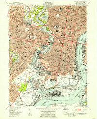
 1943 Philadelphia1943 Print · USGSCovers Wynnefield Heights, including Philadelphia, Upper Darby, and other nearby areas
 - 1944 Map of Newark, 1971 Print
 1944 Newark1971 Print · USGSCovers Wynnefield Heights, including New York, Philadelphia, and other nearby areas5 unique versions available
 - 1946 Map of Wilmington, 1948 Print
 1946 Wilmington1948 Print · USGSCovers Wynnefield Heights, including Philadelphia, Toms River, and other nearby areas2 unique versions available
 - 1949 Map of Newark
 1949 Newark1949 Print · USGSCovers Wynnefield Heights, including New York, Philadelphia, and other nearby areas3 unique versions available
 - 1949 Map of Philadelphia, 1953 Print
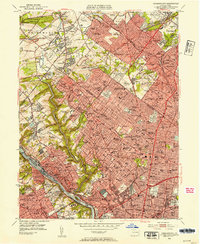
 1949 Philadelphia1953 Print · USGSCovers Wynnefield Heights, including Philadelphia, Upper Darby, and other nearby areas2 unique versions available
 - 1952 Map of Germantown, 1954 Print
 1952 Germantown1954 Print · USGSCovers Wynnefield Heights, including Philadelphia, Abington Township, and other nearby areas2 unique versions available
 - 1955 Map of Wilmington
 1955 Wilmington1955 Print · USGSCovers Wynnefield Heights, including Philadelphia, Toms River, and other nearby areas
 - 1956 Map of Newark
 1956 Newark1956 Print · USGSCovers Wynnefield Heights, including New York, Philadelphia, and other nearby areas2 unique versions available
 - 1957 Map of Wilmington
 1957 Wilmington1957 Print · USGSCovers Wynnefield Heights, including Philadelphia, Toms River, and other nearby areas2 unique versions available
 - 1957 Map of Newark
 1957 Newark1957 Print · USGSCovers Wynnefield Heights, including New York, Philadelphia, and other nearby areas
 - 1959 Map of Wilmington
 1959 Wilmington1959 Print · USGSCovers Wynnefield Heights, including Philadelphia, Toms River, and other nearby areas3 unique versions available
 - 1960 Map of Newark
 1960 Newark1960 Print · USGSCovers Wynnefield Heights, including New York, Philadelphia, and other nearby areas3 unique versions available
 - 1964 Map of Newark
 1964 Newark1964 Print · USGSCovers Wynnefield Heights, including New York, Philadelphia, and other nearby areas2 unique versions available
Showing maps 1-25 of 33
Frequently asked questions
- What are the different types of historical maps available for Wynnefield Heights?
- What is the oldest map of Wynnefield Heights?
- Where can I purchase historical maps of Wynnefield Heights for my home or office?
- Where can I download high-res historical maps of Wynnefield Heights?
- Are there historical topographic maps available for Wynnefield Heights?
- Is there historical aerial imagery available for Wynnefield Heights?
- Where are historical maps of Wynnefield Heights sourced from?