2020s Maps of Pleasant Valley Township, Pennsylvania
Explore 2 historic maps of Pleasant Valley Township from the 2020s. These maps offer a rare glimpse into what life looked like during the 2020s — showing old roads, neighborhoods, homes, and landmarks that have changed or disappeared over time.
Whether you're researching your family's past, planning a metal detecting trip, or studying how Pleasant Valley Township's landscape evolved across the 2020s, these high-resolution maps are a powerful tool for exploring the history of this region.
- Focus on a specific era: All maps on this page are from the 2020s, giving you a focused view of this time period.
- See what’s changed: Compare century-old streets, trails, and buildings to today's modern landscape using overlays and satellite layers.
- Research with precision: Use these maps for genealogy, historical research, land use analysis, or educational projects.
- View, download, or print: Maps are fully viewable online in high resolution, and can be downloaded or printed for your own records.
Start exploring Pleasant Valley Township's history through authentic maps from the 2020s. This is your window into the past.
Pleasant Valley Township, PA maps
(2)- 2023 Map of Roulette, 2023 Print
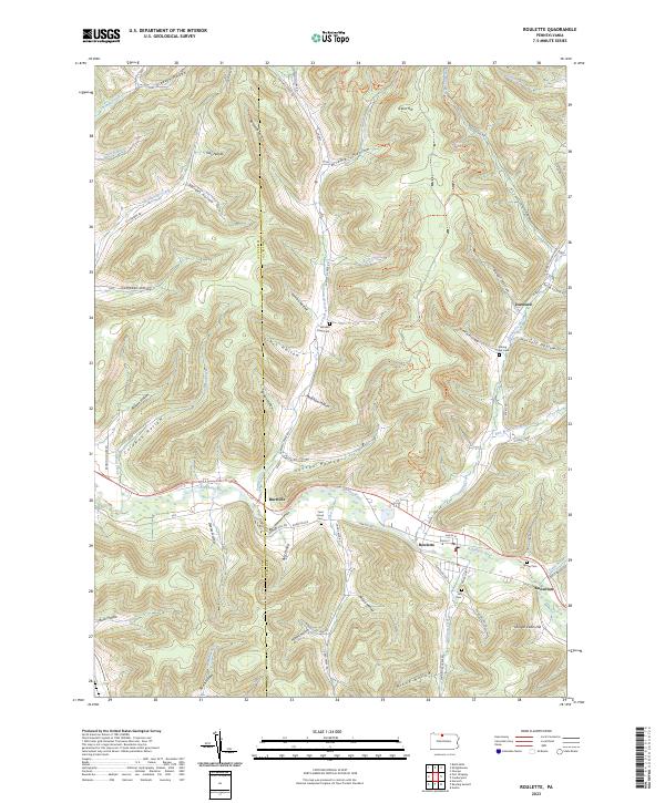 2023 Roulette2023 Print · USGSThe upper Allegheny River valley in Potter County comes alive in this contemporary record of rural Pennsylvania. Genealogists can trace family names through numerous hollows and local burial sites like Sartwell Creek Cem, Hill Cem, and Card Creek Cem.
 - 2023 Map of Shinglehouse, 2023 Print
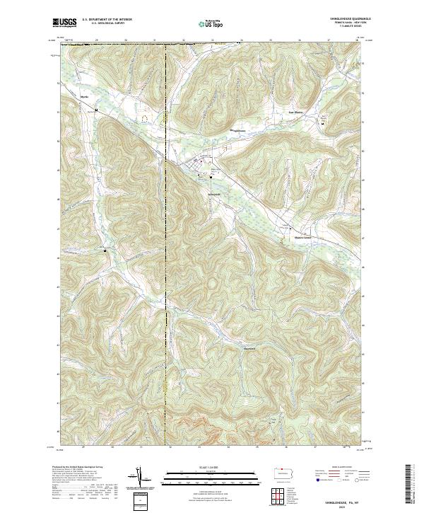 2023 Shinglehouse2023 Print · USGSPotter County near the New York border remains a landscape of deep valley hollows and small creek-side settlements. Trace family roots and local history through historic burial sites like Maple Grove Cem and rural hamlets such as Sunnyside and Shaytown.
End of results
Showing maps 1-2 of 2
Top cities near Pleasant Valley Township
- Olean historical maps
- Wellsville historical maps
- Portville historical maps
- Port Allegany historical maps
- Bolivar historical maps
- Olean historical maps
See more
Top neighborhoods of Pleasant Valley Township
Frequently asked questions
- What are the different types of historical maps available for Pleasant Valley Township?
- What is the oldest map of Pleasant Valley Township?
- Where can I purchase historical maps of Pleasant Valley Township for my home or office?
- Where can I download high-res historical maps of Pleasant Valley Township?
- Are there historical topographic maps available for Pleasant Valley Township?
- Is there historical aerial imagery available for Pleasant Valley Township?
- Where are historical maps of Pleasant Valley Township sourced from?