2023 Map of Shinglehouse
USGS Topo · Published 2023About this map
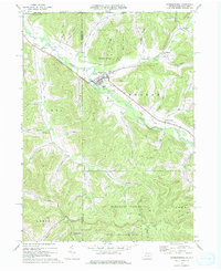
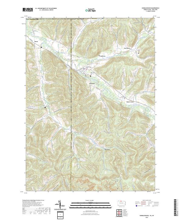
Oswayo Creek and Honeoye Creek converge near the heart of Shinglehouse, forming a valley landscape defined by long, parallel hollows such as Bee Hollow and Blauvelt Hollow. This modern survey illustrates the persistent settlement patterns of northern Potter County, where residential streets like Academy St and Honeoye St center around the borough while outlying hamlets like East Sharon and Sharon Center remain anchored by their namesake burial grounds. The map reveals the intricate network of valley-floor drainage, with Bell Run and Cow Run threading through deep notches in the terrain. Genealogists will find the specific locations of historic burial sites, including Maple Grove Cem and Myrtle Cem, providing precise spatial context for local family histories near the McKean and Potter county line.
Find a feature on this map
79 named features on this map. Tap any name to fly to it.
Don’t see what you’re looking for? This feature index may not catch every label — zoom into the map to look around manually.
Map Details
Editions of this 2023 Shinglehouse Map
This is the sole edition of this map. No revisions or reprints were ever made.