Old Maps of Sylvania Township, Pennsylvania for Hiking & Exploration
Hike through history with 27 historic maps of Sylvania Township. Explore old trails, ghost towns, and forgotten backroads — perfect for outdoor adventurers and local explorers.
- Rediscover forgotten places: Map out old mining camps, roads, and footpaths that no longer exist on modern maps.
- Layer with modern tools: Combine with LiDAR or satellite views to plan hikes through historical terrain.
- Made for exploration: Popular among hikers, overlanders, and local history lovers.
Use these maps to find adventure and explore the hidden past of Sylvania Township.
Sylvania Township, PA maps
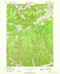
(27)- 1947 Map of Conrad, 1952 Print
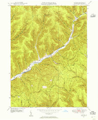
 1947 Conrad1952 Print · USGSPotter County’s timbered ridges and deep hollows are captured here just after the war, showing a rural landscape before modern development. Researchers can locate family cemeteries like Angell Cem and Reed Cem, or trace the old Jersey Shore Turnpike.4 unique versions available
 - 1947 Map of Conrad, 1956 Print
 1947 Conrad1956 Print · USGSPotter County’s deep valleys and timberlands are captured here in the mid-1940s as industry and nature intersected. Genealogists and hikers can trace old homesteads near Conrad, find the McFall Cem, and follow the historic Hammersley Trail.5 unique versions available
 - 1947 Map of Ayers Hill, 1957 Print
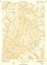
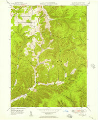 1947 Ayers Hill1957 Print · USGSPotter County’s high ridges and deep hollows are captured here just after the war, showing a landscape defined by old family settlements and emerging recreation. Genealogists and hikers can trace early routes like the Coudersport Jersey Shore Turnpike or locate family sites like Anson Cem and the United Brethren Ch.3 unique versions available
 - 1948 Map of Emporium, 1952 Print
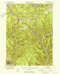 1948 Emporium1952 Print · USGSThe northern Pennsylvania highlands come into focus in the late 1940s, showing a network of mountain settlements and headwater streams. You can trace family roots at Wharton Cem and St Marks Cem or locate old schoolhouse sites like Reesville Sch.3 unique versions available
 - 1948 Map of Wharton, 1958 Print
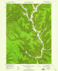 1948 Wharton1958 Print · USGSMid-century Potter County comes to life along the winding First Fork Sinnemahoning Creek and its narrow tributary hollows. Genealogists can pinpoint old family burial grounds like Forest Hill Cem and local landmarks like the Reesville Sch.3 unique versions available
 - 1948 Map of Austin, 1965 Print
 1948 Austin1965 Print · USGSThe valley of the Allegheny River and the settlement of Austin are shown here in the late 1940s. Genealogists and local historians can trace family-named landmarks like Cochrane Hol and find rural infrastructure such as the Inez Sch.4 unique versions available
 - 1949 Map of Ayers Hill
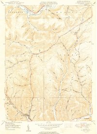
 1949 Ayers Hill1949 Print · USGSPotter County’s wooded highlands appear here just after the war, showing the network of rural mountain roads and small hollows that shaped local life. Genealogists can locate family landmarks like Ayers Hill Cem, Borie, and the United Brethren Ch.2 unique versions available
 - 1950 Map of Conrad
 1950 Conrad1950 Print · USGSPotter County’s remote valley landscapes are captured here at the start of the 1950s, showing the intersection of forest management and the gas industry. Researchers can find old family sites at McFall Cem or trace the early paths of Wild Boy Trail and Gravel Lick Trail.
 - 1950 Map of Austin
 1950 Austin1950 Print · USGSPotter County's deep-cut valleys and timbered ridges are captured here at mid-century as the local economy transitioned toward modern energy and infrastructure. Genealogists and historians can trace family-named hollows and vanished landmarks like the Inez Sch, the riverside hamlet of Mina, and the industrial footprint of Austin.2 unique versions available
 - 1950 Map of Wharton
 1950 Wharton1950 Print · USGSPotter County's deep-cut valleys and river confluences are captured here in the post-war era. Genealogists and historians can locate remote family landmarks like Reesville Sch, the Splash Dam on Bailey Run, and the burial grounds at Forest Hill Cem.2 unique versions available
 - 1954 Map of Williamsport
 1954 Williamsport1954 Print · USGSNorth-central Pennsylvania in the mid-fifties is defined by the winding West Branch Susquehanna River and its industrial valley. Local historians can trace the massive Susquehanna Ordnance Depot and the extensive rail networks of the Pennsylvania Railroad.
 - 1957 Map of Warren, 1964 Print
 1957 Warren1964 Print · USGSThe northern Pennsylvania oil and timber country comes into focus in the mid-fifties, showing the region before modern highway expansions. Trace the industrial rail networks of the Pennsylvania RR and the early Allegheny River Reservoir near Warren and Oil City.4 unique versions available
 - 1958 Map of Warren
 1958 Warren1958 Print · USGSNorthern Pennsylvania’s timber and oil country is captured here during the late fifties, showing the interplay of industrial valleys and vast state forests. Genealogists can trace family connections across the Cornplanter Indian Reservation or through rail hubs like Oil City and Saint Marys.
 - 1959 Map of Warren
 1959 Warren1959 Print · USGSNorthern Pennsylvania's oil and timber country comes alive in this late-fifties study of the forest-clad plateaus. Trace the historic Cornplanter (Indian Reservation), the sprawling Oil Field, and the rail lines of the Pennsylvania RR.2 unique versions available
 - 1960 Map of Williamsport
 1960 Williamsport1960 Print · USGSNorth-central Pennsylvania in the mid-twentieth century was a vital corridor of rail and river industry stretching from the New York line to the coal regions. Genealogists can trace the rail networks of the Pennsylvania RR and Lehigh Valley RR connecting towns like Williamsport, Towanda, and Lock Haven.
 - 1962 Map of Williamsport, 1966 Print
 1962 Williamsport1966 Print · USGSNorth-central Pennsylvania was a landscape of industrial river hubs and vast state woodlands in the early sixties. Researchers can trace the path of the Pennsylvania Railroad through Williamsport and explore the remote reaches of Bucktail State Park.5 unique versions available
 - 1965 Map of Williamsport
 1965 Williamsport1965 Print · USGSNorth-central Pennsylvania in the mid-1960s is defined by the industrial river towns and vast timberlands of the Allegheny Plateau. Researchers can trace historic rail lines like the Erie Lackawanna and Reading as they thread through Williamsport, Lock Haven, and Jersey Shore.
 - 1966 Map of Williamsport
 1966 Williamsport1966 Print · USGSThe Susquehanna Valley was a hub of transit and industry in the mid-seventies, where the river's West Branch connected major college towns and timberlands. Researchers can trace historical rail lines like the Reading or locate regional landmarks from Jersey Shore to Ricketts Glen State Park.
 - 1971 Map of Warren
 1971 Warren1971 Print · USGSNorth Central Pennsylvania is captured here in the early seventies, showing a landscape defined by industrial centers and massive state forests. Genealogists and historians can trace the rail lines of the Penn Central and Erie Lackawanna connecting towns like Warren, Kane, and Du Bois.
 - 1980 Map of Bradford, 1982 Print
 1980 Bradford1982 Print · USGSNorthern Pennsylvania's oil country and deep forests are captured here during the 1980s. Genealogists and researchers can trace rail-side settlements like Kushequa, Gifford, and Lewis Run or locate specific Oil and Gas Field sites across the plateau.
 - 1981 Map of Wellsboro, 1982 Print
 1981 Wellsboro1982 Print · USGSNorthern Pennsylvania in the early eighties shows a landscape of deep river gorges and vast state forests. Trace the rail lines of Conrail and explore old settlements from Coudersport to the Pine Creek Gorge.
 - 1994 Map of Conrad, 1999 Print
 1994 Conrad1999 Print · USGSPotter County's deep woods and steep valleys are shown here in the mid-1990s, centered on the winding Sinnemahoning Creek East Fork. Researchers can trace old family burial grounds at Brooks Cem and follow forest paths like the Nelson Trail through Susquehannock State Forest.
 - 1994 Map of Wharton, 1999 Print
 1994 Wharton1999 Print · USGSThe First Fork Sinnemahoning valley in Potter County remained a heartland of state forestry and small river settlements in the late twentieth century. Genealogists can locate family landmarks such as Wharton Cem, Rees Cem, and the old Reesville Sch site.
 - 2023 Map of Wharton, 2023 Print
 2023 Wharton2023 Print · USGSPotter County's deep valley settlements of Wharton and Costello are shown in detail as they appeared recently. Genealogists can locate family burial sites at Saint Augustine Saint Paul Cem or trace the old rail grades along Trackbed Ln.
 - 2023 Map of Conrad, 2023 Print
 2023 Conrad2023 Print · USGSPotter County's high ridges and deep creek valleys are shown in detail as they appeared recently. Genealogists and hikers can trace the geography of Conrad, locate McFall Cem, and follow the Susquehannock Trail System.
Showing maps 1-25 of 27
Top cities near Sylvania Township
- Emporium historical maps
- Liberty Township historical maps
- Roulette Township historical maps
- Sweden Township historical maps
- Hebron Township historical maps
- Norwich Township historical maps
See more
Frequently asked questions
- What are the different types of historical maps available for Sylvania Township?
- What is the oldest map of Sylvania Township?
- Where can I purchase historical maps of Sylvania Township for my home or office?
- Where can I download high-res historical maps of Sylvania Township?
- Are there historical topographic maps available for Sylvania Township?
- Is there historical aerial imagery available for Sylvania Township?
- Where are historical maps of Sylvania Township sourced from?