2020s Maps of Porter Township, Pennsylvania
Explore 3 historic maps of Porter Township from the 2020s. These maps offer a rare glimpse into what life looked like during the 2020s — showing old roads, neighborhoods, homes, and landmarks that have changed or disappeared over time.
Whether you're researching your family's past, planning a metal detecting trip, or studying how Porter Township's landscape evolved across the 2020s, these high-resolution maps are a powerful tool for exploring the history of this region.
- Focus on a specific era: All maps on this page are from the 2020s, giving you a focused view of this time period.
- See what’s changed: Compare century-old streets, trails, and buildings to today's modern landscape using overlays and satellite layers.
- Research with precision: Use these maps for genealogy, historical research, land use analysis, or educational projects.
- View, download, or print: Maps are fully viewable online in high resolution, and can be downloaded or printed for your own records.
Start exploring Porter Township's history through authentic maps from the 2020s. This is your window into the past.
Porter Township, PA maps
(3)- 2023 Map of Tremont, 2023 Print
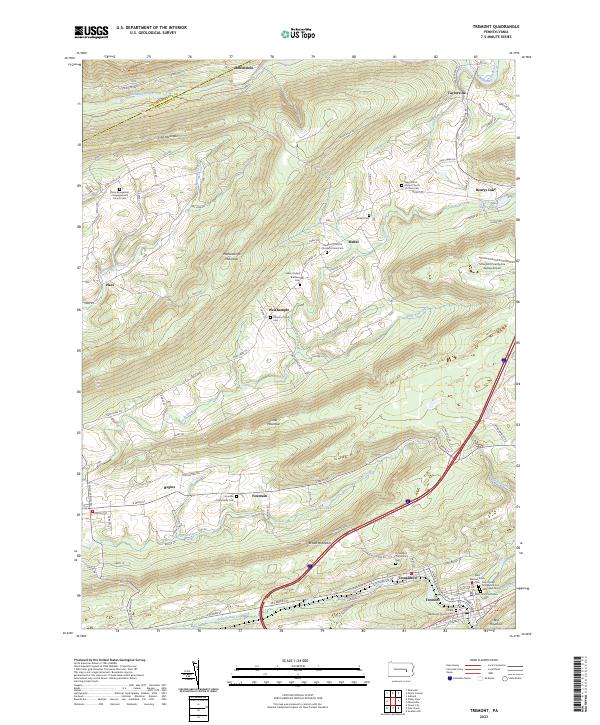 2023 Tremont2023 Print · USGSSchuylkill County's ridge-and-valley landscape is mapped here in detail, showing the coal region settlements of Tremont and Donaldson. Genealogists can locate family landmarks like the Fountain Community Cem and Zions Evangelical Congregational Church Cem.
 - 2023 Map of Pine Grove, 2023 Print
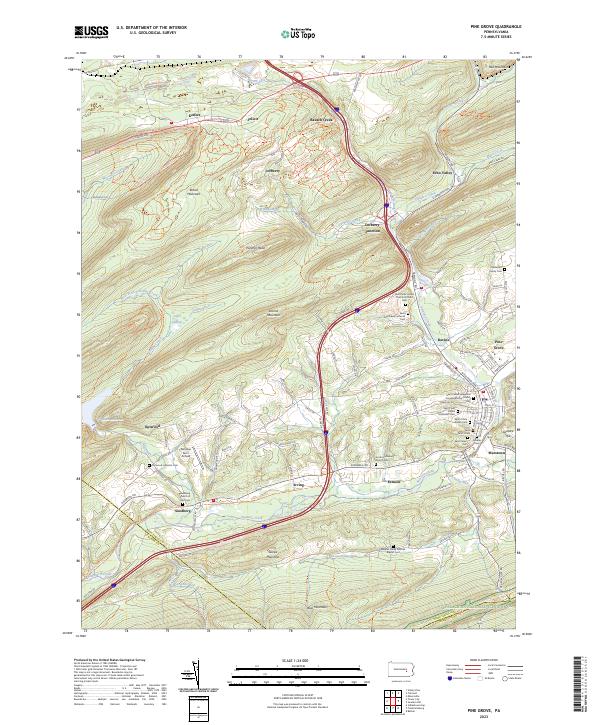 2023 Pine Grove2023 Print · USGSThe Swatara Creek valley comes alive in this contemporary look at Schuylkill County's ridges and rural crossroads. Local historians can trace family names at the Haldeman Family Cem or locate the old landing at Fairview Farm Airfield.
 - 2023 Map of Tower City, 2023 Print
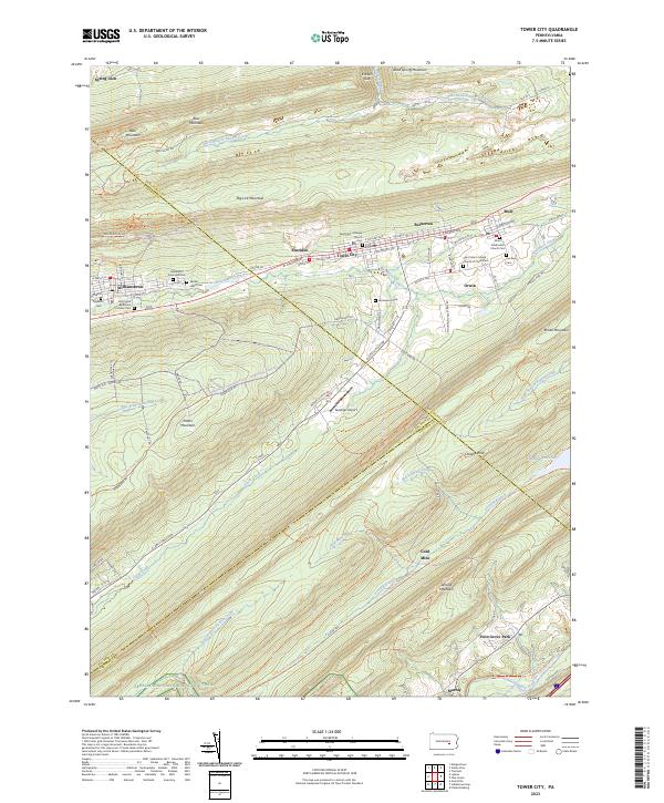 2023 Tower City2023 Print · USGSThe northern anthracite region comes to life in this detailed survey of the valley between Big Lick Mountain and Peters Mountain. Genealogists and local historians can trace the foundations of Tower City and Williamstown, locating local landmarks like the Sacred Heart Cem and the Gold Mine.
End of results
Showing maps 1-3 of 3
Top cities near Porter Township
- Shamokin historical maps
- Mount Carmel historical maps
- Bethel Township historical maps
- Hegins Township historical maps
- East Hanover Township historical maps
- Kulpmont historical maps
See more
Top neighborhoods of Porter Township
- Reinerton historical maps
- Reinerton-Orwin-Muir historical maps
- Keffers historical maps
- Williams Valley Junction historical maps
- Sheridan historical maps
- Good Spring historical maps
See more
Frequently asked questions
- What are the different types of historical maps available for Porter Township?
- What is the oldest map of Porter Township?
- Where can I purchase historical maps of Porter Township for my home or office?
- Where can I download high-res historical maps of Porter Township?
- Are there historical topographic maps available for Porter Township?
- Is there historical aerial imagery available for Porter Township?
- Where are historical maps of Porter Township sourced from?