1990s Maps of Walker Township, Pennsylvania
Explore 6 historic maps of Walker Township from the 1990s. These maps offer a rare glimpse into what life looked like during the 1990s — showing old roads, neighborhoods, homes, and landmarks that have changed or disappeared over time.
Whether you're researching your family's past, planning a metal detecting trip, or studying how Walker Township's landscape evolved across the 1990s, these high-resolution maps are a powerful tool for exploring the history of this region.
- Focus on a specific era: All maps on this page are from the 1990s, giving you a focused view of this time period.
- See what’s changed: Compare century-old streets, trails, and buildings to today's modern landscape using overlays and satellite layers.
- Research with precision: Use these maps for genealogy, historical research, land use analysis, or educational projects.
- View, download, or print: Maps are fully viewable online in high resolution, and can be downloaded or printed for your own records.
Start exploring Walker Township's history through authentic maps from the 1990s. This is your window into the past.
Walker Township, PA maps
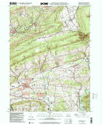
(6)- 1992 Map of New Ringgold, 1994 Print
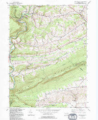 1992 New Ringgold1994 Print · USGSBlue Mountain and the Schuylkill valley dominate this 1990s portrait of rural Pennsylvania conservation and settlement. Genealogists and hikers can trace the Appalachian Trail past Hawk Mountain Sanctuary or locate historic family landmarks like Steigerwalts Sch and Bolich Ch.
 - 1995 Map of Tamaqua, 1996 Print
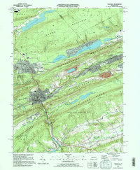 1995 Tamaqua1996 Print · USGSThe Anthracite coal region's industrial and residential landscape comes into focus during the mid-1990s. Researchers can trace local genealogy and rail history through Arlington Yards, Skyview Memorial Park, and the borough of Tamaqua.
 - 1997 Map of New Ringgold, 1998 Print
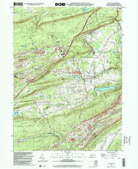
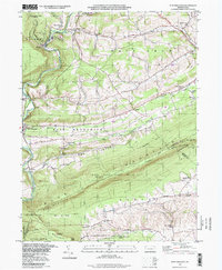 1997 New Ringgold1998 Print · USGSThe Blue Mountain ridge and Schuylkill River valley define this rural Pennsylvania landscape in the late nineties. Genealogists and hikers can trace the Appalachian Trail past Hawk Mountain Sanctuary or locate family sites like Bolich Ch and Eckville.
 - 1997 Map of Tamaqua, 2000 Print
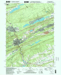 1997 Tamaqua2000 Print · USGSTamaqua and the surrounding coal region are shown in the late 1990s, caught between industrial heritage and mountain conservation. Genealogists and historians can trace local landmarks like Skyview Memorial Park, Arlington Yards, and the Rush Sch near Hometown.
 - 1999 Map of Orwigsburg, 2001 Print
 1999 Orwigsburg2001 Print · USGSSchuylkill County at the end of the millennium reveals a landscape of industrial coal roots and growing communities near the Schuylkill River. Genealogists and local historians can trace locations like Pinedale Sch, Bethel Ch, and the Drive-in Theater.
 - 1999 Map of Delano, 2001 Print
 1999 Delano2001 Print · USGSThe coal and rail networks of the Pennsylvania anthracite region are on display in this late-twentieth-century study of Schuylkill County. Researchers can trace the legacy of hilltop settlements and rail junctions like Delano, Grier City, and East Mahanoy Jct.
End of results
Showing maps 1-6 of 6
Top cities near Walker Township
- Hazleton historical maps
- Pottsville historical maps
- Maxatawny Township historical maps
- Tamaqua historical maps
- Shenandoah historical maps
- Schuylkill Haven historical maps
See more
Top neighborhoods of Walker Township
- Zehners historical maps
- Lewistown historical maps
- New England historical maps
- Reynolds historical maps
- Webster historical maps
Frequently asked questions
- What are the different types of historical maps available for Walker Township?
- What is the oldest map of Walker Township?
- Where can I purchase historical maps of Walker Township for my home or office?
- Where can I download high-res historical maps of Walker Township?
- Are there historical topographic maps available for Walker Township?
- Is there historical aerial imagery available for Walker Township?
- Where are historical maps of Walker Township sourced from?