Old Maps of Wayne Township, Pennsylvania for Genealogy
Trace your family roots with 25 historic maps of Wayne Township. These high-res maps reveal old neighborhoods, homesites, landmarks, and streets — helping you uncover where your ancestors lived and how the area evolved over time.
- Explore historic neighborhoods: Identify where your relatives may have lived in the 1800s or 1900s.
- Compare maps over time: Trace the changes in streets, buildings, and landmarks for multi-generational research.
- Perfect for genealogy & ancestry research: Used by family historians and researchers to map out lineage and migration.
These maps are an incredible resource for exploring your personal connection to Wayne Township's past.
Wayne Township, PA maps
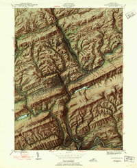
(25)- 1889 Map of Pottsville, 1964 Print
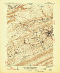
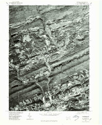
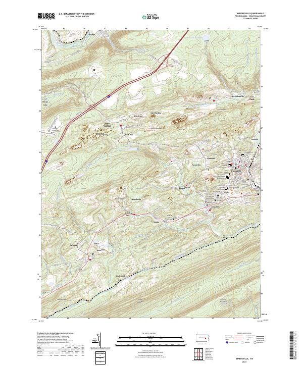
 1889 Pottsville1964 Print · USGSAnthracite coal country and the complex rail networks of the late nineteenth century dominate this survey of the Schuylkill River valley. Genealogists and industrial historians can trace the early footprints of Pottsville, Schuylkill Haven, and the numerous rail branches serving New Philadelphia and Port Carbon.
 - 1891 Map of Pottsville
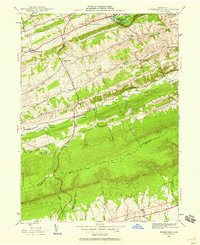
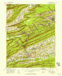
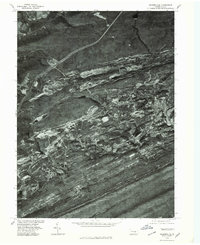
 1891 Pottsville1891 Print · USGSSchuylkill County enters its industrial height in the 1890s, when anthracite coal and iron rails reshaped the mountains. Trace the dense rail networks of the Philadelphia and Reading Railroad connecting Pottsville, St. Clair, and Schuylkill Haven.10 unique versions available
 - 1892 Map of Pine Grove
 1892 Pine Grove1892 Print · USGSSchuylkill County coal country comes alive in the late 1800s, showing a landscape defined by sharp ridges and heavy industry. Genealogists and historians can trace rail-dependent mining towns like Minersville, Branch Dale, and the bustling junction at Tremont.10 unique versions available
 - 1944 Map of Pottsville
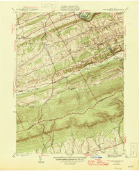
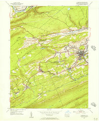
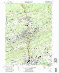
 1944 Pottsville1944 Print · USGSThe anthracite region of Pennsylvania shows its industrial density during the 1940s, with coal-dependent settlements lining the mountain valleys. Genealogists and historians can trace the rail networks of the Reading and Lehigh lines through Pottsville, St Clair, and East Mines.10 unique versions available
 - 1945 Map of Friedensburg, 1958 Print
 1945 Friedensburg1958 Print · USGSSchuylkill County at the end of the war is a landscape of valley townships and ridge-top trails. Genealogists can trace a dense network of rural schools and villages like Friedensburg, Summit Station, and Brommerstown, alongside the early route of the Appalachian Trail.7 unique versions available
 - 1946 Map of Friedensburg
 1946 Friedensburg1946 Print · USGSSchuylkill and Berks counties appear here shortly after the war, showing the mountain ridges and valley towns of the mid-1940s. Trace local family history at Friedensburg, old rural schools like Panther Valley Sch, or the path of the Appalachian Trail.2 unique versions available
 - 1946 Map of Swatara Hill
 1946 Swatara Hill1946 Print · USGSSchuylkill and Berks counties are shown in the 1940s as a landscape of ridge-and-valley farming and early mountain recreation. Genealogists can locate family landmarks like Manbeck Cem or tracing historic schoolhouses such as Kershner Sch and Fidler Sch.2 unique versions available
 - 1947 Map of Minersville
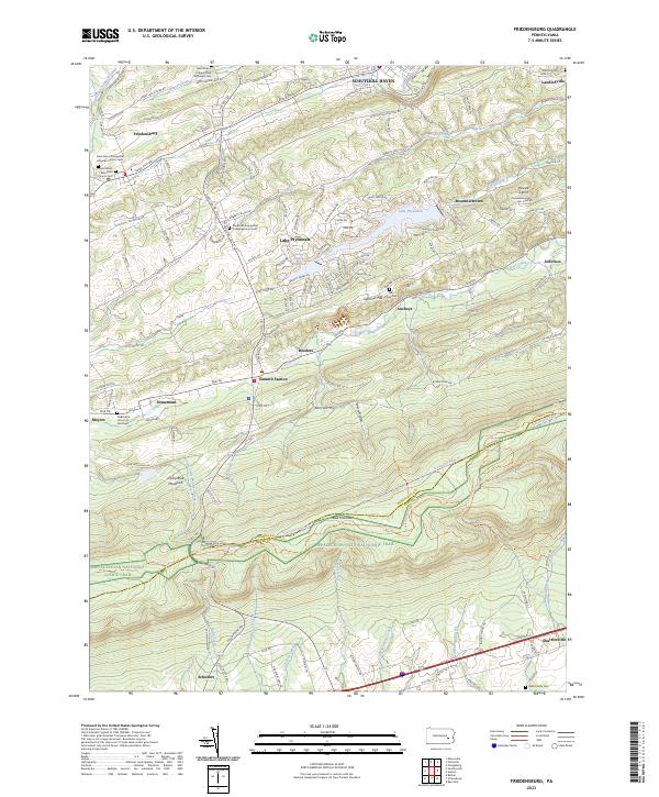
 1947 Minersville1947 Print · USGSAnthracite coal mining and rail infrastructure define this mid-century look at the Schuylkill County landscape. Genealogists and historians can trace the detailed street grids of Minersville and find smaller coal settlements like Heckscherville, New Mines, and Coal Castle.2 unique versions available
 - 1950 Map of Harrisburg, 1952 Print
 1950 Harrisburg1952 Print · USGSMid-century Central Pennsylvania comes alive through its dense rail networks and river valley settlements during the post-war industrial era. Genealogists and historians can trace family roots through hubs like Harrisburg, locate Carlisle Barracks, or follow the Pennsylvania RR through the Lebanon Valley.
 - 1955 Map of Swatara Hill, 1956 Print
 1955 Swatara Hill1956 Print · USGSSchuylkill County in the mid-fifties shows a landscape of ridge-top trails and valley railroads. Genealogists and historians can trace family-named landmarks like Schweigerts Sch or visit rural congregations at Hauers Ch and St Marks Ch.6 unique versions available
 - 1955 Map of Minersville, 1956 Print
 1955 Minersville1956 Print · USGSSchuylkill County mining towns thrive amidst the ridges of the anthracite coal region in the mid-1950s. Genealogists and industrial historians can trace the intricate rail lines of the Reading and find vanished local landmarks like Triedens Ch and New Mines.6 unique versions available
 - 1955 Map of Pine Grove, 1958 Print
 1955 Pine Grove1958 Print · USGSSchuylkill County coal towns and the Blue Mountain ridges are documented here in the mid-1950s. Genealogists and researchers can locate family-named landmarks like Klingers Sch and Hauer Ch alongside coal-era infrastructure like Coal Castle.3 unique versions available
 - 1957 Map of Harrisburg
 1957 Harrisburg1957 Print · USGSMid-century Central Pennsylvania comes into focus as a bustling network of rail, river, and mountain ridges. Genealogists and historians can trace the development of the State Capitol and surrounding hubs like Middletown, Columbia, and Pottsville.7 unique versions available
 - 1961 Map of Harrisburg
 1961 Harrisburg1961 Print · USGSCentral Pennsylvania is shown at a mid-century peak of industrial and military activity, from the Susquehanna water gaps to the fertile Dutch Country. Genealogists and historians can trace the rail corridors of the Pennsylvania RR and find landmarks like Carlisle Barracks or the Anthracite Coal Fields.2 unique versions available
 - 1964 Map of Harrisburg
 1964 Harrisburg1964 Print · USGSCentral Pennsylvania in the mid-fifties reveals a landscape shaped by ridge-and-valley geology and critical Cold War infrastructure. Researchers can trace the massive Indiantown Gap Military Reservation or the rail corridors of the Pennsylvania RR and Reading RR.
 - 1976 Map of Pottsville, 1979 Print
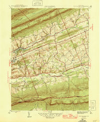
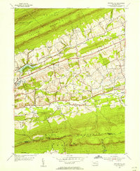
 1976 Pottsville1979 Print · USGSSchuylkill County at the height of the 1970s shows a landscape deeply defined by its industrial heritage and mountain geography. Researchers can trace the layout of anthracite boroughs from Pottsville to New Philadelphia and the path of the Schuylkill River.
 - 1976 Map of Minersville, 1979 Print
 1976 Minersville1979 Print · USGSThe Southern Anthracite Field comes into sharp focus during the mid-seventies, showing the physical footprint of Pennsylvania coal country. Genealogists and local historians can trace the residential layouts of Minersville and Llewellyn against the backdrop of Broad Mountain.
 - 1984 Map of Sunbury, 1985 Print
 1984 Sunbury1985 Print · USGSPennsylvania coal country and the Susquehanna valley appear here in the early eighties, showcasing a landscape defined by industrial ridges and river towns. Genealogists and historians can trace rail corridors like Conrail and explore mountain settlements from Mahanoy City to Elizabethville.2 unique versions available
 - 1994 Map of Pottsville, 1995 Print
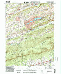
 1994 Pottsville1995 Print · USGSSchuylkill County at the end of the twentieth century shows a landscape shaped by coal and industry. Researchers can trace family roots through the German Cem, locate the Penn State University campus, and see the extent of strip mines near St Clair.
 - 1999 Map of Friedensburg, 2001 Print
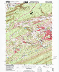
 1999 Friedensburg2001 Print · USGSSchuylkill County at the end of the millennium shows a landscape shaped by the ridge of Blue Mountain and a network of valley settlements. Genealogists and historians can locate several local schools such as Black Horse Sch and Reber Sch, or trace the path of the Appalachian National Scenic Trail.
 - 1999 Map of Minersville, 2001 Print
 1999 Minersville2001 Print · USGSSchuylkill County coal country comes into sharp focus at the end of the century as industrial valleys meet the high ridges of the Appalachians. Genealogists and historians can trace family-named sites and vanished industrial works from Minersville to New Mines and Coal Castle.
 - 2023 Map of Friedensburg, 2023 Print
 2023 Friedensburg2023 Print · USGSCentral Pennsylvania's ridges and valleys are meticulously detailed in this recent survey, featuring the crossing of the Appalachian National Scenic Trail. Trace family history at Saint Johns Reformed Church Cem or find the remote Feick Family Cem.
 - 2023 Map of Minersville, 2023 Print
 2023 Minersville2023 Print · USGSSchuylkill County's coal-country heritage is on full display in this recent survey of the ridges and valleys surrounding Minersville. Genealogists can locate numerous local burial sites like Saint Stanislaus Kosta Cem Number 1 and trace the paths of the West Branch Schuylkill River.
 - 2023 Map of Pottsville, 2023 Print
 2023 Pottsville2023 Print · USGSSchuylkill County's coal-belt communities and steep ridges are meticulously detailed in this recent study. Researchers can trace ancestral roots through dozens of local sites like Charles Baber Cem, Dark Water, and Saint Casimir's Church.
 - 2023 Map of Swatara Hill, 2023 Print
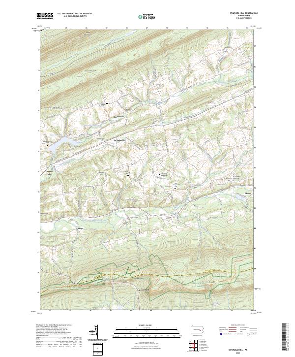 2023 Swatara Hill2023 Print · USGSSchuylkill County at the opening of the 2020s remains a landscape of high ridges and narrow agricultural valleys. Genealogists can trace family names through numerous rural burial sites like Hetzel's Church Cem or find the path of the Appalachian National Scenic Trail over Round Head.
End of results
Showing maps 1-25 of 25
Top cities near Wayne Township
- Pottsville historical maps
- Mount Carmel historical maps
- Schuylkill Haven historical maps
- Bethel Township historical maps
- Minersville historical maps
- Frackville historical maps
See more
Top neighborhoods of Wayne Township
- Reedsville historical maps
- Summit Station historical maps
- Roeders historical maps
- Roeders historical maps
- Moyers historical maps
- Stonemont historical maps
See more
Frequently asked questions
- What are the different types of historical maps available for Wayne Township?
- What is the oldest map of Wayne Township?
- Where can I purchase historical maps of Wayne Township for my home or office?
- Where can I download high-res historical maps of Wayne Township?
- Are there historical topographic maps available for Wayne Township?
- Is there historical aerial imagery available for Wayne Township?
- Where are historical maps of Wayne Township sourced from?