2020s Maps of Addison Township, Pennsylvania
Explore 6 historic maps of Addison Township from the 2020s. These maps offer a rare glimpse into what life looked like during the 2020s — showing old roads, neighborhoods, homes, and landmarks that have changed or disappeared over time.
Whether you're researching your family's past, planning a metal detecting trip, or studying how Addison Township's landscape evolved across the 2020s, these high-resolution maps are a powerful tool for exploring the history of this region.
- Focus on a specific era: All maps on this page are from the 2020s, giving you a focused view of this time period.
- See what’s changed: Compare century-old streets, trails, and buildings to today's modern landscape using overlays and satellite layers.
- Research with precision: Use these maps for genealogy, historical research, land use analysis, or educational projects.
- View, download, or print: Maps are fully viewable online in high resolution, and can be downloaded or printed for your own records.
Start exploring Addison Township's history through authentic maps from the 2020s. This is your window into the past.
Addison Township, PA maps
(6)- 2023 Map of Confluence, 2023 Print
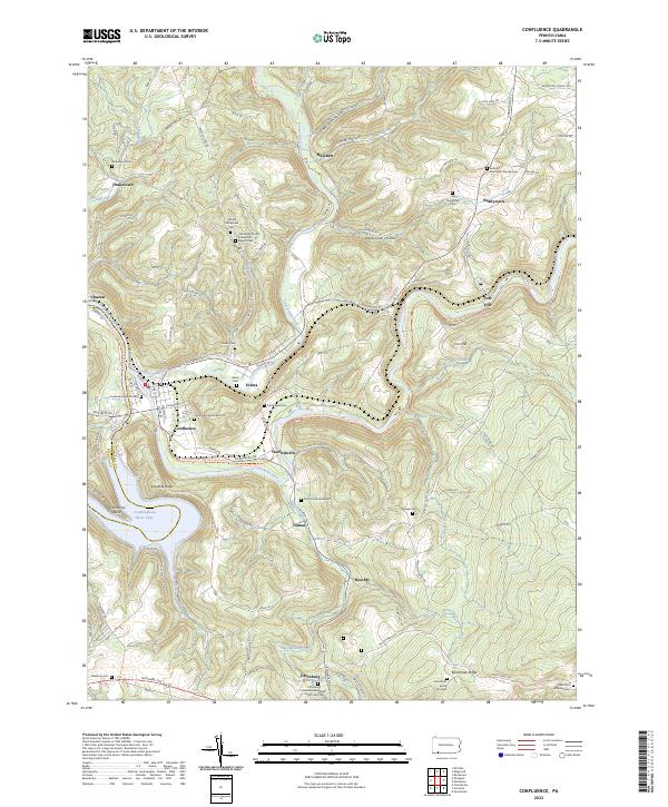 2023 Confluence2023 Print · USGSThe river valleys of Somerset County meet at the turn of the Youghiogheny, where high ridges overlook old river-town settlements. Genealogists can trace family lines at the Old Jersey Church Turkeyfoot Baptist Cemetery, McClintock Graveyard, and Boardman Burial Grounds.
 - 2023 Map of Markleton, 2023 Print
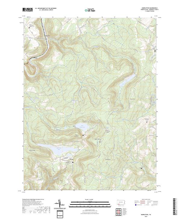 2023 Markleton2023 Print · USGSThe high Allegheny ridges of Somerset County come into focus here during the early 2020s, dominated by the summit of Mount Davis. Local historians can trace family land markers and remote burial sites like Vought Cem and the Old Jonas Maust Farm Cem.
 - 2023 Map of Ohiopyle, 2023 Print
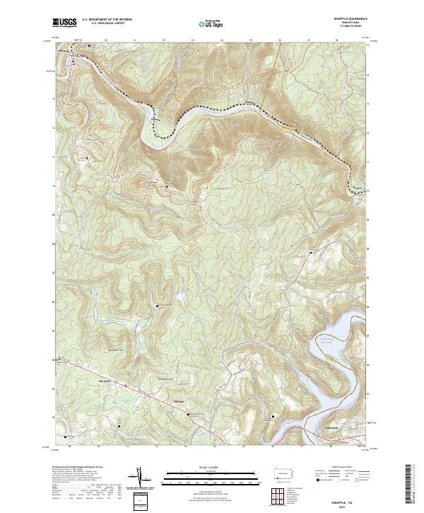 2023 Ohiopyle2023 Print · USGSThe Pennsylvania highlands between Fayette and Somerset counties are shown here in modern detail. Trace family history through numerous small burial sites like Tressler Farm Cemetery and Bird-Burd Cemetery or locate the historic National Pike.
 - 2023 Map of Friendsville, 2023 Print
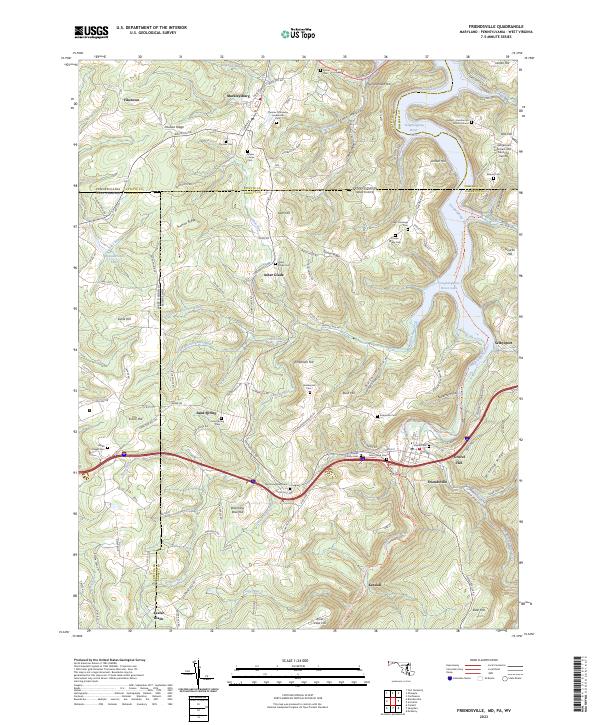 2023 Friendsville2023 Print · USGSThe tri-state border country of Maryland, Pennsylvania, and West Virginia is captured here in the contemporary era. Genealogists can trace deep local roots through numerous family sites like the Friend Family Cem and the Harden - Humberton Burial Ground.
 - 2023 Map of Grantsville, 2023 Print
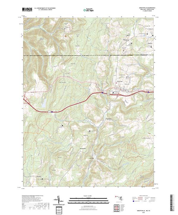 2023 Grantsville2023 Print · USGSGrantsville and the surrounding Garrett County highlands are captured here at the start of the 2020s, showing a landscape rich in family history and Appalachian geography. Genealogists can locate numerous small family plots such as the Beachy Grave Yard and the Negro Mountain Cem near the historic National Pike.
 - 2023 Map of Accident, 2023 Print
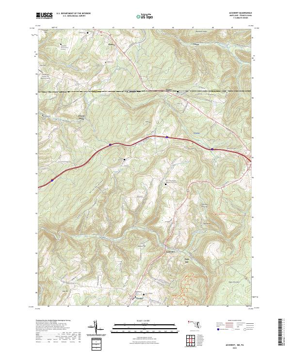 2023 Accident2023 Print · USGSGarrett County's high ridges and border valleys are shown here in detail during the early twenty-first century. Genealogists can trace family names through numerous remote burial sites like Augustine Burial Ground Number 1 and local industry at Kaese Mill.
End of results
Showing maps 1-6 of 6
Top cities near Addison Township
- Somerset historical maps
- Milford historical maps
- Rockwood historical maps
- Salisbury historical maps
- Confluence historical maps
- Grantsville historical maps
See more
Top neighborhoods of Addison Township
- Beachly historical maps
- Somerfield historical maps
- Unamis historical maps
- Dumas historical maps
- Listonburg historical maps
Frequently asked questions
- What are the different types of historical maps available for Addison Township?
- What is the oldest map of Addison Township?
- Where can I purchase historical maps of Addison Township for my home or office?
- Where can I download high-res historical maps of Addison Township?
- Are there historical topographic maps available for Addison Township?
- Is there historical aerial imagery available for Addison Township?
- Where are historical maps of Addison Township sourced from?