Old Maps of Somerset County, Pennsylvania
Explore 289 old maps of Somerset County, spanning from 1898 to today. These high-resolution historic maps reveal how streets, neighborhoods, landmarks, and natural features evolved over time — perfect for genealogy, metal detecting, research, and local history exploration.
What you can do with these maps:
- See how Somerset County changed over time: Compare historical maps to modern-day views to trace roads, homesites, rail lines & more.
- View detailed metadata: Each map includes creators, publishers, year, scale, and archive source.
- Overlay maps with satellite & LiDAR: Visualize the past alongside modern tools to explore terrain & human change.
- Trusted historical sources: Maps sourced from the USGS, Library of Congress, and other archives.
- Access maps your way: View online, download high-res files, or order prints for personal or research use.
Start exploring old maps of Somerset County to uncover forgotten places, hidden landmarks, and the deep history beneath your feet.
Somerset County, PA maps
(289)- 1898 Map of Frostburg
 1898 Frostburg1898 Print · USGSMaryland's coal country and the Potomac borderlands are captured here at the height of the Victorian industrial era. Researchers can trace the extensive rail lines and mining infrastructure connecting settlements like Eckhart Mines, Mount Savage, and the historic C & O Canal.
 - 1899 Map of Grantsville
 1899 Grantsville1899 Print · USGSThe Maryland-Pennsylvania borderlands are documented here at the close of the nineteenth century, showing a landscape of high ridges and narrow valley settlements. Researchers can trace family-named landmarks like Ridgley Hill and early mountain hamlets such as New Germany or Moscow Mills.
 - 1900 Map of Accident
 1900 Accident1900 Print · USGSGarrett County highlands at the turn of the century reveal a landscape of mountain settlements and river-valley industry. Genealogists can trace family roots through the Blooming Rose Settlement, early milling sites like Speelman Mills, and the Baltimore and Ohio RR corridor.6 unique versions available
 - 1901 Map of Frostburg
 1901 Frostburg1901 Print · USGSMaryland's coal country and the critical mountain pass at Cumberland are shown in detail at the turn of the century. Genealogists and industrial historians can locate old mining works at Eckhart Mines, the path of the C. & O. Canal, and the early layout of Frostburg.2 unique versions available
 - 1904 Map of Grantsville
 1904 Grantsville1904 Print · USGSGarrett County at the close of the nineteenth century is captured here as a rugged corridor of timbering and coal transport. You can trace the path of the National Road through Grantsville or locate early industrial sites like Moscow Mills and the Jennings Brothers RR.5 unique versions available
 - 1904 Map of Johnstown, 1954 Print
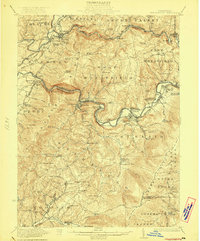
 1904 Johnstown1954 Print · USGSJohnstown and the Cambria County coalfields are shown in detail during their industrial peak in the early twentieth century. Researchers can trace ancestral neighborhoods like Morrellville and Franklin, or locate historic landmarks such as the Old Portage RR Tunnel and Grandview Cemetery.2 unique versions available
 - 1907 Map of Johnstown
 1907 Johnstown1907 Print · USGSJohnstown and the surrounding coal valleys are captured here at the height of their industrial expansion in the early twentieth century. Researchers can trace the path of the Pennsylvania RR and find vanished local landmarks like Expedit PO and the Old Portage RR Tunnel.6 unique versions available
 - 1908 Map of Frostburg
 1908 Frostburg1908 Print · USGSAllegany County mining and rail networks are in full view at the turn of the century. Trace the old coal patches and rail spurs from Eckhart Mines to Borden Shaft, and follow the C & O Canal along the North Branch Potomac River.5 unique versions available
 - 1908 Map of Bedford, 1958 Print
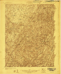
 1908 Bedford1958 Print · USGSBedford County at the turn of the century reveals a landscape of ridge-top schools and valley mill towns connected by early rail. Genealogists can trace family roots through numerous sites like Ryan Mill, Eight Square School, and Ogleton Felix PO.
 - 1910 Map of Bedford
 1910 Bedford1910 Print · USGSBedford County's agrarian valleys and mountain ridges are captured here during the peak of the rural schoolhouse era. Researchers can trace ancestral locations at Weyant PO, Schellsburg, and Mowrys Mills, or locate early landmarks like Eight Square School.4 unique versions available
 - 1913 Map of Somerset, 1961 Print
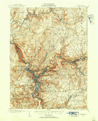
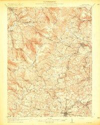
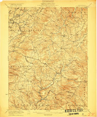
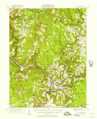
 1913 Somerset1961 Print · USGSSomerset County was a rugged crossroads of rail and mountain ridges in the decade before the First World War. Local historians can trace the Pittsburgh and Philadelphia Road and find vanished local landmarks like Rectors Mill, the Quemahoning Tunnel, and Sipesville Station.
 - 1914 Map of Windber, 1955 Print
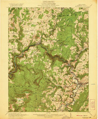
 1914 Windber1955 Print · USGSSomerset County coal and rail towns thrive along the Allegheny front during the height of the early industrial era. Genealogists and historians can trace the foundations of Windber, locate the Old Shade Furnace, and map family-named schools like Keafer School.3 unique versions available
 - 1915 Map of Somerset
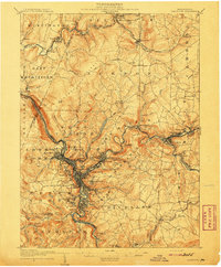
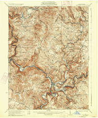
 1915 Somerset1915 Print · USGSSomerset and the surrounding Laurel Ridge region are captured here during the peak of the early twentieth-century coal boom. Genealogists and historians can trace family-named sites and industrial landmarks including Husband Mine, Rectors Mill, and the Quemahoning Tunnel.6 unique versions available
 - 1916 Map of Windber
 1916 Windber1916 Print · USGSSomerset County coal country and the Laurel Highlands come alive in the decade before the Great War. Genealogists and historians can trace family locations through dozens of named sites like Old Shade Furnace, Stauffer Mine No 3, and Walkers Mill.4 unique versions available
 - 1920 Map of New Florence, 1958 Print
 1920 New Florence1958 Print · USGSThe Conemaugh River valley at the dawn of the 1920s shows a landscape defined by the PENNSYLVANIA RR and industrial coal towns. Genealogists can locate family homesteads near dozens of named country schools like Wallace School or trace the old Lincoln Highway through Armagh.
 - 1921 Map of New Florence
 1921 New Florence1921 Print · USGSWestmoreland and Indiana counties are captured in the early 1920s as industrial rail corridors and the Lincoln Highway begin to modernize the rural landscape. Genealogists can locate family landmarks like Campbell's Mill, the Centerville Huff PO, and several country schools including Robbs School.
 - 1921 Map of Meyersdale
 1921 Meyersdale1921 Print · USGSSomerset County's industrial and mountain landscape comes to life in the early 1920s as coal mining and railroads dominate the Casselman River valley. Genealogists can trace family roots through dozens of local sites like Sanners Church, Shaw Mines, and the Ganguey School.3 unique versions available
 - 1922 Map of Confluence
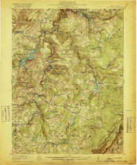
 1922 Confluence1922 Print · USGSThe confluence of the Youghiogheny River and Casselman River was a major rail and river hub in the 1920s. Genealogists and local historians can trace the foundations of many small settlements and mountain schools, from Ohiopyle to the Baldwin Mine and Wesley Chapel.3 unique versions available
 - 1922 Map of Donegal
 1922 Donegal1922 Print · USGSWestmoreland and Fayette counties are captured here in the early twenties, showing a landscape of mountain ridges and busy valley crossroads. Genealogists can trace family roots through dozens of rural landmarks like St Boniface Chapel, Hoods Mill, and the Snowball School.2 unique versions available
 - 1922 Map of New Florence
 1922 New Florence1922 Print · USGSWestern Pennsylvania in the early 1920s shows a landscape of river-carved ridges and busy rail corridors connecting coal and quarry towns. Genealogists can trace family footprints across dozens of rural schools and stations like Lockport Station, Centerville (Huff PO), and Grafton.5 unique versions available
 - 1923 Map of Berlin
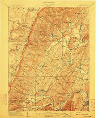
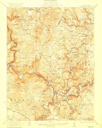
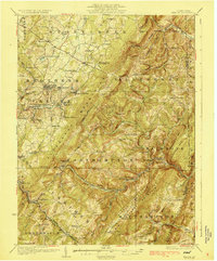
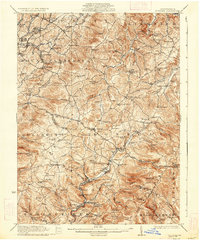
 1923 Berlin1923 Print · USGSSomerset County’s high ridges and deep valleys are documented in the early 1920s as the rail and mining industries shaped the local economy. Genealogists and researchers can locate numerous family-named landmarks and rural hubs, including Butners Mill, Sand Patch, and the Shipley Brothers Mine.3 unique versions available
 - 1929 Map of Berlin
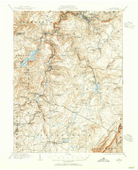
 1929 Berlin1929 Print · USGSSomerset County is shown here in the late twenties, during the peak of the mountain coal and rail era. Genealogists and historians can trace family roots through dozens of rural landmarks like Whiteoak Churches, Salco Mines, and the Falls Cut Tunnel along the B&O line.3 unique versions available
 - 1931 Map of Confluence, 1958 Print
 1931 Confluence1958 Print · USGSThe Laurel Highlands at the start of the 1930s reveal a landscape of deep river valleys and high ridges defined by coal mining and heavy rail. Genealogists can trace family names through dozens of rural sites like Sands Church, Somerfield, and the Mary Ann Mine.2 unique versions available
 - 1933 Map of Confluence
 1933 Confluence1933 Print · USGSThe Laurel Highlands during the early 1930s come into focus through the river networks of Fayette and Somerset counties. Trace family roots at Paddytown or Somerfield, and locate long-gone schoolhouses such as Clay Run School and the Mary Ann Mine.2 unique versions available
 - 1935 Map of Donegal
 1935 Donegal1935 Print · USGSWestmoreland County communities are shown here in the 1930s, as coal towns and rural hamlets relied on a network of mountain rail lines and country schools. Genealogists can trace family roots through numerous sites like Stahlstown, the Mansville Post Office, and St Boniface Chapel.2 unique versions available
Showing maps 1-25 of 289
Top cities of Somerset County
- Somerset historical maps
- Windber historical maps
- Meyersdale historical maps
- Berlin historical maps
- Boswell historical maps
- Central City historical maps
See more
Frequently asked questions
- What are the different types of historical maps available for Somerset County?
- What is the oldest map of Somerset County?
- Where can I purchase historical maps of Somerset County for my home or office?
- Where can I download high-res historical maps of Somerset County?
- Are there historical topographic maps available for Somerset County?
- Is there historical aerial imagery available for Somerset County?
- Where are historical maps of Somerset County sourced from?