1990s Maps of Somerset County, Pennsylvania
Explore 14 historic maps of Somerset County from the 1990s. These maps offer a rare glimpse into what life looked like during the 1990s — showing old roads, neighborhoods, homes, and landmarks that have changed or disappeared over time.
Whether you're researching your family's past, planning a metal detecting trip, or studying how Somerset County's landscape evolved across the 1990s, these high-resolution maps are a powerful tool for exploring the history of this region.
- Focus on a specific era: All maps on this page are from the 1990s, giving you a focused view of this time period.
- See what’s changed: Compare century-old streets, trails, and buildings to today's modern landscape using overlays and satellite layers.
- Research with precision: Use these maps for genealogy, historical research, land use analysis, or educational projects.
- View, download, or print: Maps are fully viewable online in high resolution, and can be downloaded or printed for your own records.
Start exploring Somerset County's history through authentic maps from the 1990s. This is your window into the past.
Somerset County, PA maps
(14)- 1993 Map of Seven Springs, 1998 Print
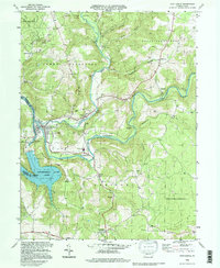
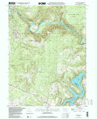
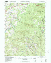 1993 Seven Springs1998 Print · USGSThe Laurel Highlands during the 1990s show a fascinating blend of traditional mountain settlements and growing recreational destinations. Researchers can locate legacy sites like Horners Mill, Pritts School, and the Nedrow Cem alongside the developed slopes of Seven Springs.
 - 1993 Map of Friendsville, 1999 Print
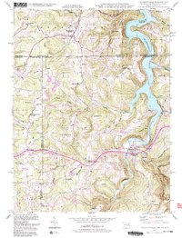 1993 Friendsville1999 Print · USGSThe tri-state border region of Maryland, Pennsylvania, and West Virginia is shown here in the 1990s as the Youghiogheny River Lake reshapes the landscape. Genealogists can trace local roots through sites like the Emberson Cem, Keeler Glade Sch, and Markleysburg.2 unique versions available
 - 1993 Map of Cumberland, 1999 Print
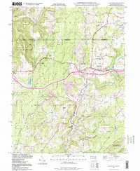
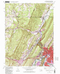 1993 Cumberland1999 Print · USGSCumberland and the Maryland-Pennsylvania borderlands are captured here in the late twentieth century, showing a landscape shaped by the Mason-Dixon Line and deep mountain gaps. Genealogists and historians can trace the C & O Canal, the grounds of the County Home, and legacy rail lines like the Baltimore and Ohio Railroad.
 - 1994 Map of Kingwood, 1997 Print
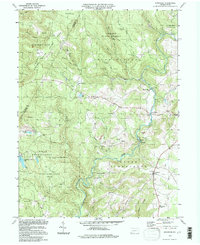 1994 Kingwood1997 Print · USGSSomerset and Fayette counties in the mid-nineties show a rugged topography shaped by state forests and coal extraction. Trace family roots and local history near Kingwood through the Kingwood Sch, a Covered Bridge, and various strip mines.
 - 1994 Map of Confluence, 1997 Print
 1994 Confluence1997 Print · USGSThe three-way meeting of the Youghiogheny, Casselman, and Laurel Hill Creek defines this Somerset County landscape in the 1990s. Genealogists and historians can trace family-named sites like Younkin Cem, Jersey Ch, and the historic National Road through Addison.
 - 1994 Map of Grantsville, 1999 Print
 1994 Grantsville1999 Print · USGSGrantsville and the surrounding Garrett County highlands are captured here in the late twentieth century as the region balanced its mountain wilderness and agricultural roots. Researchers can trace old family sites such as Slaubaugh Cem, the Yoder Sch, and traces of an Old Railroad Grade along the river.
 - 1994 Map of Stoystown, 1999 Print
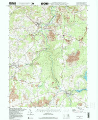 1994 Stoystown1999 Print · USGSSomerset County in the mid-1990s shows a landscape defined by the Stonycreek River and the legacy of the regional coal industry. Researchers can find old landmarks like the Walker Cem, the Rayman Ch, and a Covered Bridge near Shanksville.2 unique versions available
 - 1994 Map of Accident, 1999 Print
 1994 Accident1999 Print · USGSThe Maryland-Pennsylvania borderlands near Accident are shown here as they appeared in the 1990s, centered on the historic National Road corridor. Researchers can locate family landmarks like Turney Cem and the sites of Eagle Mill and Kaese Mill.
 - 1997 Map of Boswell, 2000 Print
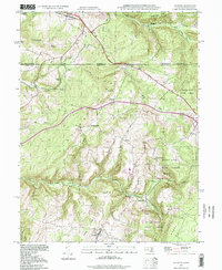
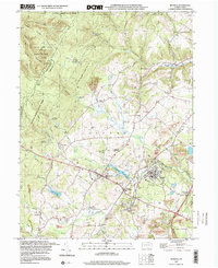 1997 Boswell2000 Print · USGSSomerset County coal towns and the ridges of the Laurel Highlands are captured here in the late nineties as the landscape shifted from active extraction to reclamation. Genealogists and researchers can locate family sites at SS Peter and Paul Cem, Klines Mill, and the settlement of Jenners Crossroads.
 - 1998 Map of Windber, 1999 Print
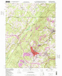
 1998 Windber1999 Print · USGSThe coal country of Somerset and Cambria counties is shown here during a period of landscape reclamation in the late nineties. Genealogists and historians can locate family landmarks like the Spaulding Sch, the Old Shade Furnace, and numerous local parishes including St Anthony Ch.
 - 1998 Map of Frostburg, 1999 Print
 1998 Frostburg1999 Print · USGSMaryland's coal country and mountain ridges are documented here in the final years of the millennium. Genealogists and historians can trace family roots through Eckhart Mines, find the Borden Tunnel, or locate the historic Rose Meadow Cem.
 - 1998 Map of Rachelwood, 2000 Print
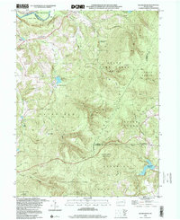 1998 Rachelwood2000 Print · USGSThe Westmoreland and Cambria county line area in the late nineties showcases a landscape of protected highlands and mountain reservoirs. Researchers can trace historic industrial sites like Baldwin Furnace and community anchors such as Legat Cem and Rachelwood.
 - 1999 Map of Mill Run, 2000 Print
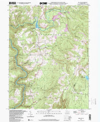 1999 Mill Run2000 Print · USGSThe Youghiogheny River corridor and Laurel Highlands appear here at the end of the millennium. Trace the rural landscape through Mill Run Reservoir and local centers like Normalville, or find family sites at Hickman Chapel and Mt Tabor Cem.
 - 1999 Map of Ohiopyle, 2000 Print
 1999 Ohiopyle2000 Print · USGSFayette County's river-carved landscape is captured here as the century turned, centered on the dramatic bends of the Youghiogheny River. Researchers can locate legacy sites like Bidwell Sta, the Marclay Sch, and numerous family burial grounds including Sugarloaf Cem.
End of results
Showing maps 1-14 of 14
Top cities of Somerset County
- Somerset historical maps
- Windber historical maps
- Meyersdale historical maps
- Berlin historical maps
- Boswell historical maps
- Central City historical maps
See more
Frequently asked questions
- What are the different types of historical maps available for Somerset County?
- What is the oldest map of Somerset County?
- Where can I purchase historical maps of Somerset County for my home or office?
- Where can I download high-res historical maps of Somerset County?
- Are there historical topographic maps available for Somerset County?
- Is there historical aerial imagery available for Somerset County?
- Where are historical maps of Somerset County sourced from?