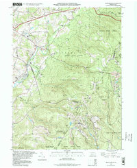
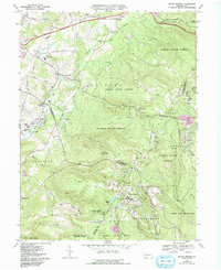
1993 Map of Seven Springs
USGS Topo · Published 1998About this map
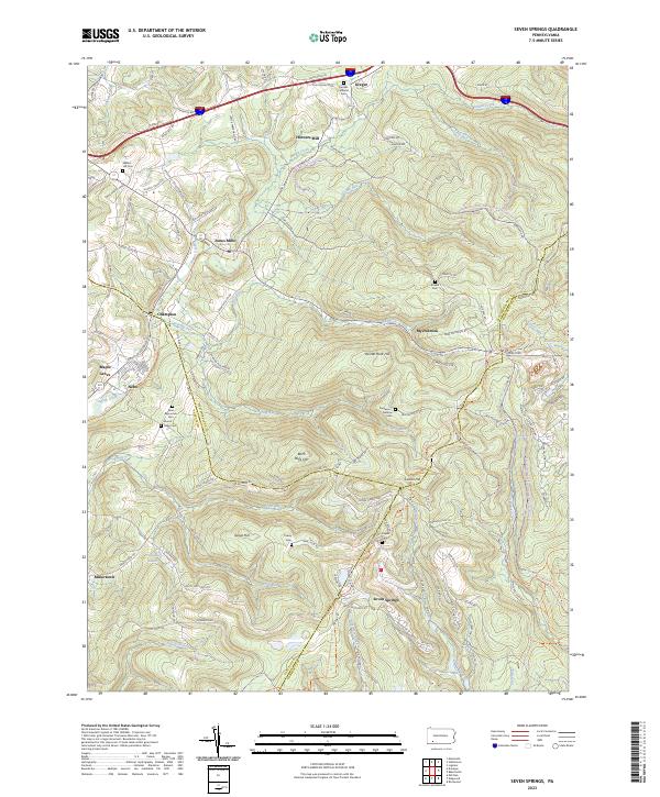
Forbes State Forest and Laurel Ridge State Park dominate this landscape where the borders of Westmoreland, Fayette, and Somerset counties converge. The rugged topography is defined by prominent peaks like Rock Hill and Birch Rock Hill, while the local economy is transitioning toward recreation, evidenced by the Seven Springs resort area, Hidden Valley Ski Area, and the Pike Run Country Club. Traces of earlier transportation and industry remain visible, such as the Old Railroad Grade and the Old Toll Road (Pennsylvania Turnpike). Small settlements like Jones Mills, Champion, and Donegal serve as anchors for the rural community, each marked by local landmarks like Mt Olive Ch and Donegal Sch. The map also captures several family-named landmarks and cemeteries, including the Nedrow Cem and St Raymonds Cem, providing valuable points of reference for local historians.
Find a feature on this map
69 named features on this map. Tap any name to fly to it.
Don’t see what you’re looking for? This feature index may not catch every label — zoom into the map to look around manually.
Map Details
Editions of this 1993 Seven Springs Map
This is the sole edition of this map. No revisions or reprints were ever made.
Historical Maps of Seven Springs Through Time
8 maps found
Featured Locations
- Saltlick Township, PA
- Springfield Township, PA
- Seven Springs, PA
- Kregar, Donegal Township
- Maple Grove, Saltlick Township